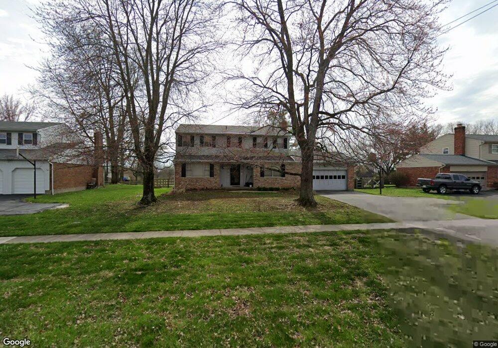
4883 W Fork Rd Cincinnati, OH 45247
West Monfort Heights NeighborhoodEstimated Value: $338,307 - $377,000
4
Beds
3
Baths
2,176
Sq Ft
$165/Sq Ft
Est. Value
About This Home
This home is located at 4883 W Fork Rd, Cincinnati, OH 45247 and is currently estimated at $358,077, approximately $164 per square foot. 4883 W Fork Rd is a home located in Hamilton County with nearby schools including Monfort Heights Elementary School, White Oak Middle School, and Colerain High School.
Ownership History
Date
Name
Owned For
Owner Type
Purchase Details
Closed on
Sep 4, 2008
Sold by
Robbins Linda I
Bought by
Robbins Damond L
Current Estimated Value
Purchase Details
Closed on
Aug 28, 1991
Sold by
Listermann Louis R
Bought by
Goetz William J
Create a Home Valuation Report for This Property
The Home Valuation Report is an in-depth analysis detailing your home's value as well as a comparison with similar homes in the area
Home Values in the Area
Average Home Value in this Area
Purchase History
| Date | Buyer | Sale Price | Title Company |
|---|---|---|---|
| Robbins Damond L | -- | Attorney | |
| Goetz William J | $123,500 | -- |
Source: Public Records
Tax History
| Year | Tax Paid | Tax Assessment Tax Assessment Total Assessment is a certain percentage of the fair market value that is determined by local assessors to be the total taxable value of land and additions on the property. | Land | Improvement |
|---|---|---|---|---|
| 2025 | $4,822 | $88,897 | $14,431 | $74,466 |
| 2024 | $4,715 | $88,897 | $14,431 | $74,466 |
| 2023 | $4,737 | $88,897 | $14,431 | $74,466 |
| 2022 | $4,053 | $62,108 | $13,993 | $48,115 |
| 2021 | $3,715 | $62,108 | $13,993 | $48,115 |
| 2020 | $3,752 | $62,108 | $13,993 | $48,115 |
| 2019 | $3,699 | $55,454 | $12,495 | $42,959 |
| 2018 | $3,295 | $55,454 | $12,495 | $42,959 |
| 2017 | $3,114 | $55,454 | $12,495 | $42,959 |
| 2016 | $3,270 | $57,379 | $12,369 | $45,010 |
| 2015 | $3,300 | $57,379 | $12,369 | $45,010 |
| 2014 | $3,305 | $57,379 | $12,369 | $45,010 |
| 2013 | $3,123 | $57,960 | $12,495 | $45,465 |
Source: Public Records
Map
Nearby Homes
- 4491 W Fork Rd
- 5525 Whispering Way
- 4192 Timberpoint Dr
- 4366 Runningfawn Dr
- 4252 Runningfawn Dr
- 5339 Race Rd
- 4600 Farcrest Ct
- 4643 Whispering Oak Trail
- 5588 W Fork Rd
- 3899 Ridgedale Dr
- 5563 Haft Rd
- 5320 Meadow Walk Ln
- 5876 Sutters Mill Dr
- 4575 Boomer Rd
- 5165 N Bend Crossing
- 5165 Rowan Dr
- 5225 Ivy Rose Ln
- 5440 Asbury Lake Dr
- 5236 Ivy Rose Ln
- 5804 Cedaridge Dr
- 4861 W Fork Rd
- 4915 W Fork Rd
- 4838 Nighthawk Dr
- 4829 W Fork Rd
- 5426 Timberchase Ct
- 4943 W Fork Rd
- 4866 Nighthawk Dr
- 5418 Timberchase Ct
- 4890 W Fork Rd
- 4922 Nighthawk Dr
- 4983 W Fork Rd
- 4930 Nighthawk Dr
- 4815 Nighthawk Dr
- 5431 Timberchase Ct
- 4851 Nighthawk Dr
- 5027 W Fork Rd
- 4950 Nighthawk Dr
- 4869 Nighthawk Dr
- 5419 Timberchase Ct
- 4925 Nighthawk Dr
Your Personal Tour Guide
Ask me questions while you tour the home.