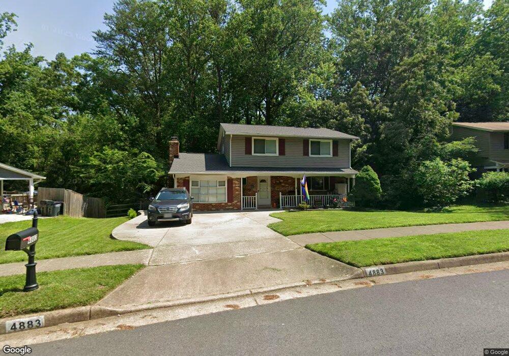
4883 Wheatstone Dr Fairfax, VA 22032
Estimated Value: $785,000 - $879,000
4
Beds
3
Baths
1,938
Sq Ft
$428/Sq Ft
Est. Value
About This Home
This home is located at 4883 Wheatstone Dr, Fairfax, VA 22032 and is currently estimated at $829,426, approximately $427 per square foot. 4883 Wheatstone Dr is a home located in Fairfax County with nearby schools including Laurel Ridge Elementary School, James W Robinson, Jr. Secondary School, and Truro Preschool & Kindergarten.
Ownership History
Date
Name
Owned For
Owner Type
Purchase Details
Closed on
Jun 16, 2006
Sold by
Swenson Dane M
Bought by
Charbonneau David W
Current Estimated Value
Home Financials for this Owner
Home Financials are based on the most recent Mortgage that was taken out on this home.
Original Mortgage
$417,000
Outstanding Balance
$245,847
Interest Rate
6.62%
Mortgage Type
New Conventional
Estimated Equity
$583,579
Create a Home Valuation Report for This Property
The Home Valuation Report is an in-depth analysis detailing your home's value as well as a comparison with similar homes in the area
Home Values in the Area
Average Home Value in this Area
Purchase History
| Date | Buyer | Sale Price | Title Company |
|---|---|---|---|
| Charbonneau David W | $525,000 | -- |
Source: Public Records
Mortgage History
| Date | Status | Borrower | Loan Amount |
|---|---|---|---|
| Open | Charbonneau David W | $417,000 |
Source: Public Records
Tax History
| Year | Tax Paid | Tax Assessment Tax Assessment Total Assessment is a certain percentage of the fair market value that is determined by local assessors to be the total taxable value of land and additions on the property. | Land | Improvement |
|---|---|---|---|---|
| 2025 | $8,376 | $788,940 | $286,000 | $502,940 |
| 2024 | $8,376 | $722,980 | $281,000 | $441,980 |
| 2023 | $8,050 | $713,370 | $281,000 | $432,370 |
| 2022 | $7,373 | $644,780 | $256,000 | $388,780 |
| 2021 | $7,196 | $613,250 | $236,000 | $377,250 |
| 2020 | $6,841 | $578,000 | $221,000 | $357,000 |
| 2019 | $6,625 | $559,740 | $216,000 | $343,740 |
| 2018 | $6,287 | $546,720 | $216,000 | $330,720 |
| 2017 | $6,121 | $527,210 | $206,000 | $321,210 |
| 2016 | $5,812 | $501,690 | $191,000 | $310,690 |
Source: Public Records
Map
Nearby Homes
- 4797 Tapestry Dr
- 4773 Farndon Ct
- 10456 Malone Ct
- 4819 Carriagepark Rd
- 10441 Carriagepark Ct
- 5262 Pumphrey Dr
- 10429 Headly Ct
- 5203 Mornington Ct
- 10215 Commonwealth Blvd
- 10125 Commonwealth Blvd
- 5206 Pimlico Ct
- 5105 Holden St
- 10118 Spinning Wheel Ct
- 5105 Coleridge Dr
- 4664 Braddock Green Ct
- 5122 Pommeroy Dr
- 10204 Aspen Willow Dr
- 10243 Aspen Willow Dr
- 10705 Ames St
- 10710 Almond St
- 4881 Wheatstone Dr
- 4885 Wheatstone Dr
- 4887 Wheatstone Dr
- 4879 Wheatstone Dr
- 4884 Wheatstone Dr
- 4888 Wheatstone Dr
- 4880 Wheatstone Dr
- 4889 Wheatstone Dr
- 4877 Wheatstone Dr
- 4890 Wheatstone Dr
- 4876 Wheatstone Dr
- 4809 Allenby Rd
- 4952 Swinton Dr
- 4891 Wheatstone Dr
- 4845 Allenby Rd
- 4875 Wheatstone Dr
- 4782 Catterick Ct
- 4780 Catterick Ct
- 4784 Catterick Ct
- 4893 Wheatstone Dr
Your Personal Tour Guide
Ask me questions while you tour the home.