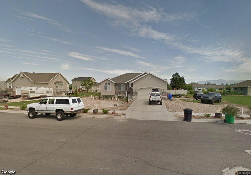
4888 W Mallard Dr West Point, UT 84015
Estimated Value: $513,000 - $575,000
5
Beds
3
Baths
2,512
Sq Ft
$217/Sq Ft
Est. Value
About This Home
This home is located at 4888 W Mallard Dr, West Point, UT 84015 and is currently estimated at $545,063, approximately $216 per square foot. 4888 W Mallard Dr is a home located in Davis County with nearby schools including West Point School, West Point Junior High School, and Syracuse High School.
Ownership History
Date
Name
Owned For
Owner Type
Purchase Details
Closed on
Jan 19, 2017
Sold by
Thurston Nathan B and Thurston Lisa
Bought by
Thurston Nathan B and Thurston Lisa G
Current Estimated Value
Purchase Details
Closed on
Jun 12, 2014
Sold by
Rigby Jamie K
Bought by
Rigby Jamie K and Rigby Samantha
Home Financials for this Owner
Home Financials are based on the most recent Mortgage that was taken out on this home.
Original Mortgage
$187,000
Outstanding Balance
$142,088
Interest Rate
4.25%
Mortgage Type
New Conventional
Estimated Equity
$402,975
Purchase Details
Closed on
Sep 12, 2013
Sold by
Wells Fargo Bank Na
Bought by
Secretary Of Hud
Purchase Details
Closed on
Jul 14, 2008
Sold by
Us Bank Na
Bought by
Faulkner Lisa
Home Financials for this Owner
Home Financials are based on the most recent Mortgage that was taken out on this home.
Original Mortgage
$175,100
Interest Rate
6.07%
Mortgage Type
Purchase Money Mortgage
Purchase Details
Closed on
Nov 27, 2007
Sold by
Wilson Alfred C
Bought by
Us Bank Na
Purchase Details
Closed on
Sep 13, 2006
Sold by
Williams Scott R and Williams Amanda K
Bought by
Wilson Alfred C
Home Financials for this Owner
Home Financials are based on the most recent Mortgage that was taken out on this home.
Original Mortgage
$177,300
Interest Rate
9.5%
Mortgage Type
Purchase Money Mortgage
Purchase Details
Closed on
Jun 9, 2004
Sold by
S M Carter Co
Bought by
Williams Scott R and Williams Amanda K
Home Financials for this Owner
Home Financials are based on the most recent Mortgage that was taken out on this home.
Original Mortgage
$150,450
Interest Rate
5.99%
Mortgage Type
Construction
Purchase Details
Closed on
Oct 29, 2003
Sold by
Paice Farms Llc
Bought by
S M Carter Co
Home Financials for this Owner
Home Financials are based on the most recent Mortgage that was taken out on this home.
Original Mortgage
$202,500
Interest Rate
5.98%
Mortgage Type
Construction
Purchase Details
Closed on
Apr 16, 2003
Sold by
Mark Higley Construction Lc and Boothe Gordon
Bought by
Paice Farms Llc
Home Financials for this Owner
Home Financials are based on the most recent Mortgage that was taken out on this home.
Original Mortgage
$850,000
Interest Rate
6.22%
Mortgage Type
Seller Take Back
Create a Home Valuation Report for This Property
The Home Valuation Report is an in-depth analysis detailing your home's value as well as a comparison with similar homes in the area
Home Values in the Area
Average Home Value in this Area
Purchase History
| Date | Buyer | Sale Price | Title Company |
|---|---|---|---|
| Thurston Nathan B | -- | Mountain View Title & Escrow | |
| Rigby Jamie K | -- | Us Title Co | |
| Rigby Jamie K | -- | Us Title Company O | |
| Secretary Of Hud | -- | Inwest Title Services | |
| Wells Fargo Bank Na | $182,750 | Etitle Insurance Agency | |
| Faulkner Lisa | -- | First American Title | |
| Us Bank Na | $195,961 | Inwest Title Services Inc | |
| Wilson Alfred C | -- | First American Title | |
| Williams Scott R | -- | Security Title Company | |
| S M Carter Co | -- | Security Title Company | |
| Paice Farms Llc | -- | Heritage West Title Insuranc |
Source: Public Records
Mortgage History
| Date | Status | Borrower | Loan Amount |
|---|---|---|---|
| Open | Rigby Jamie K | $187,000 | |
| Previous Owner | Faulkner Lisa | $175,100 | |
| Previous Owner | Wilson Alfred C | $177,300 | |
| Previous Owner | Williams Scott R | $150,450 | |
| Previous Owner | S M Carter Co | $202,500 | |
| Previous Owner | Paice Farms Llc | $850,000 |
Source: Public Records
Tax History Compared to Growth
Tax History
| Year | Tax Paid | Tax Assessment Tax Assessment Total Assessment is a certain percentage of the fair market value that is determined by local assessors to be the total taxable value of land and additions on the property. | Land | Improvement |
|---|---|---|---|---|
| 2025 | $2,904 | $267,300 | $114,087 | $153,213 |
| 2024 | $2,916 | $269,500 | $102,706 | $166,794 |
| 2023 | $2,701 | $459,000 | $128,378 | $330,622 |
| 2022 | $2,920 | $271,700 | $66,877 | $204,823 |
| 2021 | $2,681 | $373,000 | $104,108 | $268,892 |
| 2020 | $2,358 | $323,000 | $87,530 | $235,470 |
| 2019 | $2,297 | $310,000 | $84,900 | $225,100 |
| 2018 | $2,122 | $282,000 | $84,748 | $197,252 |
| 2016 | $1,838 | $128,150 | $32,798 | $95,352 |
| 2015 | $1,852 | $122,375 | $32,798 | $89,577 |
| 2014 | $1,678 | $112,200 | $32,798 | $79,402 |
| 2013 | -- | $110,960 | $32,075 | $78,885 |
Source: Public Records
Map
Nearby Homes
- 4669 W 75 N
- 4594 W 75 N Unit 405
- 128 N 4500 W
- 477 N 4500 W
- 4719 W 650 N
- 4366 W 200 N
- 4352 W 300 N
- 4325 W 75 N
- 120 N 4325 W
- 4362 West St Unit 106
- 4358 West St Unit 105
- 356 S 4300 W Unit 611
- 364 S 4300 W Unit 610
- 357 N 4000 W
- 3949 W 250 N
- 696 S 4500 W
- Charleston Plan at Bluff View
- 3851 W 50 S Unit 425
- 3849 W 50 S Unit 426
- 3847 W 50 S Unit 428
- 4888 W Mallard Dr Unit 11
- 4888 W Mallard Dr
- 4902 W 250 N
- 4887 W 300 N
- 264 N 4875 W
- 4865 W 300 N
- 4901 W 300 N
- 221 N 4875 W
- 222 N 4875 W
- 4914 W Mallard Dr
- 4914 W Mallard Dr
- 4854 W 300 N
- 4914 W 250 N
- 4913 W 300 N
- 4911 W Mallard Dr
- 4911 W Mallard Dr
- 193 N 4875 W
- 4859 W 300 N
- 188 N 4875 W
- 4912 Morning Dove Dr