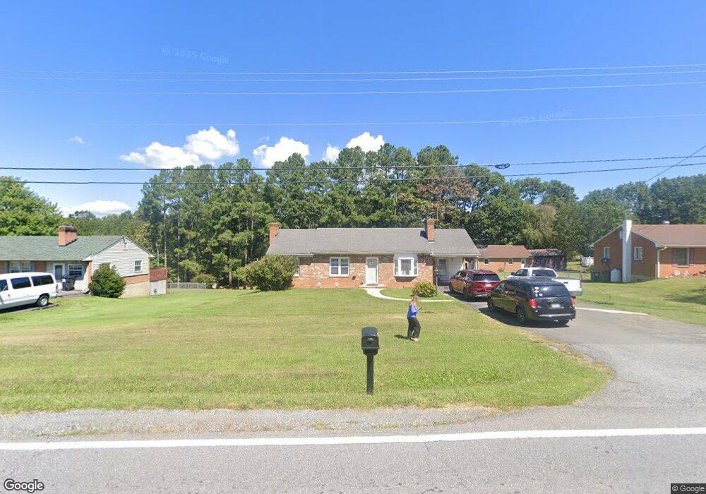
489 Amelon Rd Madison Heights, VA 24572
Estimated Value: $204,000 - $225,000
3
Beds
2
Baths
1,029
Sq Ft
$208/Sq Ft
Est. Value
About This Home
This home is located at 489 Amelon Rd, Madison Heights, VA 24572 and is currently estimated at $213,608, approximately $207 per square foot. 489 Amelon Rd is a home located in Amherst County with nearby schools including Amelon Elementary School, Monelison Middle School, and Amherst County High School.
Ownership History
Date
Name
Owned For
Owner Type
Purchase Details
Closed on
Feb 5, 2008
Sold by
Humphreys Robert H and Sowa Rachel E
Bought by
Wingfield Sherri D
Current Estimated Value
Home Financials for this Owner
Home Financials are based on the most recent Mortgage that was taken out on this home.
Original Mortgage
$112,500
Outstanding Balance
$71,184
Interest Rate
6.12%
Mortgage Type
New Conventional
Estimated Equity
$142,424
Create a Home Valuation Report for This Property
The Home Valuation Report is an in-depth analysis detailing your home's value as well as a comparison with similar homes in the area
Home Values in the Area
Average Home Value in this Area
Purchase History
| Date | Buyer | Sale Price | Title Company |
|---|---|---|---|
| Wingfield Sherri D | -- | None Available |
Source: Public Records
Mortgage History
| Date | Status | Borrower | Loan Amount |
|---|---|---|---|
| Open | Wingfield Sherri D | $112,500 |
Source: Public Records
Tax History Compared to Growth
Tax History
| Year | Tax Paid | Tax Assessment Tax Assessment Total Assessment is a certain percentage of the fair market value that is determined by local assessors to be the total taxable value of land and additions on the property. | Land | Improvement |
|---|---|---|---|---|
| 2025 | $667 | $109,400 | $17,500 | $91,900 |
| 2024 | $667 | $109,400 | $17,500 | $91,900 |
| 2023 | $667 | $109,400 | $17,500 | $91,900 |
| 2022 | $667 | $109,400 | $17,500 | $91,900 |
| 2021 | $667 | $109,400 | $17,500 | $91,900 |
| 2020 | $667 | $109,400 | $17,500 | $91,900 |
| 2019 | $688 | $112,800 | $23,500 | $89,300 |
| 2018 | $688 | $112,800 | $23,500 | $89,300 |
| 2017 | $688 | $112,800 | $23,500 | $89,300 |
| 2016 | $688 | $112,800 | $23,500 | $89,300 |
| 2015 | $632 | $112,800 | $23,500 | $89,300 |
| 2014 | $632 | $112,800 | $23,500 | $89,300 |
Source: Public Records
Map
Nearby Homes
- TBD Stratford Place Unit 39
- 289 Todd Ln
- 151 Stratford Place
- 193 Daniels Dr
- 4123 S Amherst Hwy
- 327 Dixie Airport Rd
- 571 Dixie Airport Rd
- 272 Dixie Airport Rd
- 193 Fernridge Ct
- 150 Glenwood Dr
- 4512 S Amherst Hwy
- 167 Mansfield Dr
- 505 Royal Gardens Ct
- 156 Bryant Rd
- 115 Morgan Rd
- 0 Lot 10 & 11 Stoney Creek Dr Unit 345183
- 0 Monticello Ln
- 250 S Wood Duck Dr
- 51 Patrick Ct
- 171 Woodvue Dr