Estimated Value: $230,000 - $250,000
3
Beds
2
Baths
1,395
Sq Ft
$172/Sq Ft
Est. Value
About This Home
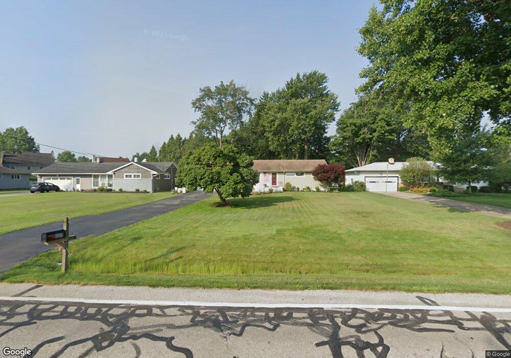
This home is located at 489 Barrett Rd, Berea, OH 44017 and is currently estimated at $239,515, approximately $171 per square foot. 489 Barrett Rd is a home located in Cuyahoga County with nearby schools including Grindstone Elementary School, Berea-Midpark Middle School, and Berea-Midpark High School.
Ownership History
Date
Name
Owned For
Owner Type
Purchase Details
Closed on
May 14, 2009
Sold by
Trausch Marianne and Trausch Robert
Bought by
Maechner Kurt G and Maechner Beth A
Current Estimated Value
Home Financials for this Owner
Home Financials are based on the most recent Mortgage that was taken out on this home.
Original Mortgage
$40,000
Interest Rate
4.51%
Mortgage Type
Purchase Money Mortgage
Purchase Details
Closed on
Sep 1, 1989
Sold by
Carl C Ciepluch
Bought by
Tokar Rose
Purchase Details
Closed on
Jun 14, 1983
Sold by
Ciepluch Carl C and Ciepluch Dolores J
Bought by
Carl C Ciepluch
Purchase Details
Closed on
Jan 1, 1975
Bought by
Ciepluch Carl C and Ciepluch Dolores J
Create a Home Valuation Report for This Property
The Home Valuation Report is an in-depth analysis detailing your home's value as well as a comparison with similar homes in the area
Home Values in the Area
Average Home Value in this Area
Purchase History
| Date | Buyer | Sale Price | Title Company |
|---|---|---|---|
| Maechner Kurt G | $150,000 | Resource Title Agency Inc | |
| Tokar Rose | $86,000 | -- | |
| Carl C Ciepluch | -- | -- | |
| Ciepluch Carl C | -- | -- |
Source: Public Records
Mortgage History
| Date | Status | Borrower | Loan Amount |
|---|---|---|---|
| Closed | Maechner Kurt G | $40,000 |
Source: Public Records
Tax History
| Year | Tax Paid | Tax Assessment Tax Assessment Total Assessment is a certain percentage of the fair market value that is determined by local assessors to be the total taxable value of land and additions on the property. | Land | Improvement |
|---|---|---|---|---|
| 2025 | $3,988 | $68,845 | $16,205 | $52,640 |
| 2024 | $3,986 | $68,845 | $16,205 | $52,640 |
| 2023 | $3,740 | $54,150 | $13,760 | $40,390 |
| 2022 | $3,716 | $54,150 | $13,760 | $40,390 |
| 2021 | $3,685 | $54,150 | $13,760 | $40,390 |
| 2020 | $3,520 | $45,890 | $11,660 | $34,230 |
| 2019 | $3,426 | $131,100 | $33,300 | $97,800 |
| 2018 | $3,110 | $45,890 | $11,660 | $34,230 |
| 2017 | $3,022 | $37,770 | $9,940 | $27,830 |
| 2016 | $3,000 | $37,770 | $9,940 | $27,830 |
| 2015 | $2,985 | $37,770 | $9,940 | $27,830 |
| 2014 | $2,985 | $39,770 | $10,470 | $29,300 |
Source: Public Records
Map
Nearby Homes
- 379 Laurel Dr
- 428 Park Place
- 446 Redwood Dr
- 160 Stonepointe Dr
- 487 Karen Dr
- 132 Stonefield Dr
- 659 Wesley Dr
- 147 Stone Ridge Way
- 725 Shakespeare Dr
- 6574 Burton Dr
- 100 River Rock Way
- 93 W 5th Ave
- 146 Marian Ln
- 160 Marian Ln Unit 6A
- 0 River Rd Unit 5169658
- 56 3rd Ave
- 143 Baker St
- 211 W Bridge St
- 7461 River Rd
- 300 West St
Your Personal Tour Guide
Ask me questions while you tour the home.