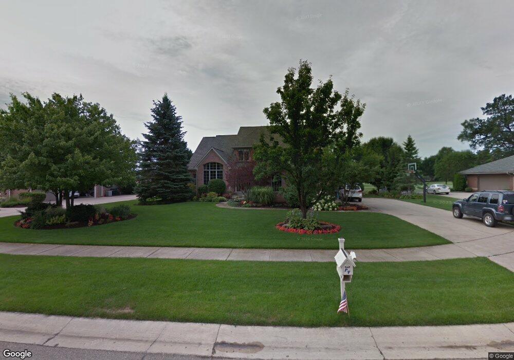
489 Carnoustie Highland, MI 48357
Estimated Value: $592,000 - $643,000
4
Beds
3
Baths
2,853
Sq Ft
$217/Sq Ft
Est. Value
About This Home
This home is located at 489 Carnoustie, Highland, MI 48357 and is currently estimated at $618,670, approximately $216 per square foot. 489 Carnoustie is a home located in Oakland County with nearby schools including Heritage Elementary School, Muir Middle School, and Christ Lutheran Christian Day School.
Ownership History
Date
Name
Owned For
Owner Type
Purchase Details
Closed on
Oct 5, 2020
Sold by
Hamlin Jeffrey E and Hamlin Christine M
Bought by
Hamlin Jeffrey E and Hamlin Christine M
Current Estimated Value
Purchase Details
Closed on
Nov 8, 2017
Sold by
Hamlin Jeffrey E and Hamlin Christine M
Bought by
Hamlin Jeffrey E and Hamlin Christine M
Purchase Details
Closed on
Dec 19, 2001
Sold by
Jeffrey E Hamlin Tr
Bought by
Hamlin Jeffrey E
Purchase Details
Closed on
Oct 25, 2001
Sold by
Hamlin Jeffrey E
Bought by
Jeffrey E Hamlin Tr
Create a Home Valuation Report for This Property
The Home Valuation Report is an in-depth analysis detailing your home's value as well as a comparison with similar homes in the area
Home Values in the Area
Average Home Value in this Area
Purchase History
| Date | Buyer | Sale Price | Title Company |
|---|---|---|---|
| Hamlin Jeffrey E | -- | None Available | |
| Hamlin Jeffrey E | -- | None Available | |
| Hamlin Jeffrey E | -- | -- | |
| Jeffrey E Hamlin Tr | -- | -- |
Source: Public Records
Tax History Compared to Growth
Tax History
| Year | Tax Paid | Tax Assessment Tax Assessment Total Assessment is a certain percentage of the fair market value that is determined by local assessors to be the total taxable value of land and additions on the property. | Land | Improvement |
|---|---|---|---|---|
| 2024 | $3,767 | $264,970 | $0 | $0 |
| 2023 | $3,593 | $239,530 | $0 | $0 |
| 2022 | $5,042 | $214,950 | $0 | $0 |
| 2021 | $4,771 | $195,550 | $0 | $0 |
| 2020 | $3,290 | $192,670 | $0 | $0 |
| 2019 | $4,641 | $181,180 | $0 | $0 |
| 2018 | $4,547 | $183,880 | $0 | $0 |
| 2017 | $4,357 | $183,880 | $0 | $0 |
| 2016 | $4,324 | $182,120 | $0 | $0 |
| 2015 | -- | $171,030 | $0 | $0 |
| 2014 | -- | $147,660 | $0 | $0 |
| 2011 | -- | $124,310 | $0 | $0 |
Source: Public Records
Map
Nearby Homes
- 688 Perthshire Ct
- 489 Gleneagles
- 398 Delmar Ct
- 446 Delmar Ct
- 1156 Alissa Marie Dr Unit 6
- 53 Ash Ave Unit 53
- 1449 Gleneagles Unit 257
- 265 E Livingston Rd
- 173 Birch Unit 173
- 1570 Lone Tree Rd
- 1569 Gleneagles
- 246 Spruce Unit 246
- 248 Spruce Unit 248
- 1665 Gleneagles
- 1713 Gleneagles Unit 268
- 1039 Troon
- 83 Elm
- 33 Pine Unit 33
- 431 Timber Ridge Dr Unit 10
- 2358 Canterwood
- 465 Carnoustie
- 513 Carnoustie
- 490 Carnoustie Unit 202
- 441 Carnoustie
- 464 Carnoustie
- 537 Carnoustie
- 538 Carnoustie Unit 200
- 574 Carnoustie Unit 201
- 442 Carnoustie Unit 204
- 417 Carnoustie
- 418 Carnoustie Unit 205
- 393 Carnoustie Unit 193
- 717 Helen
- 394 Carnoustie
- 369 Carnoustie
- 370 Carnoustie
- 825 Helen
- 837 Helen
- 719 Helen
- 855 Helen