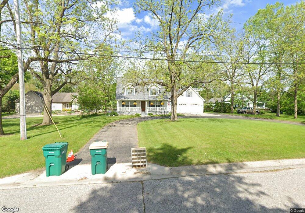
489 Hut West Dr Flushing, MI 48433
Estimated Value: $346,116 - $385,000
--
Bed
--
Bath
2,535
Sq Ft
$145/Sq Ft
Est. Value
About This Home
This home is located at 489 Hut West Dr, Flushing, MI 48433 and is currently estimated at $368,529, approximately $145 per square foot. 489 Hut West Dr is a home located in Genesee County with nearby schools including Central Elementary School, Flushing Middle School, and Flushing High School.
Ownership History
Date
Name
Owned For
Owner Type
Purchase Details
Closed on
Mar 23, 2023
Sold by
Flynn Deborah M
Bought by
Randall W And Deborah M Flynn Revocable Livin
Current Estimated Value
Purchase Details
Closed on
Jul 6, 2001
Sold by
Kiertzner James A
Bought by
Kiertzner Deborah M
Home Financials for this Owner
Home Financials are based on the most recent Mortgage that was taken out on this home.
Original Mortgage
$192,800
Interest Rate
7.27%
Create a Home Valuation Report for This Property
The Home Valuation Report is an in-depth analysis detailing your home's value as well as a comparison with similar homes in the area
Home Values in the Area
Average Home Value in this Area
Purchase History
| Date | Buyer | Sale Price | Title Company |
|---|---|---|---|
| Randall W And Deborah M Flynn Revocable Livin | -- | None Listed On Document | |
| Kiertzner Deborah M | $36,365 | First American Title Ins Co |
Source: Public Records
Mortgage History
| Date | Status | Borrower | Loan Amount |
|---|---|---|---|
| Previous Owner | Kiertzner Deborah M | $192,800 |
Source: Public Records
Tax History Compared to Growth
Tax History
| Year | Tax Paid | Tax Assessment Tax Assessment Total Assessment is a certain percentage of the fair market value that is determined by local assessors to be the total taxable value of land and additions on the property. | Land | Improvement |
|---|---|---|---|---|
| 2025 | $5,134 | $173,000 | $0 | $0 |
| 2024 | $4,130 | $166,000 | $0 | $0 |
| 2023 | $3,967 | $142,600 | $0 | $0 |
| 2022 | $4,405 | $136,200 | $0 | $0 |
| 2021 | $4,405 | $129,000 | $0 | $0 |
| 2020 | $3,484 | $118,400 | $0 | $0 |
| 2019 | $3,445 | $110,200 | $0 | $0 |
| 2018 | $4,124 | $107,800 | $0 | $0 |
| 2017 | $3,853 | $104,000 | $0 | $0 |
| 2016 | $3,821 | $88,726 | $0 | $0 |
| 2015 | $3,805 | $0 | $0 | $0 |
| 2012 | -- | $82,600 | $82,600 | $0 |
Source: Public Records
Map
Nearby Homes
- 210 N Hazelton St
- 410 E Main St
- 120 Boman St
- 0 Double Tree Estates
- 113 N Mckinley Rd
- 428 Leland St
- 212 W Henry St
- 537 Sharon Dr
- 422 Old Mill Dr
- 5082 Prestonwood Ln
- 507 Dale St
- 6289 W River Rd
- 544 Warren Ave
- 751 River Edge Ct
- 515 Chestnut St
- 1011 Clearview Dr
- 0 E River Rd Unit 50180952
- 308 N Seymour Rd
- Lot 1 across from 74 E River Rd
- 6106 E River Rd
- 485 Hut Dr W
- 485 Hut West Dr
- 493 Hut West Dr
- 409 Hut West Dr
- 409 Hut West Dr
- 413 Coutant St
- 413 Coutant St
- 492 Hut West Dr
- 503 Coutant St
- 497 Hut Dr W
- 497 Hut West Dr
- 401 Hut West Dr
- 415 Coutant St
- 415 Coutant St Unit D
- 496 Hut Dr W
- 496 Hut West Dr
- 409 Coutant St
- 411 Coutant St
- 501 Hut West Dr
- 407 Coutant St