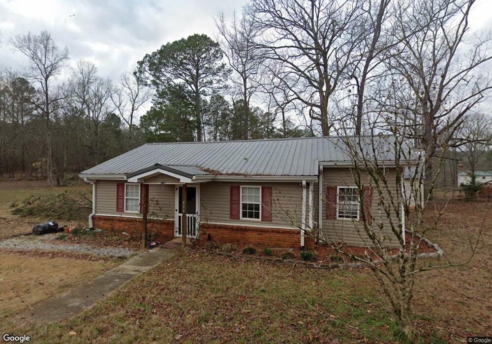
489 Walthall Rd Jackson, GA 30233
Worthville NeighborhoodEstimated Value: $141,000 - $202,000
3
Beds
1
Bath
855
Sq Ft
$201/Sq Ft
Est. Value
About This Home
This home is located at 489 Walthall Rd, Jackson, GA 30233 and is currently estimated at $171,803, approximately $200 per square foot. 489 Walthall Rd is a home located in Butts County with nearby schools including Jackson High School.
Ownership History
Date
Name
Owned For
Owner Type
Purchase Details
Closed on
May 14, 2018
Sold by
Wilmington Savings Fund So
Bought by
High West Llc
Current Estimated Value
Purchase Details
Closed on
Feb 6, 2018
Sold by
Robins Nathan G
Bought by
Wilmington Savings Fund Societ
Purchase Details
Closed on
Aug 31, 2007
Sold by
Not Provided
Bought by
Robins Nathan G and Moor Kaylin M
Home Financials for this Owner
Home Financials are based on the most recent Mortgage that was taken out on this home.
Original Mortgage
$62,400
Interest Rate
6.62%
Mortgage Type
New Conventional
Create a Home Valuation Report for This Property
The Home Valuation Report is an in-depth analysis detailing your home's value as well as a comparison with similar homes in the area
Home Values in the Area
Average Home Value in this Area
Purchase History
| Date | Buyer | Sale Price | Title Company |
|---|---|---|---|
| High West Llc | $47,800 | -- | |
| Wilmington Savings Fund Societ | $63,009 | -- | |
| Robins Nathan G | $78,000 | -- | |
| Robins Nathan G | $78,000 | -- |
Source: Public Records
Mortgage History
| Date | Status | Borrower | Loan Amount |
|---|---|---|---|
| Previous Owner | Robins Nathan G | $62,400 | |
| Previous Owner | Robins Nathan G | $15,600 |
Source: Public Records
Tax History Compared to Growth
Tax History
| Year | Tax Paid | Tax Assessment Tax Assessment Total Assessment is a certain percentage of the fair market value that is determined by local assessors to be the total taxable value of land and additions on the property. | Land | Improvement |
|---|---|---|---|---|
| 2024 | $1,143 | $47,476 | $4,646 | $42,830 |
| 2023 | $1,146 | $43,758 | $4,646 | $39,112 |
| 2022 | $897 | $33,042 | $4,646 | $28,396 |
| 2021 | $707 | $24,354 | $4,444 | $19,910 |
| 2020 | $691 | $22,899 | $4,444 | $18,455 |
| 2019 | $558 | $23,192 | $4,444 | $18,748 |
| 2018 | $548 | $20,001 | $4,444 | $15,557 |
| 2017 | $531 | $19,150 | $4,444 | $14,706 |
| 2016 | $545 | $19,150 | $4,444 | $14,706 |
| 2015 | $539 | $19,150 | $4,444 | $14,706 |
| 2014 | $541 | $18,207 | $4,444 | $13,763 |
Source: Public Records
Map
Nearby Homes
- 115 Heyman Dr
- 477 Walthall Rd
- 120 Oak Brook Ln
- 234 Peoples Rd
- LOT 184 Southern Shores Rd
- 0 Parker Rd Unit 10548997
- 0 Southern Shores Rd Unit 182005
- 178 Southern Shores Rd
- 25 Sloane Ct
- 126 Elizabeth Cir
- 2564 Highway 36 E Unit C
- 115 Rivercrest Ln
- LOT 24 Hamlin Rd
- 124 Cherokee Dr
- 5467 Highway 162 S
- 0 Apache Dr Unit RTC3043137
- 0 Apache Dr Unit 1523744
- 531 S River Dr
- 0 S River Dr Unit 10598613
- 0 S River Dr Unit 7644682
- 492 Walthall Rd
- 494 Walthall Rd
- 505 Walthall Rd
- 446 Walthall Rd
- 435 Walthall Rd
- 478 Walthall Rd
- 440 Walthall Rd
- 421 Walthall Rd
- 0 Whathal Rd Unit 7150225
- 431 Walthall Rd
- 432 Walthall Rd
- 424 Walthall Rd
- 418 Walthall Rd
- 264 Katy Lake Rd
- 412 Walthall Rd
- 133 Katy Lake Rd
- 411 Walthall Rd
- 250 Katy Lake Rd
- 145 Katy Lake Rd
- 242 Katy Lake Rd