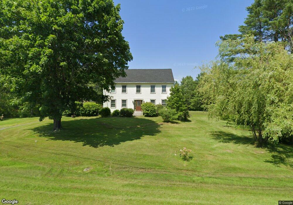
489 Willow Ln Wiscasset, ME 04578
Estimated Value: $464,509 - $602,000
3
Beds
3
Baths
2,112
Sq Ft
$248/Sq Ft
Est. Value
About This Home
This home is located at 489 Willow Ln, Wiscasset, ME 04578 and is currently estimated at $523,377, approximately $247 per square foot. 489 Willow Ln is a home located in Lincoln County.
Ownership History
Date
Name
Owned For
Owner Type
Purchase Details
Closed on
Nov 25, 2009
Sold by
Knight James M
Bought by
Gulecki Deborah L
Current Estimated Value
Home Financials for this Owner
Home Financials are based on the most recent Mortgage that was taken out on this home.
Original Mortgage
$99,550
Outstanding Balance
$64,999
Interest Rate
4.92%
Mortgage Type
Unknown
Estimated Equity
$458,378
Purchase Details
Closed on
Jan 18, 2005
Sold by
Green Misty D and Green Richard G
Bought by
Knight James M
Home Financials for this Owner
Home Financials are based on the most recent Mortgage that was taken out on this home.
Original Mortgage
$104,240
Interest Rate
9%
Mortgage Type
Adjustable Rate Mortgage/ARM
Create a Home Valuation Report for This Property
The Home Valuation Report is an in-depth analysis detailing your home's value as well as a comparison with similar homes in the area
Home Values in the Area
Average Home Value in this Area
Purchase History
| Date | Buyer | Sale Price | Title Company |
|---|---|---|---|
| Gulecki Deborah L | $221,550 | -- | |
| Knight James M | -- | -- |
Source: Public Records
Mortgage History
| Date | Status | Borrower | Loan Amount |
|---|---|---|---|
| Open | Gulecki Deborah L | $99,550 | |
| Previous Owner | Knight James M | $104,240 |
Source: Public Records
Tax History Compared to Growth
Tax History
| Year | Tax Paid | Tax Assessment Tax Assessment Total Assessment is a certain percentage of the fair market value that is determined by local assessors to be the total taxable value of land and additions on the property. | Land | Improvement |
|---|---|---|---|---|
| 2024 | $5,077 | $285,700 | $71,200 | $214,500 |
| 2023 | $4,871 | $285,700 | $71,200 | $214,500 |
| 2022 | $4,588 | $228,500 | $56,900 | $171,600 |
| 2021 | $4,597 | $228,500 | $56,900 | $171,600 |
| 2020 | $4,597 | $228,500 | $56,900 | $171,600 |
| 2019 | $4,547 | $228,500 | $56,900 | $171,600 |
| 2018 | $4,160 | $212,800 | $41,200 | $171,600 |
| 2017 | $3,992 | $212,800 | $41,200 | $171,600 |
| 2016 | $3,981 | $212,800 | $41,200 | $171,600 |
| 2015 | $3,490 | $212,800 | $41,200 | $171,600 |
| 2014 | $3,618 | $212,800 | $41,200 | $171,600 |
| 2013 | $3,447 | $212,800 | $41,200 | $171,600 |
Source: Public Records
Map
Nearby Homes
- 467 Lowelltown Rd
- Lot 9 Foye Rd
- Lot 11 Spruce Knoll Rd
- 8 Foye Rd
- 10 Foye Rd
- Lot 15&40 Gibbs Rd
- 12 Micmac Dr
- 3 Langdon Rd
- 40 Old Bath Rd
- 18 Churchill St
- Lot # 0 Deer Ridge Rd
- 83 Bath Rd
- R05-58A W Alna Rd
- 22 Sand Hill Rd
- 18 High St
- 200 Main St
- 1051 Gardiner Rd Unit 3
- 105 Old Sheepscot Rd
- 583 W Alna Rd
- 14 Hedge Bridge Rd
- 505 Willow Ln
- 0 Lowelltown Rd Unit 825462
- 0 Lowelltown Rd Unit 820444
- 0 Lowelltown Rd Unit 796383
- 0 Lowelltown Rd Unit 776291
- 0 Lowelltown Rd Unit 776292
- 0 Lowelltown Rd Unit 740394
- 0 Lowelltown Rd Unit 714241
- 0 Lowelltown Rd Unit 595843
- 0 Lowelltown Rd Unit 557545
- 0 Lowelltown Rd Unit 404433
- 0 Lowelltown Rd Unit 404361
- 0 Lowelltown Rd Unit 820445
- 0 Lowelltown Rd Unit 773383
- 0 Lowelltown Rd Unit 846608
- 0 Lowelltown Rd Unit 545155
- 0 Lowelltown Rd Unit 222944
- 0 Lowelltown Rd Unit 594871
- 0 Lowelltown Rd Unit 766059
- 0 Lowelltown Rd Unit 890171