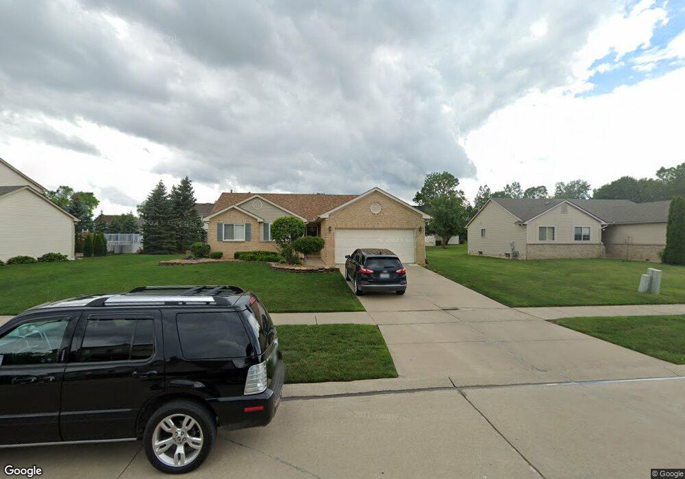
48906 Ashbury Dr Unit 38 Belleville, MI 48111
Estimated Value: $305,155 - $367,000
3
Beds
2
Baths
1,271
Sq Ft
$270/Sq Ft
Est. Value
About This Home
This home is located at 48906 Ashbury Dr Unit 38, Belleville, MI 48111 and is currently estimated at $343,289, approximately $270 per square foot. 48906 Ashbury Dr Unit 38 is a home located in Wayne County with nearby schools including Rawsonville Elementary School, Owen Intermediate School, and McBride Middle School.
Ownership History
Date
Name
Owned For
Owner Type
Purchase Details
Closed on
Jan 19, 2023
Sold by
Folks Rebecca L
Bought by
Folks Daniel B
Current Estimated Value
Purchase Details
Closed on
Dec 17, 2002
Sold by
Prudential Relocation Inc
Bought by
Folks Daniel B
Purchase Details
Closed on
Dec 9, 2002
Sold by
Jaeger Steven and Jaeger Sharon
Bought by
Prudential Relocation Inc and Citicapitol Relocation Inc
Create a Home Valuation Report for This Property
The Home Valuation Report is an in-depth analysis detailing your home's value as well as a comparison with similar homes in the area
Home Values in the Area
Average Home Value in this Area
Purchase History
| Date | Buyer | Sale Price | Title Company |
|---|---|---|---|
| Folks Daniel B | -- | -- | |
| Folks Daniel B | $190,000 | Metropolitan Title | |
| Prudential Relocation Inc | $190,000 | Metropolitan Title |
Source: Public Records
Tax History Compared to Growth
Tax History
| Year | Tax Paid | Tax Assessment Tax Assessment Total Assessment is a certain percentage of the fair market value that is determined by local assessors to be the total taxable value of land and additions on the property. | Land | Improvement |
|---|---|---|---|---|
| 2025 | $1,632 | $153,400 | $0 | $0 |
| 2024 | $1,632 | $137,200 | $0 | $0 |
| 2023 | $1,557 | $127,800 | $0 | $0 |
| 2022 | $2,537 | $107,900 | $0 | $0 |
| 2021 | $2,478 | $92,800 | $0 | $0 |
| 2020 | $2,454 | $96,900 | $0 | $0 |
| 2019 | $2,395 | $88,000 | $0 | $0 |
| 2018 | $1,206 | $79,000 | $0 | $0 |
| 2017 | $2,237 | $77,900 | $0 | $0 |
| 2016 | $2,037 | $78,400 | $0 | $0 |
| 2015 | $6,218 | $75,400 | $0 | $0 |
| 2013 | $6,080 | $60,800 | $0 | $0 |
| 2010 | -- | $71,400 | $0 | $0 |
Source: Public Records
Map
Nearby Homes
- 6420 Denton Rd
- 49962 Kent Ct
- 49869 Kent Ct
- 49905 Kent Ct
- 49891 Kent Ct
- 49851 Kent Ct
- 5522 Lewiston Rd
- 5635 Lewiston Rd
- 5643 Lewiston Rd
- 5616 Lewiston Rd
- 5621 Lewiston Rd
- 5456 Lewiston Rd
- 5182 Lewiston Rd
- 5196 Lewiston Rd
- 5224 Lewiston Rd
- 5208 Lewiston Rd
- 5136 Barnes Rd
- 5164 Barnes Rd
- 50285 Cromwell Rd
- 50327 Cromwell Rd
- 48888 Ashbury Dr Unit 39
- 6315 Sandalwood Dr Unit 33
- 48920 Ashbury Dr Unit 37
- 6289 Sandalwood Dr Unit 32
- 6327 Sandalwood Dr Unit 34
- 48897 Ashbury Dr
- 48913 Ashbury Dr Unit 18
- 48929 Ashbury Dr Unit 19
- 48881 Ashbury Dr Unit Bldg-Unit
- 48881 Ashbury Dr
- 6224 Sandalwood Dr
- 48945 Ashbury Dr Unit 20
- 6248 Sandalwood Dr Unit 12
- 48865 Ashbury Dr
- 48952 Ashbury Dr Unit 36
- 6236 Sandalwood Dr
- 6320 Sandalwood Dr
- 6308 Sandalwood Dr
- 6346 Sandalwood Dr
- 48984 Ashbury Dr Unit 35