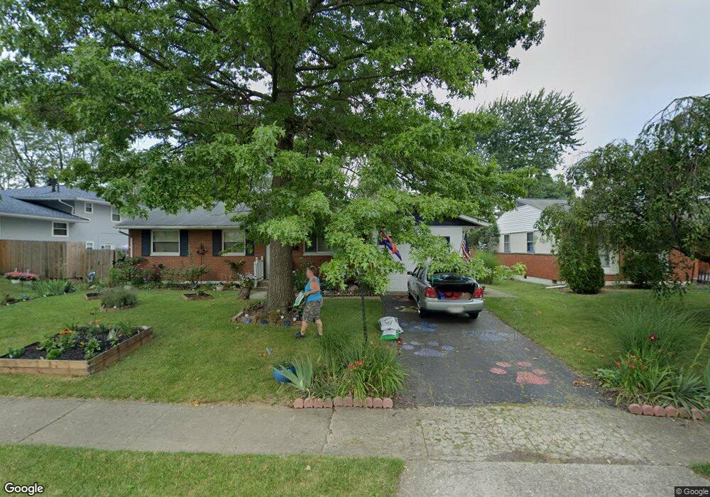
4891 Colonel Perry Dr Columbus, OH 43229
Woodward Park NeighborhoodEstimated Value: $251,466 - $293,000
3
Beds
2
Baths
1,176
Sq Ft
$232/Sq Ft
Est. Value
About This Home
This home is located at 4891 Colonel Perry Dr, Columbus, OH 43229 and is currently estimated at $272,367, approximately $231 per square foot. 4891 Colonel Perry Dr is a home located in Franklin County with nearby schools including Valley Forge Elementary School, Woodward Park Middle School, and Northland High School.
Ownership History
Date
Name
Owned For
Owner Type
Purchase Details
Closed on
Nov 15, 2008
Sold by
Menon Shiv R and Menon Ingrid C
Bought by
Fairhurst Karen A
Current Estimated Value
Home Financials for this Owner
Home Financials are based on the most recent Mortgage that was taken out on this home.
Original Mortgage
$110,541
Outstanding Balance
$72,130
Interest Rate
5.96%
Mortgage Type
FHA
Estimated Equity
$200,237
Purchase Details
Closed on
Sep 21, 2001
Sold by
Grout Amber L and Grout Amber L
Bought by
Menon Shiv R and Menon Ingrid C
Home Financials for this Owner
Home Financials are based on the most recent Mortgage that was taken out on this home.
Original Mortgage
$88,000
Interest Rate
6.12%
Purchase Details
Closed on
May 11, 1988
Create a Home Valuation Report for This Property
The Home Valuation Report is an in-depth analysis detailing your home's value as well as a comparison with similar homes in the area
Home Values in the Area
Average Home Value in this Area
Purchase History
| Date | Buyer | Sale Price | Title Company |
|---|---|---|---|
| Fairhurst Karen A | $112,000 | Title First | |
| Menon Shiv R | $110,000 | -- | |
| -- | $67,900 | -- |
Source: Public Records
Mortgage History
| Date | Status | Borrower | Loan Amount |
|---|---|---|---|
| Open | Fairhurst Karen A | $110,541 | |
| Previous Owner | Menon Shiv R | $88,000 |
Source: Public Records
Tax History Compared to Growth
Tax History
| Year | Tax Paid | Tax Assessment Tax Assessment Total Assessment is a certain percentage of the fair market value that is determined by local assessors to be the total taxable value of land and additions on the property. | Land | Improvement |
|---|---|---|---|---|
| 2024 | $3,493 | $77,840 | $20,720 | $57,120 |
| 2023 | $3,449 | $77,840 | $20,720 | $57,120 |
| 2022 | $2,317 | $44,670 | $11,170 | $33,500 |
| 2021 | $2,321 | $44,670 | $11,170 | $33,500 |
| 2020 | $2,324 | $44,670 | $11,170 | $33,500 |
| 2019 | $2,198 | $36,230 | $8,930 | $27,300 |
| 2018 | $2,058 | $36,230 | $8,930 | $27,300 |
| 2017 | $2,197 | $36,230 | $8,930 | $27,300 |
| 2016 | $2,117 | $31,960 | $8,330 | $23,630 |
| 2015 | $1,922 | $31,960 | $8,330 | $23,630 |
| 2014 | $1,927 | $31,960 | $8,330 | $23,630 |
| 2013 | $999 | $33,600 | $8,750 | $24,850 |
Source: Public Records
Map
Nearby Homes
- 4923 Karl Rd Unit 4925
- 4852 Colonel Perry Dr
- 1485 Norma Rd
- 4816 Bourke Rd
- 4800 Bourke Rd
- 4815 Bourke Rd
- 1414 Alvina Dr
- 4791 Bourke Rd
- 4761 Colonel Perry Dr
- 5022 Sienna Ln
- 1385 Thurell Rd
- 1704 Riverbirch Dr
- 4840 Almont Dr
- 4904 Almont Dr
- 1493 Boxwood Dr
- 4983 Almont Dr
- 5231 Arrowood Ct
- 1125 Upland Dr
- 1116 Tulsa Dr
- 4455 Kenfield Rd
- 4901 Colonel Perry Dr
- 1506 Urban Dr
- 1492 Urban Dr
- 1507 Fullen Rd
- 1495 Fullen Rd
- 1487 Fullen Rd
- 1484 Urban Dr
- 4890 Colonel Perry Dr
- 4882 Colonel Perry Dr
- 4900 Colonel Perry Dr
- 4861 Colonel Perry Dr
- 4874 Colonel Perry Dr
- 1479 Fullen Rd
- 4910 Colonel Perry Dr
- 1491 Urban Dr
- 4868 Colonel Perry Dr
- 1476 Urban Dr
- 1483 Urban Dr
- 1471 Fullen Rd
- 4860 Colonel Perry Dr