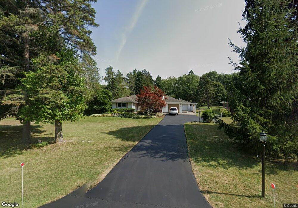
4891 Newton Rd Hamburg, NY 14075
Estimated Value: $312,640 - $336,000
3
Beds
2
Baths
1,390
Sq Ft
$231/Sq Ft
Est. Value
About This Home
This home is located at 4891 Newton Rd, Hamburg, NY 14075 and is currently estimated at $321,660, approximately $231 per square foot. 4891 Newton Rd is a home located in Erie County with nearby schools including Hamburg Middle School, Sts. Peter & Paul Elementary School, and Hamburg Christian Academy.
Ownership History
Date
Name
Owned For
Owner Type
Purchase Details
Closed on
Aug 17, 2012
Sold by
Diliberto Susan M Susan M
Bought by
Diliberto Gary
Current Estimated Value
Purchase Details
Closed on
Feb 5, 2007
Sold by
Meyer Norbert F
Bought by
Wetzi Glenn
Purchase Details
Closed on
Oct 4, 2004
Sold by
Minton Donald and Minton Dianne
Bought by
Diliberto Gary S and Diliberto Susan M
Home Financials for this Owner
Home Financials are based on the most recent Mortgage that was taken out on this home.
Original Mortgage
$129,280
Interest Rate
5.84%
Mortgage Type
Purchase Money Mortgage
Create a Home Valuation Report for This Property
The Home Valuation Report is an in-depth analysis detailing your home's value as well as a comparison with similar homes in the area
Home Values in the Area
Average Home Value in this Area
Purchase History
| Date | Buyer | Sale Price | Title Company |
|---|---|---|---|
| Diliberto Gary | -- | -- | |
| Wetzi Glenn | $125,000 | None Available | |
| Diliberto Gary S | $161,600 | -- |
Source: Public Records
Mortgage History
| Date | Status | Borrower | Loan Amount |
|---|---|---|---|
| Previous Owner | Diliberto Gary S | $129,280 |
Source: Public Records
Tax History Compared to Growth
Tax History
| Year | Tax Paid | Tax Assessment Tax Assessment Total Assessment is a certain percentage of the fair market value that is determined by local assessors to be the total taxable value of land and additions on the property. | Land | Improvement |
|---|---|---|---|---|
| 2024 | $6,274 | $90,100 | $10,000 | $80,100 |
| 2023 | $6,200 | $90,100 | $10,000 | $80,100 |
| 2022 | $5,980 | $90,100 | $10,000 | $80,100 |
| 2021 | $5,919 | $90,100 | $10,000 | $80,100 |
| 2020 | $5,232 | $90,100 | $10,000 | $80,100 |
| 2019 | $5,192 | $90,100 | $10,000 | $80,100 |
| 2018 | $4,951 | $90,100 | $10,000 | $80,100 |
| 2017 | $2,513 | $90,100 | $10,000 | $80,100 |
| 2016 | $4,846 | $90,100 | $10,000 | $80,100 |
| 2015 | -- | $107,800 | $10,000 | $97,800 |
| 2014 | -- | $107,800 | $10,000 | $97,800 |
Source: Public Records
Map
Nearby Homes
- 4995 Newton Rd
- 4700 Newton Rd
- 6145 Mckinley Pkwy Unit 5
- 6145 Mckinley Pkwy Unit 31
- 5985 Mckinley Pkwy
- 4920 Holly Place
- 6309 Boston State Rd
- 42 Sandra Place
- 88 Raymond St
- 82 Raymond St
- 55 Therin Dr
- 0 Keems Ln
- 4479 Clark St
- 27 Huntington Ct
- 30 Thornapple Ln
- 187 Hunt Ave
- 4373 Clark St
- 11 Hunt Ave
- 66 Elizabeth St
- 4780 Clark St