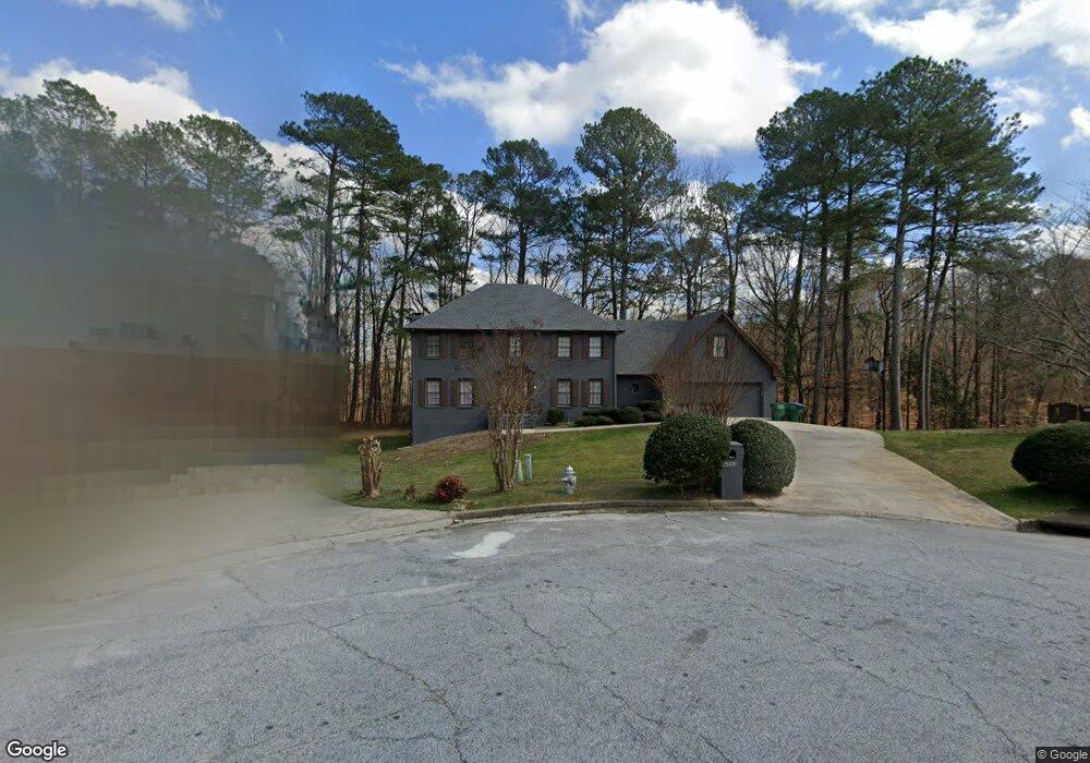
4892 Signal Ct SW Unit 11 Lilburn, GA 30047
Estimated Value: $485,698 - $537,000
4
Beds
3
Baths
3,412
Sq Ft
$148/Sq Ft
Est. Value
About This Home
This home is located at 4892 Signal Ct SW Unit 11, Lilburn, GA 30047 and is currently estimated at $504,425, approximately $147 per square foot. 4892 Signal Ct SW Unit 11 is a home located in Gwinnett County with nearby schools including Shiloh Elementary School, Shiloh Middle School, and Shiloh High School.
Ownership History
Date
Name
Owned For
Owner Type
Purchase Details
Closed on
Apr 30, 2024
Sold by
Blackmon Nathaniel H
Bought by
Tanamo Corp
Current Estimated Value
Purchase Details
Closed on
Oct 29, 1999
Sold by
Posener Robert S and Posener Helen H
Bought by
Blackmon Nathaniel H
Home Financials for this Owner
Home Financials are based on the most recent Mortgage that was taken out on this home.
Original Mortgage
$211,500
Interest Rate
7.76%
Mortgage Type
New Conventional
Create a Home Valuation Report for This Property
The Home Valuation Report is an in-depth analysis detailing your home's value as well as a comparison with similar homes in the area
Home Values in the Area
Average Home Value in this Area
Purchase History
| Date | Buyer | Sale Price | Title Company |
|---|---|---|---|
| Tanamo Corp | -- | -- | |
| Blackmon Nathaniel H | $235,000 | -- |
Source: Public Records
Mortgage History
| Date | Status | Borrower | Loan Amount |
|---|---|---|---|
| Previous Owner | Blackmon Nathaniel H | $211,500 |
Source: Public Records
Tax History Compared to Growth
Tax History
| Year | Tax Paid | Tax Assessment Tax Assessment Total Assessment is a certain percentage of the fair market value that is determined by local assessors to be the total taxable value of land and additions on the property. | Land | Improvement |
|---|---|---|---|---|
| 2025 | $7,734 | $209,520 | $30,000 | $179,520 |
| 2024 | $7,233 | $199,320 | $30,000 | $169,320 |
| 2023 | $7,233 | $195,960 | $32,000 | $163,960 |
| 2022 | $6,316 | $174,240 | $28,000 | $146,240 |
| 2021 | $4,273 | $114,840 | $17,600 | $97,240 |
| 2020 | $4,299 | $114,840 | $17,600 | $97,240 |
| 2019 | $4,148 | $114,840 | $17,600 | $97,240 |
| 2018 | $4,151 | $114,840 | $17,600 | $97,240 |
| 2016 | $3,480 | $95,120 | $14,400 | $80,720 |
| 2015 | $3,332 | $89,880 | $15,600 | $74,280 |
| 2014 | -- | $79,120 | $12,000 | $67,120 |
Source: Public Records
Map
Nearby Homes
- 4922 Signal Ct SW
- 2390 Stone Dr SW
- 4806 Dean Ln SW
- 5015 Shadow Path Ln SW
- 5018 Castlewood Dr SW
- 2291 Rodao Dr SW
- 2251 Colonial Oak Way
- 0 Hudson Dr Unit 7586860
- 2224 Hudson Dr SW
- 5027 Castlewood Dr SW
- 2421 Rockbridge Rd SW
- 2650 Riverfront Dr
- 2700 Riverfront Dr Unit 4
- 2701 Gardenwood Ct SW
- 2170 Thorndale Dr SW
- 3 Shiloh Ridge Trail
- 1 Shiloh Ridge Trail
- 4 Shiloh Ridge Trail
- 2 Shiloh Ridge Trail
- 5263 Pounds Dr N
- 4902 Signal Ct SW
- 4891 Signal Ct SW
- 4901 Signal Ct SW
- 4912 Signal Ct SW
- 4911 Signal Ct SW
- 2448 Dakota Trail SW
- 4921 Signal Ct SW
- 4867 Dean Ln SW
- 2398 Dakota Trail SW Unit 11
- 4846 Dean Ln SW
- 2348 Dakota Trail SW
- 2478 Dakota Trail SW
- 2388 Dakota Trail SW
- 4843 Carlene Way SW
- 4870 Rivercliff Trace SW
- 4833 Carlene Way SW
- 2427 Dakota Trail SW
- 2488 Dakota Trail SW
- 2417 Dakota Trail SW
- 2437 Dakota Trail SW Unit II