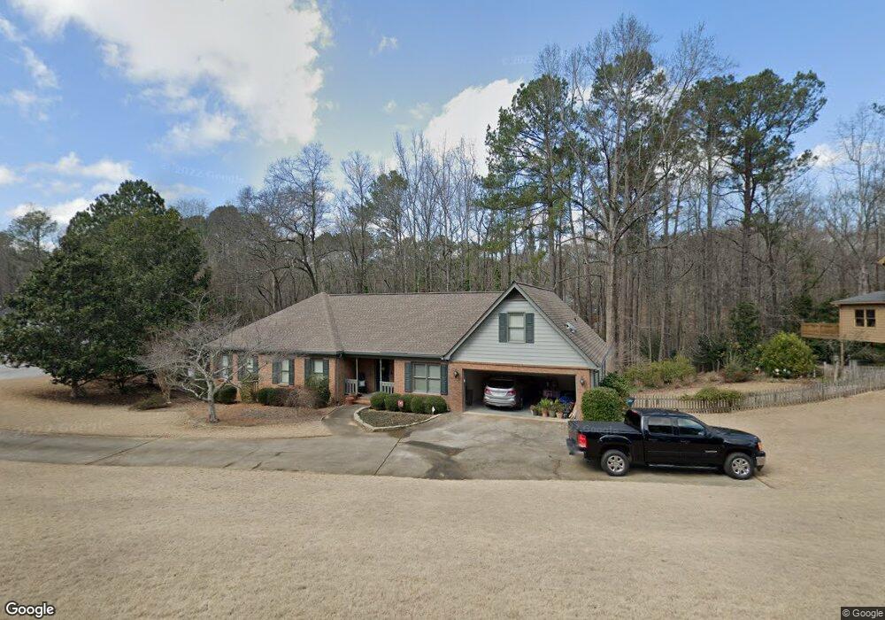
4895 Rivercliff Trace SW Lilburn, GA 30047
Estimated Value: $359,000 - $418,000
3
Beds
3
Baths
2,025
Sq Ft
$191/Sq Ft
Est. Value
About This Home
This home is located at 4895 Rivercliff Trace SW, Lilburn, GA 30047 and is currently estimated at $386,216, approximately $190 per square foot. 4895 Rivercliff Trace SW is a home with nearby schools including Shiloh Elementary School, Shiloh Middle School, and Shiloh High School.
Ownership History
Date
Name
Owned For
Owner Type
Purchase Details
Closed on
Nov 12, 1998
Sold by
Etter Michael A
Bought by
Etter Michael A and Etter Linda W
Current Estimated Value
Home Financials for this Owner
Home Financials are based on the most recent Mortgage that was taken out on this home.
Original Mortgage
$182,400
Outstanding Balance
$39,132
Interest Rate
6.95%
Mortgage Type
New Conventional
Estimated Equity
$347,084
Create a Home Valuation Report for This Property
The Home Valuation Report is an in-depth analysis detailing your home's value as well as a comparison with similar homes in the area
Home Values in the Area
Average Home Value in this Area
Purchase History
| Date | Buyer | Sale Price | Title Company |
|---|---|---|---|
| Etter Michael A | -- | -- | |
| Etter Michael A | -- | -- |
Source: Public Records
Mortgage History
| Date | Status | Borrower | Loan Amount |
|---|---|---|---|
| Open | Etter Michael A | $182,400 |
Source: Public Records
Tax History Compared to Growth
Tax History
| Year | Tax Paid | Tax Assessment Tax Assessment Total Assessment is a certain percentage of the fair market value that is determined by local assessors to be the total taxable value of land and additions on the property. | Land | Improvement |
|---|---|---|---|---|
| 2025 | $1,187 | $151,560 | $30,000 | $121,560 |
| 2024 | $1,181 | $144,760 | $30,000 | $114,760 |
| 2023 | $1,181 | $143,080 | $32,000 | $111,080 |
| 2022 | $1,140 | $129,600 | $28,000 | $101,600 |
| 2021 | $1,133 | $78,440 | $17,600 | $60,840 |
| 2020 | $1,131 | $78,440 | $17,600 | $60,840 |
| 2019 | $2,716 | $78,440 | $17,600 | $60,840 |
| 2018 | $2,716 | $78,440 | $17,600 | $60,840 |
| 2016 | $2,501 | $67,560 | $16,000 | $51,560 |
| 2015 | $2,432 | $64,600 | $12,000 | $52,600 |
| 2014 | -- | $66,120 | $12,000 | $54,120 |
Source: Public Records
Map
Nearby Homes
- 2390 Stone Dr SW
- 4922 Signal Ct SW
- 5015 Shadow Path Ln SW
- 2291 Rodao Dr SW
- 4806 Dean Ln SW
- 0 Hudson Dr Unit 7586860
- 2251 Colonial Oak Way
- 5018 Castlewood Dr SW
- 2224 Hudson Dr SW
- 2170 Thorndale Dr SW
- 2421 Rockbridge Rd SW
- 5027 Castlewood Dr SW
- 2650 Riverfront Dr
- 2700 Riverfront Dr Unit 4
- 4656 Matterhorn Dr SW
- 2701 Gardenwood Ct SW
- 5263 Pounds Dr N
- 2158 Vivid Ct
- 4882 Rock Haven Dr SW
- 3 Shiloh Ridge Trail
- 4885 Rivercliff Trace SW
- 2378 Dakota Trail SW
- 4880 Rivercliff Trace SW Unit 1
- 2377 Dakota Trail SW Unit 1
- 2367 Dakota Trail SW
- 2388 Dakota Trail SW
- 2347 Dakota Trail SW
- 4870 Rivercliff Trace SW
- 2387 Dakota Trail SW
- 2387 Dakota Trail SW Unit 1
- 2387 Dakota Trail SW Unit 57
- 2357 Dakota Trail SW Unit 1
- 2398 Dakota Trail SW Unit 11
- 2397 Dakota Trail SW
- 2316 Stone Dr SW
- 4921 Signal Ct SW
- 4911 Signal Ct SW
- 2407 Dakota Trail SW
- 4901 Signal Ct SW
- 2346 Stone Dr SW