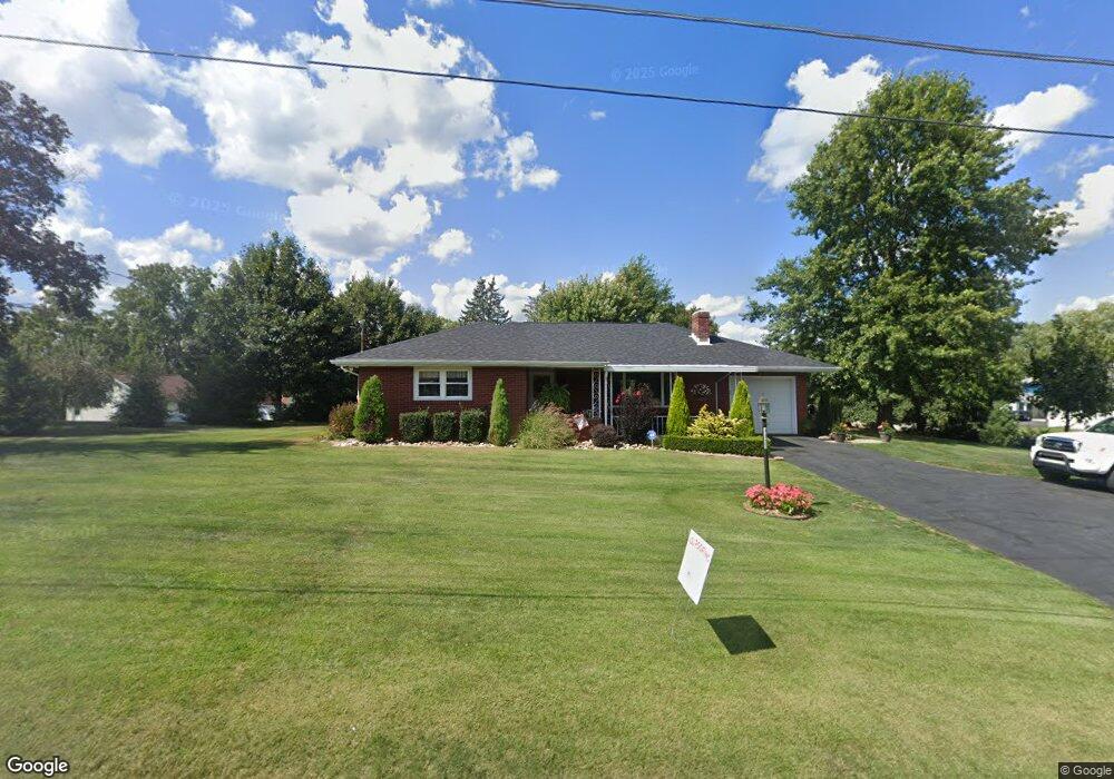
4895 State Route 982 Latrobe, PA 15650
Estimated Value: $92,468 - $277,000
2
Beds
2
Baths
--
Sq Ft
0.53
Acres
About This Home
This home is located at 4895 State Route 982, Latrobe, PA 15650 and is currently estimated at $208,117. 4895 State Route 982 is a home located in Westmoreland County with nearby schools including Grandview Elementary School, Derry Area Middle School, and Derry Area Senior High School.
Ownership History
Date
Name
Owned For
Owner Type
Purchase Details
Closed on
Dec 15, 2014
Sold by
Rager Daniel L and Rager Kara A
Bought by
Rager Daniel L and Rager Kara A
Current Estimated Value
Purchase Details
Closed on
Oct 10, 2006
Sold by
Rager Daniel L and Rager Beth A
Bought by
Rager Daniel L
Create a Home Valuation Report for This Property
The Home Valuation Report is an in-depth analysis detailing your home's value as well as a comparison with similar homes in the area
Home Values in the Area
Average Home Value in this Area
Purchase History
| Date | Buyer | Sale Price | Title Company |
|---|---|---|---|
| Rager Daniel L | -- | None Available | |
| Rager Daniel L | -- | None Available |
Source: Public Records
Tax History Compared to Growth
Tax History
| Year | Tax Paid | Tax Assessment Tax Assessment Total Assessment is a certain percentage of the fair market value that is determined by local assessors to be the total taxable value of land and additions on the property. | Land | Improvement |
|---|---|---|---|---|
| 2025 | $2,595 | $20,880 | $4,020 | $16,860 |
| 2024 | $2,595 | $20,880 | $4,020 | $16,860 |
| 2023 | $2,449 | $20,880 | $4,020 | $16,860 |
| 2022 | $2,428 | $20,880 | $4,020 | $16,860 |
| 2021 | $2,428 | $20,880 | $4,020 | $16,860 |
| 2020 | $2,386 | $20,880 | $4,020 | $16,860 |
| 2019 | $2,334 | $20,880 | $4,020 | $16,860 |
| 2018 | $2,230 | $20,880 | $4,020 | $16,860 |
| 2017 | $2,171 | $20,880 | $4,020 | $16,860 |
| 2016 | $2,077 | $20,880 | $4,020 | $16,860 |
| 2015 | $2,077 | $20,880 | $4,020 | $16,860 |
| 2014 | $2,077 | $20,880 | $4,020 | $16,860 |
Source: Public Records
Map
Nearby Homes
- 0 Hillview Ave
- 33 Brinker St
- 332 Richmond St
- 35 Highview St
- 1 Bankie Dr
- 4974 State Route 982
- 408 Highview St
- 1512 Timothy Dr
- 1939 Wood St
- 2023 Sylvan Ave
- 410 Smith St
- 4767 State Route 982
- 948 Abbott St
- 1200 Wood St
- 1937 Raymond Ave
- 934 Wood St
- 108 Peach St
- 937 Hillcrest Ave
- 108 Pandora Rd
- 1748 Dailey Ave
- 4889 State Route 982
- 20 Penn Ave
- 000 Route 982
- 4901 State Route 982
- 1 Penn Ave
- 4892 State Route 982
- 4883 State Route 982
- 4884 State Route 982
- 33 Penn Ave
- 104 Mania Ave
- 4907 State Route 982
- 18 Brinker St
- 18 Brinker St
- 4880 Pennsylvania 982
- 114 Mania Ave
- 5 15th St
- 37 Penn Ave
- 982 Hillview Ave
- 24 Brinker St
- 11 Meadow Dr