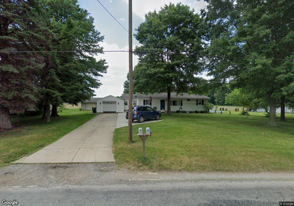
4896 Doylestown Rd Creston, OH 44217
Estimated Value: $187,000 - $249,000
3
Beds
1
Bath
1,152
Sq Ft
$188/Sq Ft
Est. Value
About This Home
This home is located at 4896 Doylestown Rd, Creston, OH 44217 and is currently estimated at $216,164, approximately $187 per square foot. 4896 Doylestown Rd is a home located in Wayne County with nearby schools including Norwayne Elementary School, Norwayne Middle School, and Norwayne High School.
Ownership History
Date
Name
Owned For
Owner Type
Purchase Details
Closed on
Oct 18, 2019
Sold by
Gasser Lois J and Auxter Kathryn
Bought by
Skaggs Weston K and Skaggs Amy J
Current Estimated Value
Home Financials for this Owner
Home Financials are based on the most recent Mortgage that was taken out on this home.
Original Mortgage
$116,100
Outstanding Balance
$101,500
Interest Rate
3.4%
Mortgage Type
New Conventional
Estimated Equity
$114,664
Purchase Details
Closed on
Aug 17, 1993
Sold by
Honaker John R and Honaker Martha S
Bought by
Gasser Lois J
Purchase Details
Closed on
Feb 27, 1986
Bought by
Honaker John R and Honaker Martha S
Purchase Details
Closed on
Jan 17, 1986
Create a Home Valuation Report for This Property
The Home Valuation Report is an in-depth analysis detailing your home's value as well as a comparison with similar homes in the area
Purchase History
| Date | Buyer | Sale Price | Title Company |
|---|---|---|---|
| Skaggs Weston K | $129,000 | None Available | |
| Gasser Lois J | $66,000 | -- | |
| Honaker John R | $41,000 | -- | |
| -- | -- | -- |
Source: Public Records
Mortgage History
| Date | Status | Borrower | Loan Amount |
|---|---|---|---|
| Open | Skaggs Weston K | $116,100 |
Source: Public Records
Tax History
| Year | Tax Paid | Tax Assessment Tax Assessment Total Assessment is a certain percentage of the fair market value that is determined by local assessors to be the total taxable value of land and additions on the property. | Land | Improvement |
|---|---|---|---|---|
| 2024 | $2,278 | $60,360 | $12,220 | $48,140 |
| 2023 | $2,293 | $60,360 | $12,220 | $48,140 |
| 2022 | $1,799 | $45,380 | $9,190 | $36,190 |
| 2021 | $1,821 | $45,380 | $9,190 | $36,190 |
| 2020 | $1,833 | $45,380 | $9,190 | $36,190 |
| 2019 | $1,157 | $36,350 | $8,270 | $28,080 |
| 2018 | $1,148 | $36,350 | $8,270 | $28,080 |
| 2017 | $1,139 | $36,350 | $8,270 | $28,080 |
| 2016 | $1,066 | $34,620 | $7,880 | $26,740 |
| 2015 | $1,053 | $34,620 | $7,880 | $26,740 |
| 2014 | $1,030 | $34,620 | $7,880 | $26,740 |
| 2013 | $1,076 | $34,990 | $7,560 | $27,430 |
Source: Public Records
Map
Nearby Homes
- 155 Sterling St
- 112 Brooklyn Ave
- 147 N Main St
- 150 N Main St
- 10368 Wooster Pike
- 124 Garden St
- 0 Burbank & Erie St
- 104 Wayne Ave
- 5913 Stuckey Rd
- 9791 Hulbert Rd
- 6760 Spruce St
- 210 Evergreen Dr
- 5052 Catawba Place Ln
- 5058 Catawba Place Ln
- 115 Elmwood Dr
- 9389 Towpath Trail
- 119 Center St
- 5222 Greenwich Rd Unit 30
- 5222 Greenwich Rd Unit 11
- 5222 Greenwich Rd Unit 1
- 4899 Doylestown Rd
- 4930 Doylestown Rd
- 4845 Doylestown Rd
- 4813 Doylestown Rd
- 5000 Doylestown Rd
- 15007 Jordon Rd
- 4999 Doylestown Rd
- 4739 Doylestown Rd
- 5002 Doylestown Rd
- 5002 Doylestown Rd
- 14494 Jordon Rd
- 5044 Doylestown Rd
- 5044 Doylestown Rd
- 14983 Jordon Rd
- 14927 Jordon Rd
- 5086 Doylestown Rd
- 5065 Doylestown Rd
- 4659 Doylestown Rd
- 5110 Doylestown Rd
- 4650 Doylestown Rd
Your Personal Tour Guide
Ask me questions while you tour the home.