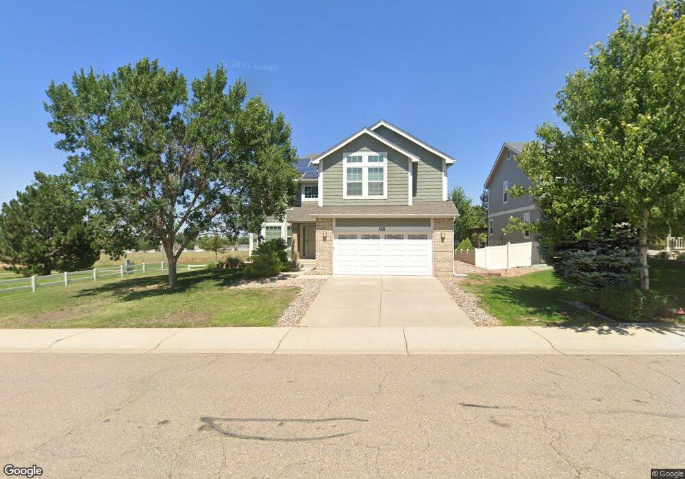
4897 Monarch Dr Firestone, CO 80504
Estimated Value: $569,327 - $616,000
5
Beds
3
Baths
2,597
Sq Ft
$227/Sq Ft
Est. Value
About This Home
This home is located at 4897 Monarch Dr, Firestone, CO 80504 and is currently estimated at $590,582, approximately $227 per square foot. 4897 Monarch Dr is a home located in Weld County with nearby schools including Centennial Elementary School, Coal Ridge Middle School, and Mead High School.
Ownership History
Date
Name
Owned For
Owner Type
Purchase Details
Closed on
Sep 22, 2011
Sold by
Dul Chamroeun and Heng Sokha
Bought by
Rowe Dan and Gill Darren
Current Estimated Value
Home Financials for this Owner
Home Financials are based on the most recent Mortgage that was taken out on this home.
Original Mortgage
$166,750
Outstanding Balance
$14,703
Interest Rate
4.24%
Mortgage Type
New Conventional
Estimated Equity
$575,879
Create a Home Valuation Report for This Property
The Home Valuation Report is an in-depth analysis detailing your home's value as well as a comparison with similar homes in the area
Home Values in the Area
Average Home Value in this Area
Purchase History
| Date | Buyer | Sale Price | Title Company |
|---|---|---|---|
| Rowe Dan | $260,000 | Land Title Guarantee Company |
Source: Public Records
Mortgage History
| Date | Status | Borrower | Loan Amount |
|---|---|---|---|
| Open | Rowe Dan | $166,750 |
Source: Public Records
Tax History
| Year | Tax Paid | Tax Assessment Tax Assessment Total Assessment is a certain percentage of the fair market value that is determined by local assessors to be the total taxable value of land and additions on the property. | Land | Improvement |
|---|---|---|---|---|
| 2025 | $3,671 | $35,610 | $7,380 | $28,230 |
| 2024 | $3,671 | $35,610 | $7,380 | $28,230 |
| 2023 | $3,521 | $39,230 | $7,980 | $31,250 |
| 2022 | $3,015 | $28,820 | $5,910 | $22,910 |
| 2021 | $3,044 | $29,650 | $6,080 | $23,570 |
| 2020 | $2,747 | $26,970 | $3,930 | $23,040 |
| 2019 | $2,787 | $26,970 | $3,930 | $23,040 |
| 2018 | $2,486 | $24,960 | $3,740 | $21,220 |
| 2017 | $2,541 | $24,960 | $3,740 | $21,220 |
| 2016 | $2,285 | $22,090 | $3,100 | $18,990 |
| 2015 | $2,216 | $22,090 | $3,100 | $18,990 |
| 2014 | $1,816 | $18,130 | $1,590 | $16,540 |
Source: Public Records
Map
Nearby Homes
- 10180 Audrey St
- 4712 Sandy Ridge Ave
- 4660 Tilbury Ct Unit 352
- 4795 Audrey St Unit 260
- 10555 Aspen St Unit 198
- 4616 Tilbury Ct
- 10611 Barron Cir Unit 426
- 10684 Aspen St Unit 72
- 10684 Aspen St
- 10639 Ashwood St
- 5387 Neighbors Pkwy
- 5286 Rustic Ave
- 9865 Buffalo St
- 9771 Cascade St
- 5221 Bowersox Pkwy
- 5046 Rangeview Ave
- 5282 Roadrunner Ave
- 5474 Wetlands Dr
- 5818 County Road 22 Unit 5
- 5818 County Road 22 Unit 4
- 4915 Monarch Dr
- 10345 Bedford St
- 4906 Monarch Dr
- 4937 Monarch Dr
- 4892 Monarch Dr
- 4872 Monarch Dr
- 4930 Monarch Dr
- 10349 Bedford St
- 10315 Bald Eagle St
- 10322 Bailey St
- 10322 Baily St
- 4940 Monarch Dr
- 10320 Bald Eagle St
- 4959 Monarch Dr
- 4852 Monarch Dr
- 10303 Bald Eagle St
- 10310 Bald Eagle St
- 10346 Bedford St
- 4952 Monarch Dr
- 10338 Bedford St
Your Personal Tour Guide
Ask me questions while you tour the home.