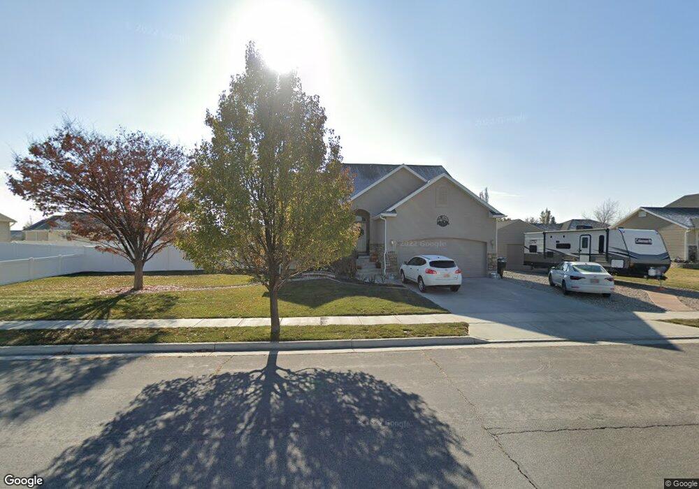
4897 Morning Dove Dr Unit 43 West Point, UT 84015
Estimated Value: $587,000 - $613,000
5
Beds
3
Baths
2,687
Sq Ft
$224/Sq Ft
Est. Value
About This Home
This home is located at 4897 Morning Dove Dr Unit 43, West Point, UT 84015 and is currently estimated at $602,343, approximately $224 per square foot. 4897 Morning Dove Dr Unit 43 is a home located in Davis County with nearby schools including West Point School, West Point Junior High School, and Syracuse High School.
Ownership History
Date
Name
Owned For
Owner Type
Purchase Details
Closed on
Oct 30, 2024
Sold by
Yochum Richard A
Bought by
Harrop Mark W and Harrop Connie D
Current Estimated Value
Home Financials for this Owner
Home Financials are based on the most recent Mortgage that was taken out on this home.
Original Mortgage
$599,000
Outstanding Balance
$592,387
Interest Rate
6.09%
Mortgage Type
VA
Estimated Equity
$9,956
Purchase Details
Closed on
Feb 11, 2015
Sold by
Jacobsen Heather
Bought by
Jacobsen Dusty
Purchase Details
Closed on
Jul 2, 2007
Sold by
Robbins Julie
Bought by
Jacobsen Heather
Home Financials for this Owner
Home Financials are based on the most recent Mortgage that was taken out on this home.
Original Mortgage
$41,550
Interest Rate
6.04%
Mortgage Type
Stand Alone Second
Purchase Details
Closed on
Apr 3, 2006
Sold by
Robbins Homes Inc
Bought by
Robbins Julie
Purchase Details
Closed on
Feb 14, 2005
Sold by
S M Carter Co
Bought by
Robbins Homes Inc
Home Financials for this Owner
Home Financials are based on the most recent Mortgage that was taken out on this home.
Original Mortgage
$165,500
Interest Rate
5.79%
Mortgage Type
Purchase Money Mortgage
Purchase Details
Closed on
Oct 29, 2003
Sold by
Paice Farms Llc
Bought by
S M Carter Co
Home Financials for this Owner
Home Financials are based on the most recent Mortgage that was taken out on this home.
Original Mortgage
$202,500
Interest Rate
5.98%
Mortgage Type
Construction
Purchase Details
Closed on
Apr 16, 2003
Sold by
Mark Higley Construction Lc and Boothe Gordon
Bought by
Paice Farms Llc
Home Financials for this Owner
Home Financials are based on the most recent Mortgage that was taken out on this home.
Original Mortgage
$850,000
Interest Rate
6.22%
Mortgage Type
Seller Take Back
Create a Home Valuation Report for This Property
The Home Valuation Report is an in-depth analysis detailing your home's value as well as a comparison with similar homes in the area
Home Values in the Area
Average Home Value in this Area
Purchase History
| Date | Buyer | Sale Price | Title Company |
|---|---|---|---|
| Harrop Mark W | -- | Stewart Title | |
| Yochum Richard A | -- | Stewart Title | |
| Jacobsen Dusty | -- | Hickman Land Title | |
| Jacobsen Heather | -- | First American Title | |
| Robbins Julie | $235,000 | Founders Title Co | |
| Robbins Homes Inc | -- | Security Title | |
| S M Carter Co | -- | Security Title Company | |
| Paice Farms Llc | -- | Heritage West Title Insuranc |
Source: Public Records
Mortgage History
| Date | Status | Borrower | Loan Amount |
|---|---|---|---|
| Open | Harrop Mark W | $599,000 | |
| Previous Owner | Jacobsen Heather | $41,550 | |
| Previous Owner | Jacobsen Heather | $221,600 | |
| Previous Owner | Robbins Homes Inc | $165,500 | |
| Previous Owner | S M Carter Co | $202,500 | |
| Previous Owner | Paice Farms Llc | $850,000 |
Source: Public Records
Tax History Compared to Growth
Tax History
| Year | Tax Paid | Tax Assessment Tax Assessment Total Assessment is a certain percentage of the fair market value that is determined by local assessors to be the total taxable value of land and additions on the property. | Land | Improvement |
|---|---|---|---|---|
| 2025 | -- | $310,200 | $112,687 | $197,513 |
| 2024 | $0 | $301,400 | $101,452 | $199,948 |
| 2023 | $176 | $510,000 | $126,380 | $383,620 |
| 2022 | $176 | $300,300 | $65,716 | $234,584 |
| 2021 | $0 | $413,000 | $102,765 | $310,235 |
| 2020 | $2,628 | $360,000 | $86,316 | $273,684 |
| 2019 | $2,571 | $347,000 | $83,748 | $263,252 |
| 2018 | $2,401 | $319,000 | $83,784 | $235,216 |
| 2016 | $2,068 | $144,155 | $32,416 | $111,739 |
| 2015 | $1,998 | $132,000 | $32,416 | $99,584 |
| 2014 | $1,725 | $115,311 | $32,416 | $82,895 |
| 2013 | -- | $120,546 | $31,811 | $88,735 |
Source: Public Records
Map
Nearby Homes
- 4669 W 75 N
- 4594 W 75 N Unit 405
- 128 N 4500 W
- 477 N 4500 W
- 4719 W 650 N
- 4366 W 200 N
- 4352 W 300 N
- 4325 W 75 N
- 4362 West St Unit 106
- 4358 West St Unit 105
- 120 N 4325 W
- 356 S 4300 W Unit 611
- 364 S 4300 W Unit 610
- 357 N 4000 W
- 696 S 4500 W
- 3949 W 250 N
- Charleston Plan at Bluff View
- 3851 W 50 S Unit 425
- 3849 W 50 S Unit 426
- 3847 W 50 S Unit 428
- 4897 Morning Dove Dr
- 4898 W 150 N
- 4909 W 175 N
- 4883 Morning Dove Dr
- 4883 Morning Dove Dr
- 4880 W 150 N
- 4910 W 150 N
- 4910 Canvasback Ln Unit 48
- 4117 Morning Dove Dr Unit 43
- 193 N 4875 W
- 4912 Morning Dove Dr
- 4912 Morning Dove Dr
- 4912 W 175 N
- 4861 W 175 N
- 4921 Morning Dove Dr Unit 45
- 4921 Morning Dove Dr
- 4921 W 175 N
- 4886 W 150 N
- 4903 W 150 N
- 4922 W 150 N