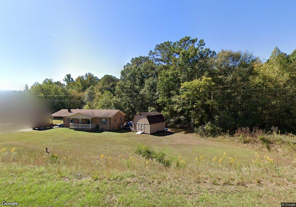
49 Airport Rd Cedartown, GA 30125
Estimated Value: $180,321 - $207,000
3
Beds
1
Bath
1,176
Sq Ft
$163/Sq Ft
Est. Value
About This Home
This home is located at 49 Airport Rd, Cedartown, GA 30125 and is currently estimated at $191,580, approximately $162 per square foot. 49 Airport Rd is a home located in Polk County.
Ownership History
Date
Name
Owned For
Owner Type
Purchase Details
Closed on
Apr 28, 2000
Sold by
Brown Gaynelle C
Bought by
Brown Alfred R
Current Estimated Value
Purchase Details
Closed on
Feb 6, 1989
Sold by
Farmers Home Admin
Bought by
Brown Alfred R
Purchase Details
Closed on
Mar 28, 1988
Sold by
Corn Lisa D
Bought by
Usa Acting Thru Fmha
Purchase Details
Closed on
Jun 5, 1986
Sold by
Farmers Home Admin
Bought by
Corn Lisa D
Purchase Details
Closed on
Jul 25, 1985
Sold by
Arnold Sandy A
Bought by
Farmers Home Admin
Purchase Details
Closed on
Nov 1, 1981
Sold by
Stringer Fred
Bought by
Arnold Sandy A
Purchase Details
Closed on
Dec 16, 1980
Bought by
Stringer Fred
Create a Home Valuation Report for This Property
The Home Valuation Report is an in-depth analysis detailing your home's value as well as a comparison with similar homes in the area
Home Values in the Area
Average Home Value in this Area
Purchase History
| Date | Buyer | Sale Price | Title Company |
|---|---|---|---|
| Brown Alfred R | -- | -- | |
| Brown Alfred R | $32,500 | -- | |
| Usa Acting Thru Fmha | -- | -- | |
| Corn Lisa D | -- | -- | |
| Farmers Home Admin | -- | -- | |
| Arnold Sandy A | -- | -- | |
| Stringer Fred | -- | -- |
Source: Public Records
Tax History Compared to Growth
Tax History
| Year | Tax Paid | Tax Assessment Tax Assessment Total Assessment is a certain percentage of the fair market value that is determined by local assessors to be the total taxable value of land and additions on the property. | Land | Improvement |
|---|---|---|---|---|
| 2024 | $796 | $52,792 | $2,208 | $50,584 |
| 2023 | $499 | $34,432 | $2,208 | $32,224 |
| 2022 | $643 | $29,112 | $1,472 | $27,640 |
| 2021 | $652 | $29,112 | $1,472 | $27,640 |
| 2020 | $653 | $29,112 | $1,472 | $27,640 |
| 2019 | $586 | $23,802 | $1,472 | $22,330 |
| 2018 | $582 | $23,132 | $1,472 | $21,660 |
| 2017 | $583 | $23,414 | $1,754 | $21,660 |
| 2016 | $557 | $22,480 | $820 | $21,660 |
| 2015 | $564 | $22,668 | $820 | $21,848 |
| 2014 | $568 | $22,668 | $820 | $21,848 |
Source: Public Records
Map
Nearby Homes
- 0 Bethlehem Rd Unit 10622470
- 2020 Old Cedartown Rd
- 3825 Rockmart Hwy
- 1907 Old Cedartown Rd
- 2056 Bellview Rd
- 0 Pine Mountain Rd Unit 7662185
- 482 Pine Mountain Rd
- 0 Pine Mountain Rd Unit 10478395
- 0 Pine Mountain Rd Unit 7540784
- 1157 Stringer Rd
- 394 Knight Rd
- 93 Clay Rd
- 65 Wheeler Rd
- 1039 Old Cedartown Rd
- 600 Grady Rd
- 1211 Bellview Rd
- 440 Mcbride Rd
- 0 Richard Pullen Rd Unit 7626794
- 0 Richard Pullen Rd Unit 10577442
- 0 Benefield Rd Unit 10405501
- 37 Airport Rd
- 27 Airport Rd
- 0 Airport Loop Rd Rd
- 0 Airport Rd
- 0 Bethlehem Rd
- 0 Airport Rd Unit 7626414
- 0 Airport Rd Unit 7512955
- 0 Bethlehem Rd Unit 8785196
- 0 Airport Rd Unit 8448069
- 0 Airport Rd Unit 8314127
- 0 Airport Rd Unit 7552643
- 0 Bethlehem Rd Unit 7174284
- 0 Airport Rd Unit 7040871
- 0 Airport Rd Unit 8935288
- 0 Airport Rd Unit 8106182
- 0 Bethlehem Rd Unit 8110888
- 0 Airport Rd Unit 8275788
- 0 Airport Rd Unit 8552933
- 91 Airport Rd
- 0 Bethlehem Rd Unit 8350960