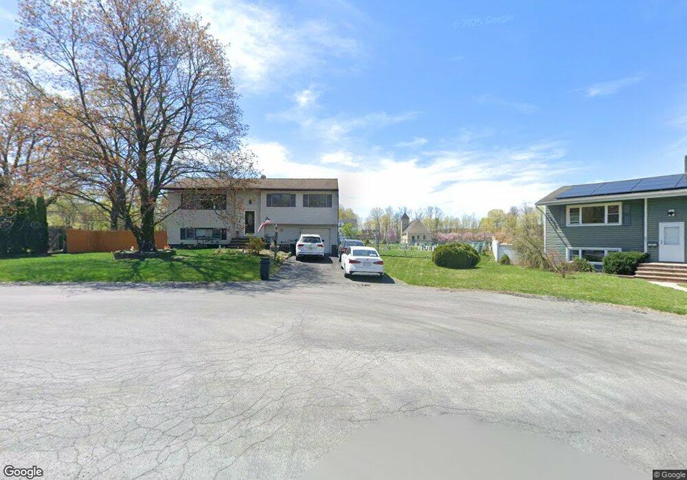
49 Beardslee Hill Dr Ogdensburg, NJ 07439
Estimated Value: $364,000 - $439,000
--
Bed
--
Bath
1,874
Sq Ft
$213/Sq Ft
Est. Value
About This Home
This home is located at 49 Beardslee Hill Dr, Ogdensburg, NJ 07439 and is currently estimated at $400,060, approximately $213 per square foot. 49 Beardslee Hill Dr is a home located in Sussex County with nearby schools including Ogdensburg Elementary School, Wallkill Valley Regional High School, and Immaculate Conception Regional School.
Ownership History
Date
Name
Owned For
Owner Type
Purchase Details
Closed on
Jun 8, 2007
Sold by
Stone Edward J and Stone Bethany M
Bought by
Oliver Brian and Oliver Danielle
Current Estimated Value
Home Financials for this Owner
Home Financials are based on the most recent Mortgage that was taken out on this home.
Original Mortgage
$242,800
Outstanding Balance
$148,568
Interest Rate
6.19%
Mortgage Type
Purchase Money Mortgage
Estimated Equity
$251,492
Purchase Details
Closed on
Aug 21, 1998
Sold by
Meigh Richard and Meigh Anne F
Bought by
Stone Edward J and Stone Bethany M
Home Financials for this Owner
Home Financials are based on the most recent Mortgage that was taken out on this home.
Original Mortgage
$132,238
Interest Rate
6.92%
Mortgage Type
FHA
Create a Home Valuation Report for This Property
The Home Valuation Report is an in-depth analysis detailing your home's value as well as a comparison with similar homes in the area
Home Values in the Area
Average Home Value in this Area
Purchase History
| Date | Buyer | Sale Price | Title Company |
|---|---|---|---|
| Oliver Brian | $303,500 | Chicago Title | |
| Stone Edward J | $133,500 | -- |
Source: Public Records
Mortgage History
| Date | Status | Borrower | Loan Amount |
|---|---|---|---|
| Open | Oliver Brian | $242,800 | |
| Previous Owner | Stone Edward J | $132,238 |
Source: Public Records
Tax History Compared to Growth
Tax History
| Year | Tax Paid | Tax Assessment Tax Assessment Total Assessment is a certain percentage of the fair market value that is determined by local assessors to be the total taxable value of land and additions on the property. | Land | Improvement |
|---|---|---|---|---|
| 2025 | $9,957 | $249,100 | $46,700 | $202,400 |
| 2024 | $9,879 | $249,100 | $46,700 | $202,400 |
| 2023 | $9,879 | $249,100 | $46,700 | $202,400 |
| 2022 | $9,384 | $249,100 | $46,700 | $202,400 |
| 2021 | $9,379 | $249,100 | $46,700 | $202,400 |
| 2020 | $9,249 | $249,100 | $46,700 | $202,400 |
| 2019 | $9,090 | $249,100 | $46,700 | $202,400 |
| 2018 | $8,948 | $249,100 | $46,700 | $202,400 |
| 2017 | $8,808 | $249,100 | $46,700 | $202,400 |
| 2016 | $8,654 | $249,100 | $46,700 | $202,400 |
| 2015 | $8,472 | $249,100 | $46,700 | $202,400 |
| 2014 | $8,360 | $249,100 | $46,700 | $202,400 |
Source: Public Records
Map
Nearby Homes
- 6 Spring St
- 270 Munsonhurst Rd
- 49 Edison Ave
- 64 Edison Ave
- 9 Madden Ave
- 33 Glenbrook Rd
- 10 Avenue B
- 8 Plaskon Terrace
- 12 Richards St
- 16 Wildcat Rd
- 285 Wild Cat Rd
- 113 Munsonhurst Rd
- 111 Munsonhurst Rd
- 109 Munsonhurst Rd
- 11 Zimmer Dr
- 69 New Jersey 23
- 10 Hemlock Dr
- 115 Scudders Rd
- 149 Maple Rd
- 7 Woodland Rd
- 47 Beardslee Hill Dr
- 51 Beardslee Hill Dr
- 52 Beardslee Hill Dr
- 45 Beardslee Hill Dr
- 48 Beardslee Hill Dr
- 44 Beardslee Hill Dr
- 50 Beardslee Hill Dr
- 43 Beardslee Hill Dr
- 38 Beardslee Hill Dr
- 41 Beardslee Hill Dr
- 36 Beardslee Hill Dr
- 39 Beardslee Hill Dr
- 34 Beardslee Hill Dr
- 37 Beardslee Hill Dr
- 28 N Clark St
- 32 N Clark St
- 35 Beardslee Hill Dr
- 20 N Clark St
- 34 N Clark St
- 32 Beardslee Hill Dr