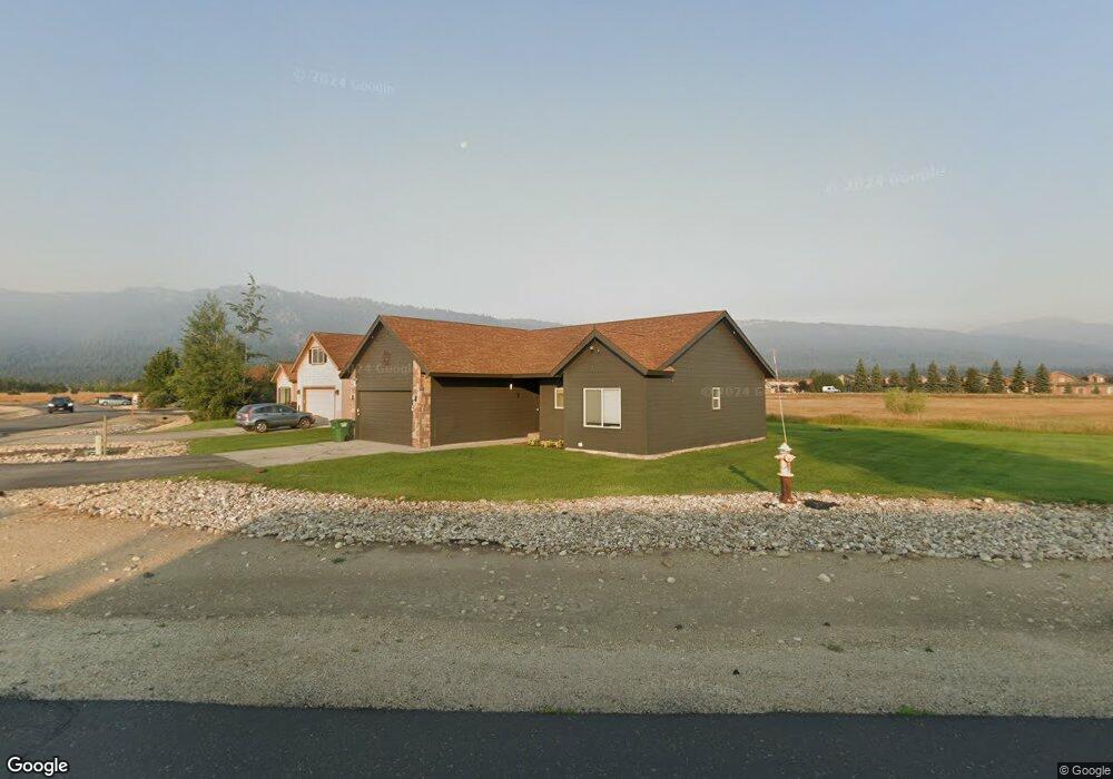
49 Buckskin Dr Donnelly, ID 83615
Estimated Value: $414,687 - $463,000
3
Beds
2
Baths
1,322
Sq Ft
$325/Sq Ft
Est. Value
About This Home
This home is located at 49 Buckskin Dr, Donnelly, ID 83615 and is currently estimated at $429,422, approximately $324 per square foot. 49 Buckskin Dr is a home located in Valley County with nearby schools including Donnelly Elementary School and McCall-Donnelly High School.
Ownership History
Date
Name
Owned For
Owner Type
Purchase Details
Closed on
Sep 13, 2023
Sold by
Jacobson James Brownlee and Jacobson Maria Catherin
Bought by
Jacobson Family Trust and Jacobson
Current Estimated Value
Purchase Details
Closed on
Jun 29, 2021
Sold by
Jec Revocable Trust and Caffey Judith E
Bought by
Jacobson James Brownlee and Jacobson Catherine Maria
Purchase Details
Closed on
Jun 22, 2021
Sold by
Caffey Judith E and Jec Revocable Trust Of 1991
Bought by
Jacobson James Brownlee and Jacobson Maria Catherine
Purchase Details
Closed on
Aug 23, 2006
Sold by
Timberline Development Llc
Bought by
Sebesta Paul
Home Financials for this Owner
Home Financials are based on the most recent Mortgage that was taken out on this home.
Original Mortgage
$61,274
Interest Rate
6.3%
Mortgage Type
Stand Alone Second
Create a Home Valuation Report for This Property
The Home Valuation Report is an in-depth analysis detailing your home's value as well as a comparison with similar homes in the area
Home Values in the Area
Average Home Value in this Area
Purchase History
| Date | Buyer | Sale Price | Title Company |
|---|---|---|---|
| Jacobson Family Trust | -- | None Listed On Document | |
| Jacobson James Brownlee | -- | First American Title | |
| Jacobson James Brownlee | -- | First American Ttl Ins Comp | |
| Sebesta Paul | -- | -- |
Source: Public Records
Mortgage History
| Date | Status | Borrower | Loan Amount |
|---|---|---|---|
| Previous Owner | Sebesta Paul | $61,274 |
Source: Public Records
Tax History Compared to Growth
Tax History
| Year | Tax Paid | Tax Assessment Tax Assessment Total Assessment is a certain percentage of the fair market value that is determined by local assessors to be the total taxable value of land and additions on the property. | Land | Improvement |
|---|---|---|---|---|
| 2025 | $1,096 | $388,780 | $27,902 | $360,878 |
| 2023 | $1,096 | $443,987 | $28,787 | $415,200 |
| 2022 | $1,218 | $396,942 | $28,787 | $368,155 |
| 2021 | $1,113 | $231,294 | $22,144 | $209,150 |
| 2020 | $1,087 | $188,657 | $28,833 | $159,824 |
| 2019 | $930 | $147,444 | $27,460 | $119,984 |
| 2018 | $915 | $137,368 | $27,514 | $109,854 |
| 2017 | $991 | $136,357 | $30,545 | $105,812 |
| 2016 | $900 | $121,242 | $25,000 | $96,242 |
| 2015 | $795 | $100,853 | $0 | $0 |
| 2013 | -- | $98,225 | $0 | $0 |
Source: Public Records
Map
Nearby Homes
- 22 Charters Dr
- 16 Buckskin Dr
- 13111 Cameron Dr
- Lot 4 Hideout Dr Unit 4
- Lot 6 Hideout Dr Unit 6
- 24 Mangum Cir Unit 1
- 20 #5 W Mangum Cir Unit 5
- 24 Mangum Dr Unit # 1 Unit 1
- 20 Mangum Cir Unit 8
- 13098 Hill House Loop
- 13078 Hill House Loop
- 13091 Hill House Loop
- 13076 Hill House Loop
- 35 1 Mangum Cir
- 35 Mangum Cir Unit 1
- 32 Mangum Cir Unit 3
- 32 Mangum Cir
- 34 Mangum Cir Unit 8
- 106 Forest Place
- 13156 Hawks Bay Rd
- 49 Buckskin Dr
- 29 Buckskin Rd
- 29 Buckskin Dr
- 27 Buckskin Dr
- 31 Buckskin Rd
- 31 Buckskin Dr
- 28 Buckskin Dr
- 28 Buckskin Rd
- 28 Timberline Dr
- 30 Timberline Dr
- 25 Buckskin Rd
- 26 Buckskin Rd
- 26 Buckskin Dr
- 33 Buckskin Rd
- 33 Buckskin Dr
- 26 Timberline Dr
- 32 Timberline Dr
- 24 Buckskin Rd
- 24 Buckskin Dr
- 27 Charters Dr