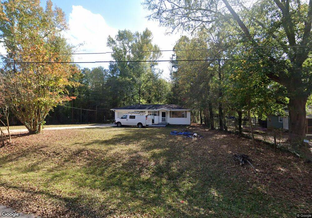
49 Cedarcrest Rd Lagrange, GA 30240
Estimated Value: $70,000 - $147,000
2
Beds
1
Bath
792
Sq Ft
$133/Sq Ft
Est. Value
About This Home
This home is located at 49 Cedarcrest Rd, Lagrange, GA 30240 and is currently estimated at $105,169, approximately $132 per square foot. 49 Cedarcrest Rd is a home located in Troup County with nearby schools including Berta Weathersbee Elementary School, Long Cane Elementary School, and Whitesville Road Elementary School.
Ownership History
Date
Name
Owned For
Owner Type
Purchase Details
Closed on
May 13, 2019
Sold by
Binion Kenneth
Bought by
Mckeen Realty Llc
Current Estimated Value
Purchase Details
Closed on
Sep 26, 1996
Sold by
Robert S Mullins
Bought by
Binion Kenneth and Mary Alice
Purchase Details
Closed on
Jul 17, 1996
Sold by
Annie Ruth Newton
Bought by
Robert S Mullins
Purchase Details
Closed on
Jan 1, 1962
Sold by
David Butler
Bought by
Annie Ruth Newton
Create a Home Valuation Report for This Property
The Home Valuation Report is an in-depth analysis detailing your home's value as well as a comparison with similar homes in the area
Purchase History
| Date | Buyer | Sale Price | Title Company |
|---|---|---|---|
| Mckeen Realty Llc | $35,000 | -- | |
| Binion Kenneth | $30,000 | -- | |
| Robert S Mullins | -- | -- | |
| Annie Ruth Newton | -- | -- |
Source: Public Records
Tax History
| Year | Tax Paid | Tax Assessment Tax Assessment Total Assessment is a certain percentage of the fair market value that is determined by local assessors to be the total taxable value of land and additions on the property. | Land | Improvement |
|---|---|---|---|---|
| 2025 | $784 | $28,120 | $8,000 | $20,120 |
| 2024 | $784 | $28,760 | $8,000 | $20,760 |
| 2023 | $708 | $25,960 | $8,000 | $17,960 |
| 2022 | $819 | $25,920 | $8,000 | $17,920 |
| 2021 | $477 | $15,800 | $6,000 | $9,800 |
| 2020 | $422 | $15,800 | $6,000 | $9,800 |
| 2019 | $434 | $14,400 | $1,800 | $12,600 |
| 2018 | $448 | $14,848 | $1,808 | $13,040 |
| 2017 | $448 | $14,848 | $1,808 | $13,040 |
| 2016 | $435 | $14,423 | $1,808 | $12,615 |
| 2015 | $436 | $14,423 | $1,808 | $12,615 |
| 2014 | $416 | $13,759 | $1,808 | $11,951 |
| 2013 | -- | $14,576 | $1,808 | $12,768 |
Source: Public Records
Map
Nearby Homes
- 509 Connie Dr
- 427 Fling Rd
- 808 S Fling Rd
- 8 Horace Carter Rd
- 124 Foxdale Dr
- 0 Glass Bridge Rd Unit 10679358
- 0 Bradfield Dr Unit 10568803
- 103 Hawthorne Cir
- 104 Bridlewood Dr
- 266 Glass Bridge Rd
- 275 Hanson Dr
- 0 Hanson Dr Unit 10641272
- 135 Planters Ridge Dr
- 640 Hudson Rd
- 336 Whitaker Rd
- 22 Freeman Rd
- 3835 W Point Rd
- 105 Redwood Dr
- 440 & 448 Kimbrough Rd
- 4.5 ACRES Whatley Rd N
- 59 Cedarcrest Rd
- 37 Cedarcrest Rd
- 69 Cedarcrest Rd
- 27 Cedarcrest Rd
- 38 Cedarcrest Rd
- 17 Cedarcrest Rd
- 68 Cedarcrest Rd
- 20 Cedarcrest Rd
- 87 Cedarcrest Rd
- 134 Teaver Rd
- 51 Sinclair Dr
- 8 Cedarcrest Rd
- 116 Teaver Rd
- 92 Cedarcrest Rd
- 37 Sinclair Dr
- 172 Teaver Rd
- 106 Teaver Rd
- 103 Cedarcrest Rd
- 188 Teaver Rd
- 151 Teaver Rd
Your Personal Tour Guide
Ask me questions while you tour the home.