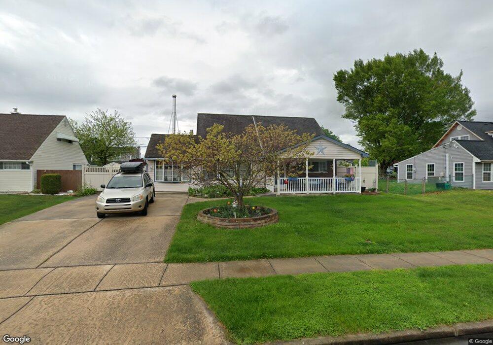
49 Cliff Rd Levittown, PA 19057
Estimated Value: $419,000 - $430,000
3
Beds
2
Baths
1,605
Sq Ft
$263/Sq Ft
Est. Value
About This Home
This home is located at 49 Cliff Rd, Levittown, PA 19057 and is currently estimated at $422,443, approximately $263 per square foot. 49 Cliff Rd is a home located in Bucks County with nearby schools including Walter Miller Elementary School, Sandburg Middle School, and Neshaminy High School.
Ownership History
Date
Name
Owned For
Owner Type
Purchase Details
Closed on
Oct 17, 2007
Sold by
Kappler Kevin F and Kappler Karen D
Bought by
Gossett Paul and Gossett Lisa
Current Estimated Value
Home Financials for this Owner
Home Financials are based on the most recent Mortgage that was taken out on this home.
Original Mortgage
$135,000
Outstanding Balance
$85,204
Interest Rate
6.42%
Mortgage Type
Purchase Money Mortgage
Estimated Equity
$337,239
Purchase Details
Closed on
Aug 15, 1994
Sold by
Hughes Gerard J and Hughes Mary B
Bought by
Kappler Kevin F and Kappler Karen D
Home Financials for this Owner
Home Financials are based on the most recent Mortgage that was taken out on this home.
Original Mortgage
$115,900
Interest Rate
8.61%
Create a Home Valuation Report for This Property
The Home Valuation Report is an in-depth analysis detailing your home's value as well as a comparison with similar homes in the area
Purchase History
| Date | Buyer | Sale Price | Title Company |
|---|---|---|---|
| Gossett Paul | $254,000 | None Available | |
| Kappler Kevin F | $122,000 | Lawyers Title Insurance Corp |
Source: Public Records
Mortgage History
| Date | Status | Borrower | Loan Amount |
|---|---|---|---|
| Open | Gossett Paul | $135,000 | |
| Previous Owner | Kappler Kevin F | $115,900 |
Source: Public Records
Tax History Compared to Growth
Tax History
| Year | Tax Paid | Tax Assessment Tax Assessment Total Assessment is a certain percentage of the fair market value that is determined by local assessors to be the total taxable value of land and additions on the property. | Land | Improvement |
|---|---|---|---|---|
| 2025 | $4,964 | $22,800 | $3,720 | $19,080 |
| 2024 | $4,964 | $22,800 | $3,720 | $19,080 |
| 2023 | $4,885 | $22,800 | $3,720 | $19,080 |
| 2022 | $4,757 | $22,800 | $3,720 | $19,080 |
| 2021 | $4,757 | $22,800 | $3,720 | $19,080 |
| 2020 | $4,700 | $22,800 | $3,720 | $19,080 |
| 2019 | $4,595 | $22,800 | $3,720 | $19,080 |
| 2018 | $4,510 | $22,800 | $3,720 | $19,080 |
| 2017 | $4,395 | $22,800 | $3,720 | $19,080 |
| 2016 | $4,395 | $22,800 | $3,720 | $19,080 |
| 2015 | $4,585 | $22,800 | $3,720 | $19,080 |
| 2014 | $4,585 | $22,800 | $3,720 | $19,080 |
Source: Public Records
Map
Nearby Homes
- 14 Cinnamon Rd
- 19 Cobalt Ridge Dr N
- 44 Cactus Rd
- 114 Nursery Ave
- 15 Cable Rd
- 212 Apple St
- 58 Queen Lily Rd
- 28 Cloister Rd
- 7 Canal Rd
- 56 Indian Red Rd
- 118 Blough Rd
- 83 Indigo Rd
- 109 Blough Rd
- 14 Iris Rd
- 7 Indian Red Rd
- 58 Rocky Pool Ln
- 29 Spindletree Rd
- 208 Trenton Rd
- 46 Hydrangea Rd
- L235.17 Edgely Rd