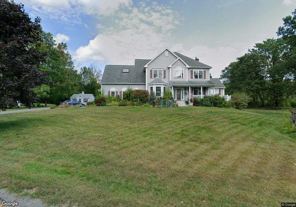
49 Cortland Cir Lunenburg, MA 01462
Estimated Value: $673,000 - $828,000
3
Beds
3
Baths
3,283
Sq Ft
$227/Sq Ft
Est. Value
About This Home
This home is located at 49 Cortland Cir, Lunenburg, MA 01462 and is currently estimated at $745,321, approximately $227 per square foot. 49 Cortland Cir is a home located in Worcester County with nearby schools including Lunenburg Primary School and Lunenburg High School.
Ownership History
Date
Name
Owned For
Owner Type
Purchase Details
Closed on
Jan 31, 2005
Sold by
Mcverry Gail M and Mcverry Thomas L
Bought by
Holt Eric D and Holt Sheila D
Current Estimated Value
Home Financials for this Owner
Home Financials are based on the most recent Mortgage that was taken out on this home.
Original Mortgage
$412,000
Outstanding Balance
$208,310
Interest Rate
5.67%
Mortgage Type
Purchase Money Mortgage
Estimated Equity
$537,011
Purchase Details
Closed on
Dec 13, 2002
Sold by
Robert M Hicks Inc
Bought by
Mcverry Thomas L and Mcverry Gail M
Home Financials for this Owner
Home Financials are based on the most recent Mortgage that was taken out on this home.
Original Mortgage
$393,550
Interest Rate
6.17%
Mortgage Type
Purchase Money Mortgage
Create a Home Valuation Report for This Property
The Home Valuation Report is an in-depth analysis detailing your home's value as well as a comparison with similar homes in the area
Home Values in the Area
Average Home Value in this Area
Purchase History
| Date | Buyer | Sale Price | Title Company |
|---|---|---|---|
| Holt Eric D | $515,000 | -- | |
| Mcverry Thomas L | $463,000 | -- |
Source: Public Records
Mortgage History
| Date | Status | Borrower | Loan Amount |
|---|---|---|---|
| Open | Holt Eric D | $412,000 | |
| Previous Owner | Mcverry Thomas L | $40,000 | |
| Previous Owner | Mcverry Thomas L | $393,550 |
Source: Public Records
Tax History Compared to Growth
Tax History
| Year | Tax Paid | Tax Assessment Tax Assessment Total Assessment is a certain percentage of the fair market value that is determined by local assessors to be the total taxable value of land and additions on the property. | Land | Improvement |
|---|---|---|---|---|
| 2025 | $9,940 | $692,200 | $0 | $692,200 |
| 2024 | $9,000 | $638,300 | $0 | $638,300 |
| 2023 | $7,021 | $480,200 | $0 | $480,200 |
| 2022 | $8,255 | $480,200 | $0 | $480,200 |
| 2020 | $7,962 | $439,400 | $0 | $439,400 |
| 2019 | $8,512 | $455,700 | $0 | $455,700 |
| 2018 | $8,601 | $436,600 | $0 | $436,600 |
| 2017 | $9,055 | $453,200 | $0 | $453,200 |
| 2016 | $8,181 | $417,200 | $0 | $417,200 |
| 2015 | $6,949 | $379,300 | $0 | $379,300 |
Source: Public Records
Map
Nearby Homes
- 166 Elmwood Rd
- 1790 Massachusetts Ave Unit 25
- 1790 Massachusetts Ave Unit 22
- 330 Arbor St
- 11 Longwood Dr
- 110 Burrage St
- 878 Flat Hill Rd
- 45 Spring St
- 61 Parker Rd
- 49 Parker Rd
- 372 Townsend Harbor Rd
- 44 Hemlock Dr
- 12 Hazen Rd
- 659 Reservoir Rd
- 828 Lancaster Ave
- 43 Longley Rd
- 2 Oakes Landing
- 185 Hemlock Dr
- 35 Leominster Rd
- 9 Fairview Rd
- 47 Cortland Cir
- 268 Flat Hill Rd
- 45 Cortland Cir
- 246 Flat Hill Rd
- 44 Cortland Cir
- 44 Cortland Cir Unit 45
- 44 Cortland Cir Unit 44
- 43 Cortland Cir
- 322 Flat Hill Rd
- 372 Flat Hill Rd
- 368 Flat Hill Rd
- 370 Flat Hill Rd
- 324 Flat Hill Rd
- 41 Cortland Cir
- 41 Cortland Cir Unit 1
- 39 Cortland Cir
- 305 Flat Hill Rd
- 242 Flat Hill Rd
- 382 Flat Hill Rd
- 360 Flat Hill Rd