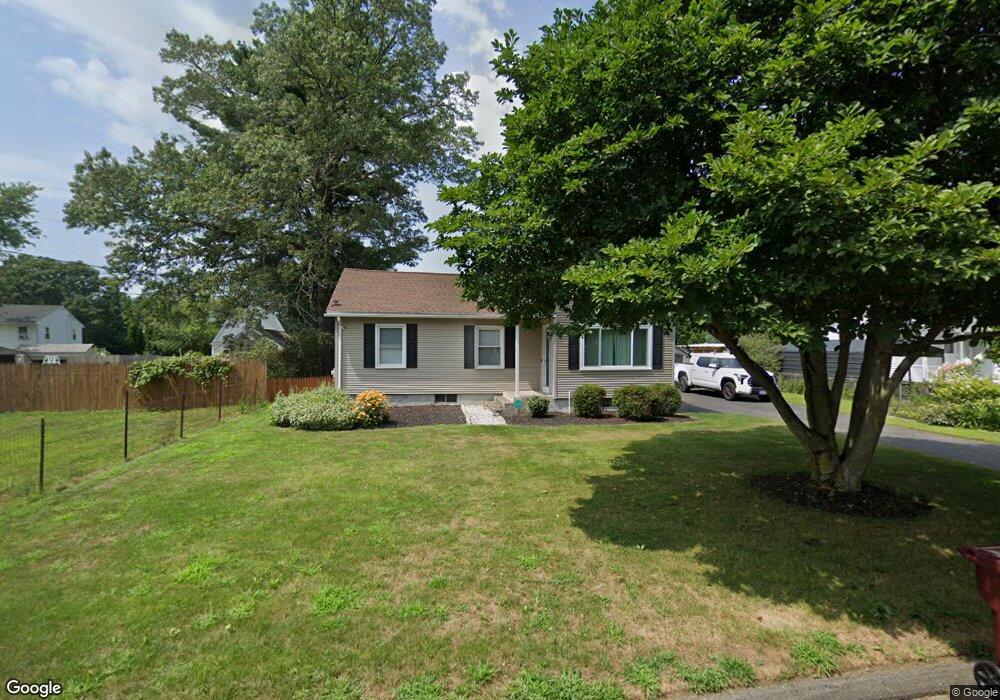
49 Crest St Ludlow, MA 01056
Estimated Value: $307,000 - $320,962
2
Beds
1
Bath
1,085
Sq Ft
$290/Sq Ft
Est. Value
About This Home
This home is located at 49 Crest St, Ludlow, MA 01056 and is currently estimated at $314,991, approximately $290 per square foot. 49 Crest St is a home located in Hampden County with nearby schools including East Street Elementary School, Chapin Street Elementary School, and Paul R. Baird Middle School.
Ownership History
Date
Name
Owned For
Owner Type
Purchase Details
Closed on
Aug 11, 2025
Sold by
Lewicki Trevor J
Bought by
Palantino Nadir and Mulhollen Michael E
Current Estimated Value
Home Financials for this Owner
Home Financials are based on the most recent Mortgage that was taken out on this home.
Original Mortgage
$287,375
Outstanding Balance
$286,631
Interest Rate
6.77%
Mortgage Type
Second Mortgage Made To Cover Down Payment
Estimated Equity
$28,360
Purchase Details
Closed on
Oct 13, 2020
Sold by
Mckay Craig J
Bought by
Lewicki Trevor J
Home Financials for this Owner
Home Financials are based on the most recent Mortgage that was taken out on this home.
Original Mortgage
$170,000
Interest Rate
2.9%
Mortgage Type
New Conventional
Purchase Details
Closed on
Sep 15, 2004
Sold by
Bertini Donna M and Bertini Michael A
Bought by
Mckay Craig J
Home Financials for this Owner
Home Financials are based on the most recent Mortgage that was taken out on this home.
Original Mortgage
$121,200
Interest Rate
6.02%
Mortgage Type
Purchase Money Mortgage
Create a Home Valuation Report for This Property
The Home Valuation Report is an in-depth analysis detailing your home's value as well as a comparison with similar homes in the area
Home Values in the Area
Average Home Value in this Area
Purchase History
| Date | Buyer | Sale Price | Title Company |
|---|---|---|---|
| Palantino Nadir | $302,500 | -- | |
| Palantino Nadir | $302,500 | -- | |
| Lewicki Trevor J | $199,000 | None Available | |
| Lewicki Trevor J | $199,000 | None Available | |
| Mckay Craig J | $159,000 | -- | |
| Mckay Craig J | $159,000 | -- | |
| Mckay Craig J | $159,000 | -- |
Source: Public Records
Mortgage History
| Date | Status | Borrower | Loan Amount |
|---|---|---|---|
| Open | Palantino Nadir | $287,375 | |
| Closed | Palantino Nadir | $287,375 | |
| Previous Owner | Lewicki Trevor J | $170,000 | |
| Previous Owner | Mckay Craig J | $121,200 | |
| Previous Owner | Mckay Craig J | $16,000 |
Source: Public Records
Tax History
| Year | Tax Paid | Tax Assessment Tax Assessment Total Assessment is a certain percentage of the fair market value that is determined by local assessors to be the total taxable value of land and additions on the property. | Land | Improvement |
|---|---|---|---|---|
| 2025 | $4,308 | $248,300 | $80,300 | $168,000 |
| 2024 | $4,114 | $227,400 | $80,300 | $147,100 |
| 2023 | $3,863 | $198,000 | $70,500 | $127,500 |
| 2022 | $3,680 | $184,100 | $70,500 | $113,600 |
| 2021 | $3,478 | $165,000 | $70,500 | $94,500 |
| 2020 | $3,334 | $161,700 | $69,400 | $92,300 |
| 2019 | $3,098 | $156,300 | $68,800 | $87,500 |
| 2018 | $2,907 | $152,900 | $68,800 | $84,100 |
| 2017 | $2,817 | $152,000 | $67,400 | $84,600 |
| 2016 | $2,652 | $146,300 | $66,100 | $80,200 |
| 2015 | $2,490 | $144,000 | $65,400 | $78,600 |
Source: Public Records
Map
Nearby Homes
- 25 Dale St
- 23 Karen Dr
- 125 Pondview Dr
- 21 Marias Way
- 37 Franklin St
- 19 Voltage Ave
- 229 Miller St Unit D-6
- 229 Miller St Unit F-13
- 229 Miller St Unit C-1
- 229 Miller St Unit E-6
- 31 Greenwich St
- 2205 Boston Rd Unit Q160
- 2205 Boston Rd Unit K100
- 308 Miller St Unit 79
- 308 Miller St Unit 78
- 308 Miller St Unit 6
- 162 Highland Ave
- 259 Prospect St
- 3 Mohawk St
- 24 Lodge Ln Unit 24
Your Personal Tour Guide
Ask me questions while you tour the home.