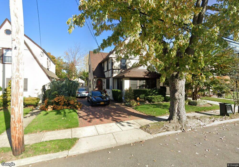
49 Durland Rd Lynbrook, NY 11563
Estimated Value: $798,000 - $831,602
3
Beds
2
Baths
1,934
Sq Ft
$421/Sq Ft
Est. Value
About This Home
This home is located at 49 Durland Rd, Lynbrook, NY 11563 and is currently estimated at $814,801, approximately $421 per square foot. 49 Durland Rd is a home located in Nassau County with nearby schools including Lynbrook Senior High School and Our Lady Of Peace School.
Ownership History
Date
Name
Owned For
Owner Type
Purchase Details
Closed on
Aug 14, 2013
Sold by
Canty Kevin and Canty Janet
Bought by
Loud Steven J and Loud Lynsie B
Current Estimated Value
Home Financials for this Owner
Home Financials are based on the most recent Mortgage that was taken out on this home.
Original Mortgage
$479,200
Outstanding Balance
$356,506
Interest Rate
4.4%
Estimated Equity
$458,295
Purchase Details
Closed on
Sep 15, 2006
Sold by
Smith Leonard
Bought by
Canty Kevin
Create a Home Valuation Report for This Property
The Home Valuation Report is an in-depth analysis detailing your home's value as well as a comparison with similar homes in the area
Home Values in the Area
Average Home Value in this Area
Purchase History
| Date | Buyer | Sale Price | Title Company |
|---|---|---|---|
| Loud Steven J | $599,000 | -- | |
| Canty Kevin | $586,500 | -- |
Source: Public Records
Mortgage History
| Date | Status | Borrower | Loan Amount |
|---|---|---|---|
| Open | Loud Steven J | $479,200 |
Source: Public Records
Tax History
| Year | Tax Paid | Tax Assessment Tax Assessment Total Assessment is a certain percentage of the fair market value that is determined by local assessors to be the total taxable value of land and additions on the property. | Land | Improvement |
|---|---|---|---|---|
| 2025 | $12,021 | $521 | $193 | $328 |
| 2024 | $1,325 | $615 | $235 | $380 |
Source: Public Records
Map
Nearby Homes
- 164 Waverly Ave
- 295 Union Ave
- 15 Baylis Place
- 161 Union Ave Unit 5
- 161 Union Ave Unit 10
- 23 Thompson Place
- 29 Norwich Ave
- 33 Prospect Ave
- 25 Davison Ave
- 11 Duryea Place
- 85 Oakland Ave
- 570 Broadway Unit 16A
- 262 Channon Rd
- 26 Dell Dr
- 10 Bulaire Rd
- 725 Scranton Ave
- 19 Dell Dr
- 16 Farnum St
- 185 Atlantic Ave Unit C-1
- 185 Atlantic Ave Unit B8
Your Personal Tour Guide
Ask me questions while you tour the home.