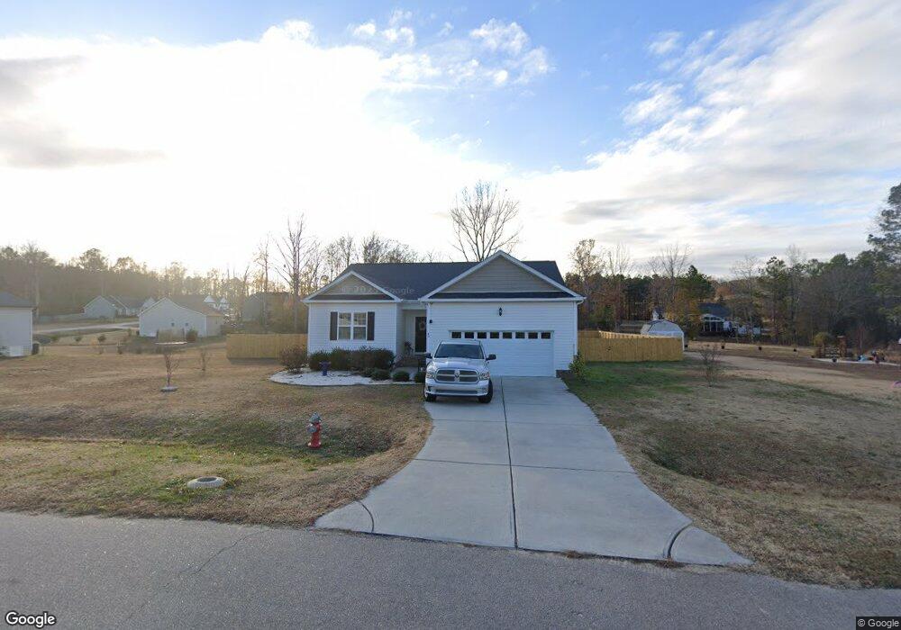
49 Eagle Swoop St Zebulon, NC 27597
Estimated Value: $322,454 - $338,000
3
Beds
2
Baths
1,525
Sq Ft
$218/Sq Ft
Est. Value
About This Home
This home is located at 49 Eagle Swoop St, Zebulon, NC 27597 and is currently estimated at $331,864, approximately $217 per square foot. 49 Eagle Swoop St is a home located in Johnston County with nearby schools including Corinth Holders Elementary School, Archer Lodge Middle School, and Corinth Holders High School.
Ownership History
Date
Name
Owned For
Owner Type
Purchase Details
Closed on
Feb 13, 2019
Sold by
Skyline Development Corp
Bought by
Sexton Raiza Eladia and Sexton Jason Anthony
Current Estimated Value
Home Financials for this Owner
Home Financials are based on the most recent Mortgage that was taken out on this home.
Original Mortgage
$213,069
Outstanding Balance
$187,326
Interest Rate
4.5%
Mortgage Type
FHA
Estimated Equity
$144,538
Purchase Details
Closed on
Jun 4, 2018
Sold by
Perry Douglas Y and Perry Patricia A
Bought by
Skyline Development Corporation
Create a Home Valuation Report for This Property
The Home Valuation Report is an in-depth analysis detailing your home's value as well as a comparison with similar homes in the area
Home Values in the Area
Average Home Value in this Area
Purchase History
| Date | Buyer | Sale Price | Title Company |
|---|---|---|---|
| Sexton Raiza Eladia | $217,000 | None Available | |
| Skyline Development Corporation | $108,000 | None Available |
Source: Public Records
Mortgage History
| Date | Status | Borrower | Loan Amount |
|---|---|---|---|
| Open | Sexton Raiza Eladia | $213,069 |
Source: Public Records
Tax History Compared to Growth
Tax History
| Year | Tax Paid | Tax Assessment Tax Assessment Total Assessment is a certain percentage of the fair market value that is determined by local assessors to be the total taxable value of land and additions on the property. | Land | Improvement |
|---|---|---|---|---|
| 2025 | $2,033 | $320,180 | $75,000 | $245,180 |
| 2024 | $1,659 | $204,780 | $48,000 | $156,780 |
| 2023 | $1,638 | $204,780 | $48,000 | $156,780 |
| 2022 | $1,720 | $204,780 | $48,000 | $156,780 |
| 2021 | $1,720 | $204,780 | $48,000 | $156,780 |
| 2020 | $1,761 | $204,780 | $48,000 | $156,780 |
| 2019 | $1,761 | $204,780 | $48,000 | $156,780 |
| 2018 | $295 | $33,500 | $33,500 | $0 |
Source: Public Records
Map
Nearby Homes
- 67 Rice Rd
- 63 Rice Rd
- 41 Tant Farm Ln
- 10320 Basmati Trail
- 38 Tant Farm Ln
- 10317 Basmati Trail
- 295 Springtooth Dr
- 48 Weathervane Dr
- 10309 Basmati Trail
- 492 Springtooth Dr
- 551 Springtooth Dr
- 575 Springtooth Dr
- 593 Springtooth Dr
- 613 Springtooth Dr
- 1398 Earpsboro Rd
- 78 Glencoe Ln
- Tbd Ember Dr
- 1304 N Carolina 96
- 348 Rye Way
- 244 Rye Way
- 25 Eagle Swoop St
- 71 Eagle Swoop St
- 42 Eagle Swoop St
- 80 Eagle Swoop St
- 199 Soaring Eagle Trail
- 93 Eagle Swoop St
- 248 Soaring Eagle Trail
- 102 Golden Eagle Ridge
- 64 Golden Eagle Ridge
- 111 Eagle Swoop St
- 118 Eagle Swoop St
- 173 Soaring Eagle Trail
- 200 Soaring Eagle Trail
- 288 Soaring Eagle Trail
- 303 Soaring Eagle Trail
- 133 Eagle Swoop St
- 134 Golden Eagle Ridge
- 73 Golden Eagle Ridge
- 140 Eagle Swoop St
- 51 Golden Eagle Ridge