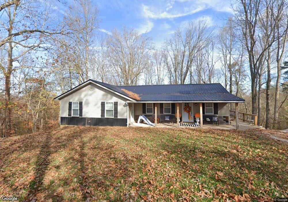
49 Eddie Dalton Rd Albany, KY 42602
Estimated Value: $71,890 - $339,000
--
Bed
--
Bath
--
Sq Ft
6.78
Acres
About This Home
This home is located at 49 Eddie Dalton Rd, Albany, KY 42602 and is currently estimated at $178,297. 49 Eddie Dalton Rd is a home with nearby schools including Clinton County Early Childhood Center, Albany Elementary School, and Clinton County Middle School.
Ownership History
Date
Name
Owned For
Owner Type
Purchase Details
Closed on
Aug 11, 2017
Sold by
Dalton Plumbing Inc
Bought by
Groce Trevor and Groce Keistan
Current Estimated Value
Home Financials for this Owner
Home Financials are based on the most recent Mortgage that was taken out on this home.
Original Mortgage
$40,165
Outstanding Balance
$33,442
Interest Rate
3.88%
Mortgage Type
Purchase Money Mortgage
Estimated Equity
$144,855
Purchase Details
Closed on
Jul 7, 2017
Sold by
Woodworth Elsie Chambers
Bought by
Conner Susan W
Home Financials for this Owner
Home Financials are based on the most recent Mortgage that was taken out on this home.
Original Mortgage
$40,165
Outstanding Balance
$33,442
Interest Rate
3.88%
Mortgage Type
Purchase Money Mortgage
Estimated Equity
$144,855
Create a Home Valuation Report for This Property
The Home Valuation Report is an in-depth analysis detailing your home's value as well as a comparison with similar homes in the area
Home Values in the Area
Average Home Value in this Area
Purchase History
| Date | Buyer | Sale Price | Title Company |
|---|---|---|---|
| Groce Trevor | $40,000 | None Available | |
| Conner Susan W | -- | None Available |
Source: Public Records
Mortgage History
| Date | Status | Borrower | Loan Amount |
|---|---|---|---|
| Open | Groce Trevor | $40,165 |
Source: Public Records
Tax History Compared to Growth
Tax History
| Year | Tax Paid | Tax Assessment Tax Assessment Total Assessment is a certain percentage of the fair market value that is determined by local assessors to be the total taxable value of land and additions on the property. | Land | Improvement |
|---|---|---|---|---|
| 2024 | $333 | $40,000 | $0 | $0 |
| 2023 | $336 | $40,000 | $0 | $0 |
| 2022 | $334 | $40,000 | $0 | $0 |
| 2021 | $334 | $40,000 | $0 | $0 |
| 2020 | $334 | $40,000 | $0 | $0 |
| 2019 | $331 | $40,000 | $0 | $0 |
| 2018 | $329 | $12,000 | $12,000 | $0 |
| 2015 | $563 | $12,000 | $12,000 | $0 |
| 2013 | -- | $74,000 | $74,000 | $0 |
Source: Public Records
Map
Nearby Homes
- 210 Lakeside Dr
- 412 Groce Subdivision Rd
- 30 Lakepointe Dr
- 350 Griffin Trail
- 1086 Martin Cross Rd
- 0 Griffin Trail Unit 74 11089354
- 620 Griffin Trail
- 0 Oak Hill Rd
- Lot 60 Holly Bend Dr
- Lot 29 Holly Bend Dr
- Lot 80 Holly Bend Dr
- Lot 63 Meadow Lark
- 0 Holly Bend Dr Unit RTC2788122
- 0 Bluebird Point
- Lot 17 Bluebird Point
- Lot 13 Holly Bend Dr
- 251 S Taxiway Dr
- 5156 Turney Groce Rd
- 12 Eagle Point Dr Unit Lot 12, 14, & most
- 17 Eagle Point Dr Unit Lot 17 & 18
- 100 Eddie Dalton Rd
- 94 Eddie Dalton Rd
- 127 Eddie Dalton Rd
- 87 Lakeside Dr
- 3 Lakeside Hideaway Rd
- Lot 2-4 Stone Cliff Subdivision
- 0 Lakeside Dr Unit 3034172
- 0 Lakeside Dr Unit 191591
- 0 Lakeside Dr
- 130 Lonnie Jones Rd
- 70 Lakeside Dr
- 306 Lakeside Dr
- 154 Lonnie Jones Rd Rd
- 6054 Wolf River Dock Rd
- 6 Lakeside Dr
- 5990 Wolf River Dock Rd
- 5986 Wolf River Dock Rd
- 5916 Wolf River Dock Rd
- 5945 Wolf River Dock Rd
- Dale Dale Hollow Ave