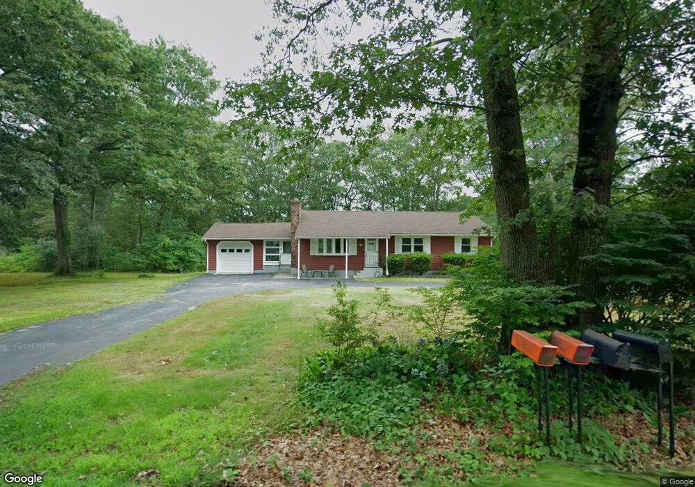
49 Fales Rd North Attleboro, MA 02760
North Attleboro NeighborhoodEstimated Value: $456,000 - $599,000
3
Beds
2
Baths
1,392
Sq Ft
$369/Sq Ft
Est. Value
About This Home
This home is located at 49 Fales Rd, North Attleboro, MA 02760 and is currently estimated at $513,241, approximately $368 per square foot. 49 Fales Rd is a home located in Bristol County with nearby schools including North Attleboro High School and Mercymount Country Day School.
Ownership History
Date
Name
Owned For
Owner Type
Purchase Details
Closed on
Jun 6, 2024
Sold by
Blanchette Mark S
Bought by
49 Fales Rd Realty Corp
Current Estimated Value
Purchase Details
Closed on
May 3, 2024
Sold by
Fauteus Joseph L Est and Hagerty
Bought by
Blanchette Mark S
Purchase Details
Closed on
Sep 5, 2018
Sold by
Fauteux Joseph L and Fauteux Mary J
Bought by
Fauteux Joseph L
Purchase Details
Closed on
Oct 11, 2016
Sold by
Fauteux Joseph L and Fauteux Mary J
Bought by
Fauteux Joseph L
Purchase Details
Closed on
May 31, 1966
Bought by
Fauteux Joseph L and Fauteux Mary Jane
Create a Home Valuation Report for This Property
The Home Valuation Report is an in-depth analysis detailing your home's value as well as a comparison with similar homes in the area
Home Values in the Area
Average Home Value in this Area
Purchase History
| Date | Buyer | Sale Price | Title Company |
|---|---|---|---|
| 49 Fales Rd Realty Corp | -- | None Available | |
| 49 Fales Rd Realty Corp | -- | None Available | |
| Blanchette Mark S | $375,000 | None Available | |
| Blanchette Mark S | $375,000 | None Available | |
| Fauteux Joseph L | -- | -- | |
| Fauteux Joseph L | -- | -- | |
| Fauteux Joseph L | -- | -- | |
| Fauteux Joseph L | -- | -- | |
| Fauteux Joseph L | -- | -- |
Source: Public Records
Tax History Compared to Growth
Tax History
| Year | Tax Paid | Tax Assessment Tax Assessment Total Assessment is a certain percentage of the fair market value that is determined by local assessors to be the total taxable value of land and additions on the property. | Land | Improvement |
|---|---|---|---|---|
| 2025 | $5,638 | $478,200 | $146,200 | $332,000 |
| 2024 | $5,336 | $462,400 | $146,200 | $316,200 |
| 2023 | $5,303 | $414,600 | $146,200 | $268,400 |
| 2022 | $4,881 | $350,400 | $146,200 | $204,200 |
| 2021 | $5,190 | $363,700 | $146,200 | $217,500 |
| 2020 | $4,880 | $340,100 | $146,200 | $193,900 |
| 2019 | $4,694 | $329,600 | $133,100 | $196,500 |
| 2018 | $3,218 | $309,100 | $133,100 | $176,000 |
| 2017 | $3,974 | $300,600 | $133,100 | $167,500 |
| 2016 | $3,831 | $289,800 | $147,900 | $141,900 |
| 2015 | $3,749 | $285,300 | $155,300 | $130,000 |
| 2014 | $3,617 | $273,200 | $143,600 | $129,600 |
Source: Public Records
Map
Nearby Homes
- 41 Stone Ridge Rd
- 34 Stone Ridge Rd
- 740 Allen Ave
- 12 Intervale Dr
- 30 Sperry Ln Unit Lot 15
- 0 Anawan Rd
- 160 Crescent Ave
- 105 Newell Dr
- 46 Westside Ave
- 25 Gregory Way
- 49 Hoppin Hill Ave
- 44 Powder Horn Way
- 22 Gilbert Ct
- 16 Johnson St
- 50 Metcalf Rd
- 80 Broadway Unit 9
- 12 Roosevelt Ave
- 16 Wollen Dr
- 181 Paine Rd
- 334 S Washington St