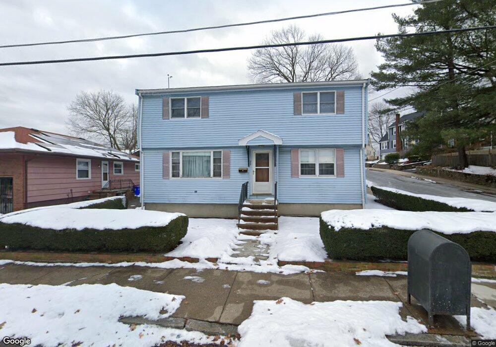
49 Hill St Unit 1 Malden, MA 02148
Forestdale NeighborhoodEstimated Value: $764,000 - $853,000
3
Beds
3
Baths
1,706
Sq Ft
$467/Sq Ft
Est. Value
About This Home
This home is located at 49 Hill St Unit 1, Malden, MA 02148 and is currently estimated at $797,068, approximately $467 per square foot. 49 Hill St Unit 1 is a home located in Middlesex County with nearby schools including Malden High School, Cheverus Catholic School, and Malden Catholic.
Ownership History
Date
Name
Owned For
Owner Type
Purchase Details
Closed on
Dec 8, 2023
Sold by
Comeau Raymond W
Bought by
Comeau Ft and Potter
Current Estimated Value
Purchase Details
Closed on
Dec 1, 1994
Sold by
Rabinovitz Steven J and Rabinovitz Marjorie
Bought by
Comeau Raymond W and Comeau Christine M
Home Financials for this Owner
Home Financials are based on the most recent Mortgage that was taken out on this home.
Original Mortgage
$102,000
Interest Rate
8.81%
Mortgage Type
Purchase Money Mortgage
Create a Home Valuation Report for This Property
The Home Valuation Report is an in-depth analysis detailing your home's value as well as a comparison with similar homes in the area
Home Values in the Area
Average Home Value in this Area
Purchase History
| Date | Buyer | Sale Price | Title Company |
|---|---|---|---|
| Comeau Ft | -- | None Available | |
| Comeau Raymond W | -- | None Available | |
| Comeau Raymond W | $140,000 | -- | |
| Comeau Raymond W | $140,000 | -- |
Source: Public Records
Mortgage History
| Date | Status | Borrower | Loan Amount |
|---|---|---|---|
| Previous Owner | Comeau Raymond W | $102,000 | |
| Previous Owner | Comeau Raymond W | $10,000 |
Source: Public Records
Tax History Compared to Growth
Tax History
| Year | Tax Paid | Tax Assessment Tax Assessment Total Assessment is a certain percentage of the fair market value that is determined by local assessors to be the total taxable value of land and additions on the property. | Land | Improvement |
|---|---|---|---|---|
| 2025 | $79 | $700,600 | $318,200 | $382,400 |
| 2024 | $7,568 | $647,400 | $295,800 | $351,600 |
| 2023 | $7,325 | $600,900 | $269,300 | $331,600 |
| 2022 | $7,058 | $571,500 | $248,900 | $322,600 |
| 2021 | $7,174 | $583,700 | $233,800 | $349,900 |
| 2020 | $7,093 | $560,700 | $222,800 | $337,900 |
| 2019 | $6,420 | $483,800 | $212,200 | $271,600 |
| 2018 | $6,425 | $456,000 | $195,800 | $260,200 |
| 2017 | $6,239 | $440,300 | $187,700 | $252,600 |
| 2016 | $5,080 | $335,100 | $165,200 | $169,900 |
| 2015 | $5,054 | $321,300 | $157,100 | $164,200 |
| 2014 | $4,759 | $295,600 | $142,800 | $152,800 |
Source: Public Records
Map
Nearby Homes
- 49 Hill St
- 68 Princeton Rd
- 156 Bainbridge St
- 153 Cherry St
- 56 Rocky Nook Unit 56
- 11 Granville Place
- 32 Johnson St
- 47 Rocky Nook Unit 47
- 26 Lanark Rd
- 73 Lanark Rd
- 31 Preston St
- 117 Pierce St
- 141 Pierce St Unit 25
- 0 Brookdale
- 117-119 Rockwell St
- 90 Pierce St
- 3 Nira St
- 15 Mount Washington Ave
- 46 Pagum St
- 452 Salem St