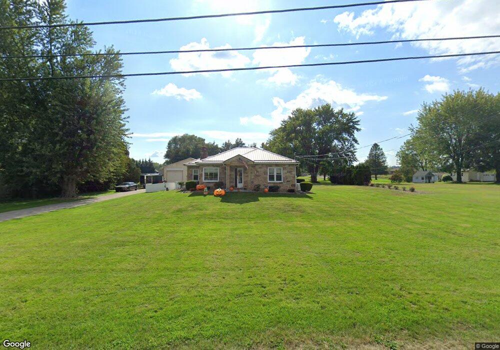
49 Jefferson Ave Selinsgrove, PA 17870
Estimated Value: $215,000 - $320,000
--
Bed
--
Bath
--
Sq Ft
1.07
Acres
About This Home
This home is located at 49 Jefferson Ave, Selinsgrove, PA 17870 and is currently estimated at $267,667. 49 Jefferson Ave is a home located in Snyder County with nearby schools including Selinsgrove Area Elementary School, Selinsgrove Intermediate School, and Selinsgrove Area Middle School.
Ownership History
Date
Name
Owned For
Owner Type
Purchase Details
Closed on
Jun 28, 2017
Sold by
Bowersox David P and Bowersox Ann
Bought by
Sampsell Tracy A
Current Estimated Value
Home Financials for this Owner
Home Financials are based on the most recent Mortgage that was taken out on this home.
Original Mortgage
$380,000
Outstanding Balance
$316,838
Interest Rate
4.02%
Mortgage Type
Seller Take Back
Estimated Equity
-$49,171
Purchase Details
Closed on
Mar 19, 2007
Sold by
Shetter Bonnie M
Bought by
Ann Bowersox David P and Ann Bowesrox
Home Financials for this Owner
Home Financials are based on the most recent Mortgage that was taken out on this home.
Original Mortgage
$84,800
Interest Rate
6.33%
Mortgage Type
Assumption
Create a Home Valuation Report for This Property
The Home Valuation Report is an in-depth analysis detailing your home's value as well as a comparison with similar homes in the area
Home Values in the Area
Average Home Value in this Area
Purchase History
| Date | Buyer | Sale Price | Title Company |
|---|---|---|---|
| Sampsell Tracy A | -- | None Available | |
| Ann Bowersox David P | $106,000 | -- |
Source: Public Records
Mortgage History
| Date | Status | Borrower | Loan Amount |
|---|---|---|---|
| Open | Sampsell Tracy A | $380,000 | |
| Closed | Ann Bowersox David P | $84,800 |
Source: Public Records
Tax History Compared to Growth
Tax History
| Year | Tax Paid | Tax Assessment Tax Assessment Total Assessment is a certain percentage of the fair market value that is determined by local assessors to be the total taxable value of land and additions on the property. | Land | Improvement |
|---|---|---|---|---|
| 2025 | $2,639 | $27,170 | $5,040 | $22,130 |
| 2024 | $2,513 | $26,650 | $5,040 | $21,610 |
| 2023 | $635 | $26,650 | $5,040 | $21,610 |
| 2022 | $2,393 | $26,650 | $5,040 | $21,610 |
| 2021 | $2,393 | $26,650 | $5,040 | $21,610 |
| 2020 | $2,393 | $26,650 | $5,040 | $21,610 |
| 2019 | $2,393 | $26,650 | $5,040 | $21,610 |
| 2018 | $2,393 | $26,650 | $5,040 | $21,610 |
| 2017 | $2,367 | $26,650 | $5,040 | $21,610 |
| 2016 | $688 | $26,650 | $5,040 | $21,610 |
| 2015 | $58,130 | $26,650 | $5,040 | $21,610 |
| 2014 | $58,130 | $26,650 | $5,040 | $21,610 |
Source: Public Records
Map
Nearby Homes
- 722 N 8th St
- 1262 N Old Trail
- 610 N 10th St
- 500 N Orange St
- 0 Roosevelt Ave
- 501 N 9th St
- 0 Mill Rd
- 594 Augusta Dr
- 34 Oakmont Ct
- 207 Orange St Unit 209
- 71 N Oakwood Ln
- Phase 4 N Oakwood Ln
- 223 E Pine St
- 301 E Pine St
- 107 Saint Andrews Way
- 79 Saint Andrews Way
- 81 Saint Andrews Way
- 195 N Oakwood Ln
- 301 E Walnut St
- 20 Quarry Rd
- 495 S Old Trail
- 81 Jefferson Ave
- 501 S Old Trail
- 473 S Old Trail
- 539 S Old Trail
- 457 S Old Trail
- 553 S Old Trail
- 553 S Old Trail
- 435 S Old Trail
- 411 S Old Trail
- 45 Washington Ave
- 367 S Old Trail
- 743 N Old Trail
- 96 Airport Rd
- 785 N Old Trail
- 801 N Old Trail
- 821 N Old Trail
- 6 Buchanan Ave
- 679 N Susquehanna Trail
- 195 Airport Rd