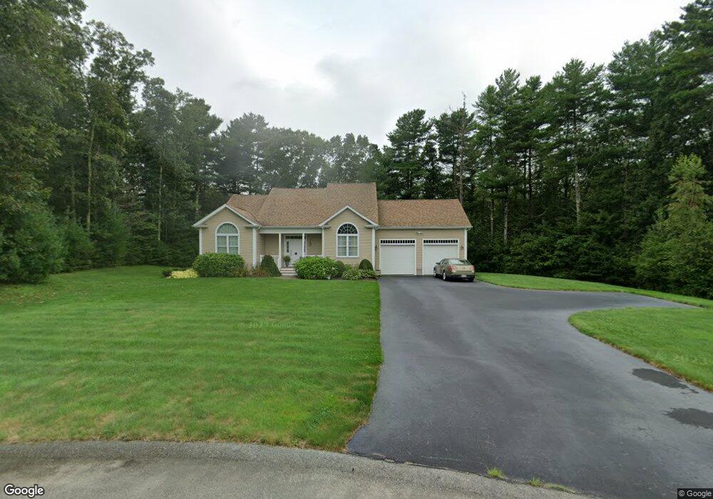
49 Kyle Jacob Rd Westport, MA 02790
North Westport NeighborhoodEstimated Value: $837,000 - $956,000
3
Beds
--
Bath
2,570
Sq Ft
$351/Sq Ft
Est. Value
About This Home
This home is located at 49 Kyle Jacob Rd, Westport, MA 02790 and is currently estimated at $900,824, approximately $350 per square foot. 49 Kyle Jacob Rd is a home with nearby schools including Alice A. Macomber Primary School, Westport Elementary School, and Westport Middle-High School.
Ownership History
Date
Name
Owned For
Owner Type
Purchase Details
Closed on
Feb 5, 2019
Sold by
Fournier Richard A and Macedo Maria J
Bought by
Fournier Macedo Lt
Current Estimated Value
Purchase Details
Closed on
Jun 19, 2009
Sold by
Brookside Woods Dev
Bought by
Fournier Richard A and Macedo Maria Joanna B
Home Financials for this Owner
Home Financials are based on the most recent Mortgage that was taken out on this home.
Original Mortgage
$363,000
Interest Rate
4.91%
Mortgage Type
Purchase Money Mortgage
Create a Home Valuation Report for This Property
The Home Valuation Report is an in-depth analysis detailing your home's value as well as a comparison with similar homes in the area
Home Values in the Area
Average Home Value in this Area
Purchase History
| Date | Buyer | Sale Price | Title Company |
|---|---|---|---|
| Fournier Macedo Lt | -- | -- | |
| Fournier Richard A | $140,000 | -- |
Source: Public Records
Mortgage History
| Date | Status | Borrower | Loan Amount |
|---|---|---|---|
| Previous Owner | Fournier Richard A | $363,000 |
Source: Public Records
Tax History Compared to Growth
Tax History
| Year | Tax Paid | Tax Assessment Tax Assessment Total Assessment is a certain percentage of the fair market value that is determined by local assessors to be the total taxable value of land and additions on the property. | Land | Improvement |
|---|---|---|---|---|
| 2025 | $6,111 | $820,300 | $221,800 | $598,500 |
| 2024 | $6,160 | $796,900 | $206,400 | $590,500 |
| 2023 | $5,932 | $726,900 | $197,100 | $529,800 |
| 2022 | $5,496 | $648,100 | $197,100 | $451,000 |
| 2021 | $5,441 | $631,200 | $180,200 | $451,000 |
| 2020 | $5,265 | $624,500 | $173,500 | $451,000 |
| 2019 | $5,365 | $648,700 | $173,500 | $475,200 |
| 2018 | $3,783 | $463,000 | $126,300 | $336,700 |
| 2017 | $3,844 | $482,300 | $122,500 | $359,800 |
| 2016 | $3,749 | $473,900 | $118,800 | $355,100 |
| 2015 | $3,535 | $445,800 | $121,300 | $324,500 |
Source: Public Records
Map
Nearby Homes
- 9 Kyle Jacob Rd
- 15 S Breault St
- 16 S Berryman St
- 116 Gifford Rd
- 27 Dias Ave
- 0 Van Buren St
- 20 Faulkner St
- 23 Donna St
- 565 Highland Ave
- 96 Forge Rd
- 29 Union Ave
- 100 D Dr
- 56 Lakeside Ave
- 3 Roller Coaster Way Unit Lot 1
- 771 Sanford Rd
- 4 Main Rd
- 55 Lakeside Ave
- 735 Reed Rd
- 818 Reed Rd
- 1276 Old Fall River Rd
- 45 Kyle Jacob Rd
- 41 Kyle Jacob Rd
- 50 Kyle Jacob Rd
- 48 Kyle Jacob Rd
- 44 Kyle Jacob Rd
- 29 Kyle Jacob Rd
- 31 Kyle Jacob Rd
- 40 Kyle Jacob Rd
- 10 Melissa Beth Way
- 14 Melissa Beth Way
- 36 Kyle Jacob Rd Unit 38
- 28 Melissa Beth Way
- 19 Melissa Beth Way
- 6 Melissa Beth Way
- 18 Melissa Beth Way
- 13 Melissa Beth Way
- 9 Melissa Beth Way
- 32 Kyle Jacob Rd
- 2 Melissa Beth Way
- 28 Kyle Jacob Rd