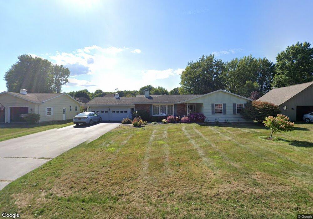
49 Laurelcrest Dr Spencerport, NY 14559
Estimated Value: $260,000 - $411,000
3
Beds
2
Baths
1,564
Sq Ft
$218/Sq Ft
Est. Value
About This Home
This home is located at 49 Laurelcrest Dr, Spencerport, NY 14559 and is currently estimated at $340,361, approximately $217 per square foot. 49 Laurelcrest Dr is a home located in Monroe County with nearby schools including A M Cosgrove Middle School and Spencerport High School.
Ownership History
Date
Name
Owned For
Owner Type
Purchase Details
Closed on
Feb 1, 2018
Sold by
Peccolo Kathryn and Meixner Carl E
Bought by
Hoose Jennifer E
Current Estimated Value
Home Financials for this Owner
Home Financials are based on the most recent Mortgage that was taken out on this home.
Original Mortgage
$120,828
Outstanding Balance
$103,289
Interest Rate
4.37%
Mortgage Type
FHA
Estimated Equity
$237,072
Purchase Details
Closed on
Oct 14, 2015
Sold by
Meixner Carl E and Meixner Louise M
Bought by
Meixner Carl E
Create a Home Valuation Report for This Property
The Home Valuation Report is an in-depth analysis detailing your home's value as well as a comparison with similar homes in the area
Home Values in the Area
Average Home Value in this Area
Purchase History
| Date | Buyer | Sale Price | Title Company |
|---|---|---|---|
| Hoose Jennifer E | $125,000 | None Available | |
| Meixner Carl E | -- | None Available |
Source: Public Records
Mortgage History
| Date | Status | Borrower | Loan Amount |
|---|---|---|---|
| Open | Hoose Jennifer E | $120,828 |
Source: Public Records
Tax History Compared to Growth
Tax History
| Year | Tax Paid | Tax Assessment Tax Assessment Total Assessment is a certain percentage of the fair market value that is determined by local assessors to be the total taxable value of land and additions on the property. | Land | Improvement |
|---|---|---|---|---|
| 2024 | $8,234 | $265,600 | $53,000 | $212,600 |
| 2023 | $7,456 | $154,400 | $45,800 | $108,600 |
| 2022 | $7,142 | $154,400 | $45,800 | $108,600 |
| 2021 | $6,978 | $154,400 | $45,800 | $108,600 |
| 2020 | $6,901 | $154,400 | $45,800 | $108,600 |
| 2019 | $3,991 | $154,400 | $45,800 | $108,600 |
| 2018 | $6,986 | $154,400 | $45,800 | $108,600 |
| 2017 | $3,576 | $147,000 | $45,800 | $101,200 |
| 2016 | $6,711 | $147,000 | $45,800 | $101,200 |
| 2015 | -- | $147,000 | $45,800 | $101,200 |
| 2014 | -- | $147,000 | $45,800 | $101,200 |
Source: Public Records
Map
Nearby Homes
- 76 Hawthorne Dr
- 24 Birdsong Terrace
- 326 Village Walk Cir
- 87 Highview Dr
- 2283 S Union St
- 154 Amity St
- 78 Clark St
- 0000 Bay Leaf Cir Lot#119
- 000
- 00 Bay Leaf Circle Lot#117
- 0 Unit R1620030
- 49 Hillcrest Dr
- 4028 Canal Rd
- 64 Coleman Ave
- 92 Coolidge Ave
- 28 Coolidge Ave
- 3375 Brockport Spencerport Rd
- 62 Clearview Dr
- 607 Trimmer Rd
- vl Canal Rd
- 53 Laurelcrest Dr
- 45 Laurelcrest Dr
- 25 Coventry Dr
- 23 Coventry Dr
- 57 Laurelcrest Dr
- 41 Laurelcrest Dr
- 27 Coventry Dr
- 48 Laurelcrest Dr
- 52 Laurelcrest Dr
- 44 Laurelcrest Dr
- 21 Coventry Dr
- 56 Laurelcrest Dr
- 40 Laurelcrest Dr
- 37 Laurelcrest Dr
- 29 Coventry Dr
- 61 Laurelcrest Dr
- 116 Hawthorne Dr
- 118 Hawthorne Dr
- 19 Coventry Dr
- 60 Laurelcrest Dr