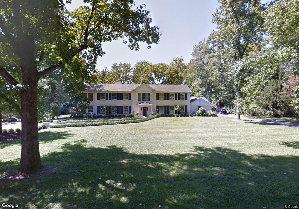
49 Log Cabin Dr Saint Louis, MO 63124
Estimated Value: $2,063,000 - $2,171,643
4
Beds
6
Baths
5,465
Sq Ft
$388/Sq Ft
Est. Value
About This Home
This home is located at 49 Log Cabin Dr, Saint Louis, MO 63124 and is currently estimated at $2,120,881, approximately $388 per square foot. 49 Log Cabin Dr is a home located in St. Louis County with nearby schools including Reed Elementary, Ladue 5th Grade Center, and Ladue Middle.
Ownership History
Date
Name
Owned For
Owner Type
Purchase Details
Closed on
Oct 11, 2001
Sold by
City Of Pine Lawn
Bought by
St Louis County Department Of Health
Current Estimated Value
Purchase Details
Closed on
Jul 16, 2001
Sold by
Shell Owen G and Shell Mary Ruth T
Bought by
Sliney David D and Sliney Bridget C
Purchase Details
Closed on
Jun 2, 1997
Sold by
Quinones Francisco J and Quinones Doris L
Bought by
Shell Owen G and Shell Mary Ruth T
Home Financials for this Owner
Home Financials are based on the most recent Mortgage that was taken out on this home.
Original Mortgage
$650,000
Interest Rate
8.1%
Create a Home Valuation Report for This Property
The Home Valuation Report is an in-depth analysis detailing your home's value as well as a comparison with similar homes in the area
Home Values in the Area
Average Home Value in this Area
Purchase History
| Date | Buyer | Sale Price | Title Company |
|---|---|---|---|
| St Louis County Department Of Health | $6,500 | -- | |
| Sliney David D | $975,000 | -- | |
| Shell Owen G | -- | -- |
Source: Public Records
Mortgage History
| Date | Status | Borrower | Loan Amount |
|---|---|---|---|
| Previous Owner | Shell Owen G | $650,000 | |
| Closed | Shell Owen G | $350,000 | |
| Closed | Sliney David D | -- |
Source: Public Records
Tax History Compared to Growth
Tax History
| Year | Tax Paid | Tax Assessment Tax Assessment Total Assessment is a certain percentage of the fair market value that is determined by local assessors to be the total taxable value of land and additions on the property. | Land | Improvement |
|---|---|---|---|---|
| 2025 | $15,295 | $461,920 | $277,510 | $184,410 |
| 2024 | $15,295 | $226,620 | $120,120 | $106,500 |
| 2023 | $15,266 | $226,620 | $120,120 | $106,500 |
| 2022 | $16,770 | $239,830 | $109,190 | $130,640 |
| 2021 | $15,951 | $239,830 | $109,190 | $130,640 |
| 2020 | $15,573 | $232,920 | $92,510 | $140,410 |
| 2019 | $15,346 | $232,920 | $92,510 | $140,410 |
| 2018 | $19,671 | $275,620 | $92,630 | $182,990 |
| 2017 | $19,587 | $275,620 | $92,630 | $182,990 |
| 2016 | $21,680 | $295,170 | $92,630 | $202,540 |
| 2015 | $20,670 | $295,170 | $92,630 | $202,540 |
| 2014 | -- | $316,690 | $94,730 | $221,960 |
Source: Public Records
Map
Nearby Homes
- 49 Waverton Dr
- 25 Midpark Ln
- 24 Twin Springs Ln
- 80 Sorrel Ln
- 901 Barnes Rd
- 910 Kent Rd
- 10 Upper Barnes Rd
- 29 Picardy Ln
- 2029 S Warson Rd
- 10135 Fieldcrest Ln
- 10074 Briarwood Dr
- 26 Creekwood Ln
- 1148 Ridgelynn Dr
- 13 Ladue Crest Ln
- 40 Upper Ladue Rd
- 10268 Ridgelynn Dr
- 29 Deerfield Rd
- 24 Daniel Rd
- 4 Dogwood Ln
- 10 Maryview Ln
- 53 Log Cabin Dr
- 45 Log Cabin Dr
- 20 Log Cabin Dr
- 48 Magnolia Dr
- 25 Log Cabin Dr
- 50 Magnolia Dr
- 44 Magnolia Dr
- 42 Magnolia Dr
- 52 Magnolia Dr
- 40 Magnolia Dr
- 38 Magnolia Dr
- 36 Magnolia Dr
- 41 Log Cabin Dr
- 57 Log Cabin Dr
- 43 Magnolia Dr
- 49 Magnolia Dr
- 41 Magnolia Dr
- 51 Magnolia Dr
- 39 Magnolia Dr
- 34 Magnolia Dr