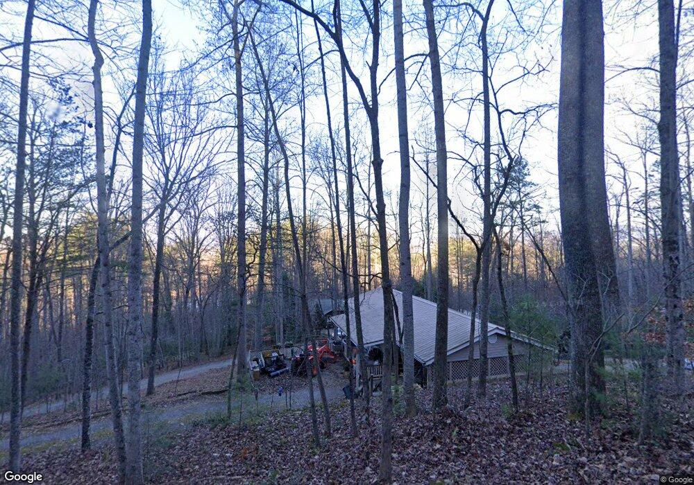
49 Mcdaniel Dr Blairsville, GA 30512
Estimated Value: $349,000 - $452,000
2
Beds
2
Baths
1,656
Sq Ft
$241/Sq Ft
Est. Value
About This Home
This home is located at 49 Mcdaniel Dr, Blairsville, GA 30512 and is currently estimated at $398,363, approximately $240 per square foot. 49 Mcdaniel Dr is a home located in Union County with nearby schools including Union County Primary School, Union County Elementary School, and Union County Middle School.
Ownership History
Date
Name
Owned For
Owner Type
Purchase Details
Closed on
Apr 22, 2005
Sold by
Dyer Curtis
Bought by
Trenton Joyce and Trenton Etheridge Edith
Current Estimated Value
Home Financials for this Owner
Home Financials are based on the most recent Mortgage that was taken out on this home.
Original Mortgage
$120,000
Outstanding Balance
$62,767
Interest Rate
5.99%
Mortgage Type
New Conventional
Estimated Equity
$335,596
Purchase Details
Closed on
Oct 12, 2004
Sold by
Adams J D Inc
Bought by
Dyer Curtis
Purchase Details
Closed on
Jun 2, 2004
Sold by
Warren Janice
Bought by
Adams J D Inc
Purchase Details
Closed on
Aug 11, 2000
Sold by
Weaving James G
Bought by
Warren Janice
Purchase Details
Closed on
Aug 20, 1985
Bought by
Weaving James G
Create a Home Valuation Report for This Property
The Home Valuation Report is an in-depth analysis detailing your home's value as well as a comparison with similar homes in the area
Home Values in the Area
Average Home Value in this Area
Purchase History
| Date | Buyer | Sale Price | Title Company |
|---|---|---|---|
| Trenton Joyce | $156,000 | -- | |
| Dyer Curtis | $25,000 | -- | |
| Adams J D Inc | $20,000 | -- | |
| Warren Janice | $10,000 | -- | |
| Weaving James G | $3,600 | -- |
Source: Public Records
Mortgage History
| Date | Status | Borrower | Loan Amount |
|---|---|---|---|
| Open | Trenton Joyce | $120,000 |
Source: Public Records
Tax History Compared to Growth
Tax History
| Year | Tax Paid | Tax Assessment Tax Assessment Total Assessment is a certain percentage of the fair market value that is determined by local assessors to be the total taxable value of land and additions on the property. | Land | Improvement |
|---|---|---|---|---|
| 2024 | $1,566 | $140,440 | $7,600 | $132,840 |
| 2023 | $1,741 | $138,440 | $7,600 | $130,840 |
| 2022 | $1,328 | $107,480 | $7,600 | $99,880 |
| 2021 | $1,240 | $86,360 | $6,840 | $79,520 |
| 2020 | $1,170 | $69,571 | $9,350 | $60,221 |
| 2019 | $1,102 | $69,571 | $9,350 | $60,221 |
| 2018 | $1,222 | $69,571 | $9,350 | $60,221 |
| 2017 | $1,081 | $69,571 | $9,350 | $60,221 |
| 2016 | $1,082 | $69,571 | $9,350 | $60,221 |
| 2015 | $1,089 | $69,571 | $9,350 | $60,221 |
| 2013 | -- | $69,570 | $9,350 | $60,220 |
Source: Public Records
Map
Nearby Homes
- 78 Enotah Ln
- 497 Hidden Lake Rd
- 277 Hamilton Rd
- 823 Hidden Lake Rd
- 43 Melton Dr
- 718 Hidden Lake Rd
- 392 Poplar Ridge Dr
- 350 Miller Cove Rd
- 516 Crawford Rd
- 59 Meeks Ln
- 998 Hamilton Rd
- 371 Coosa Way
- 144 Wilson Way
- 283 Coosa Way
- Lot 10 Lower Fox Trail
- #4 Lower Fox Trail
- #3 Lower Fox Trail
- 273 Coosa Valley Rd
- 2930 Hicks Gap Rd
- 330 Coosa Run
- 3193 Mcdaniel Dr
- 70 Hester Dr
- 91 Mcdaniel Dr
- 102 Hester Dr
- 102 Hester Dr Unit 9
- 339 Robertson Cir
- 339 Robertson Cir
- 60 Hester Dr
- 3282 Hester Dr
- 134 Hester Dr
- 3279 Hester Dr
- 0 Hester Dr Unit 8658391
- 0 Hester Dr
- 3229 Hester Dr
- 158 Hester Dr
- 119 Hester Dr
- 36 Hester Dr
- 26 Robertson Dr
- 115 Hester Dr
- 3247 Robertson Cir