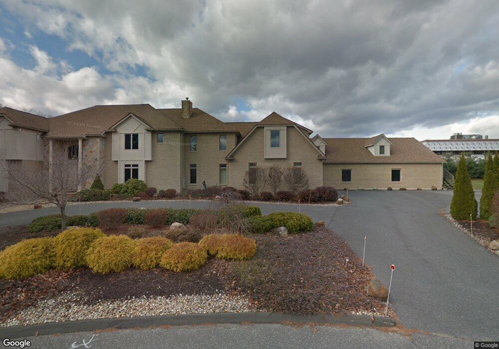
49 Memery Ln Longmeadow, MA 01106
Estimated Value: $1,398,000 - $1,633,023
7
Beds
9
Baths
7,876
Sq Ft
$188/Sq Ft
Est. Value
About This Home
This home is located at 49 Memery Ln, Longmeadow, MA 01106 and is currently estimated at $1,478,341, approximately $187 per square foot. 49 Memery Ln is a home located in Hampden County with nearby schools including Blueberry Hill, Glenbrook Middle School, and Longmeadow High School.
Ownership History
Date
Name
Owned For
Owner Type
Purchase Details
Closed on
Jul 1, 2024
Sold by
King Alton
Bought by
King Alton and Monroe Howard
Current Estimated Value
Purchase Details
Closed on
Oct 16, 2018
Sold by
Mayes Terri A and Bank Of New York Mello
Bought by
Bank New York Mellon T
Create a Home Valuation Report for This Property
The Home Valuation Report is an in-depth analysis detailing your home's value as well as a comparison with similar homes in the area
Home Values in the Area
Average Home Value in this Area
Purchase History
| Date | Buyer | Sale Price | Title Company |
|---|---|---|---|
| King Alton | -- | None Available | |
| King Alton | -- | None Available | |
| Bank New York Mellon T | $1,282,068 | -- | |
| Bank New York Mellon T | $1,282,068 | -- |
Source: Public Records
Tax History
| Year | Tax Paid | Tax Assessment Tax Assessment Total Assessment is a certain percentage of the fair market value that is determined by local assessors to be the total taxable value of land and additions on the property. | Land | Improvement |
|---|---|---|---|---|
| 2025 | $35,125 | $1,663,100 | $278,100 | $1,385,000 |
| 2024 | $34,393 | $1,663,100 | $278,100 | $1,385,000 |
| 2023 | $33,576 | $1,464,900 | $201,600 | $1,263,300 |
| 2022 | $31,741 | $1,288,200 | $201,600 | $1,086,600 |
| 2021 | $31,792 | $1,259,300 | $215,400 | $1,043,900 |
| 2020 | $30,350 | $1,253,600 | $231,000 | $1,022,600 |
| 2019 | $29,040 | $1,205,500 | $231,000 | $974,500 |
| 2018 | $32,250 | $1,324,500 | $317,700 | $1,006,800 |
| 2017 | $31,901 | $1,352,900 | $317,700 | $1,035,200 |
| 2016 | $30,797 | $1,265,800 | $296,700 | $969,100 |
| 2015 | $30,139 | $1,276,000 | $293,700 | $982,300 |
Source: Public Records
Map
Nearby Homes
- 20 Kimberly Cir
- 53 Ashford Rd
- 112 Grassy Gutter Rd
- 111 Ashford Rd
- 59 Lawrence Dr
- 330 Merriweather Dr
- 60 Exeter Ave
- 441 Inverness Ln
- 64 Magnolia Cir
- 211 Academy Dr
- 1155 Dickinson St
- 40 Halifax Ct Unit D
- 58 Shady Side Dr
- 184 Cambridge Cir
- 124 Tecumseh Dr
- 20 Jamestown Dr Unit B
- 642 Laurel St
- 170 Hopkins Place
- 153 Porter Lake Dr Unit 153
- 63 Meadowlark Dr
- 28 Memery Ln
- 35 Memery Ln
- 769 Williams St
- 303 Captain Rd
- 21 Memery Ln
- 289 Captain Rd
- 14 Memery Ln
- 232 Pendleton Ln
- 281 Captain Rd
- 118 Pendleton Ln
- 269 Captain Rd
- 215 Pendleton Ln
- 257 Captain Rd
- 108 Pendleton Ln
- 167 Pendleton Ln
- 320 Captain Rd
- 243 Pendleton Ln
- 304 Captain Rd
- 292 Captain Rd
- 280 Captain Rd
Your Personal Tour Guide
Ask me questions while you tour the home.