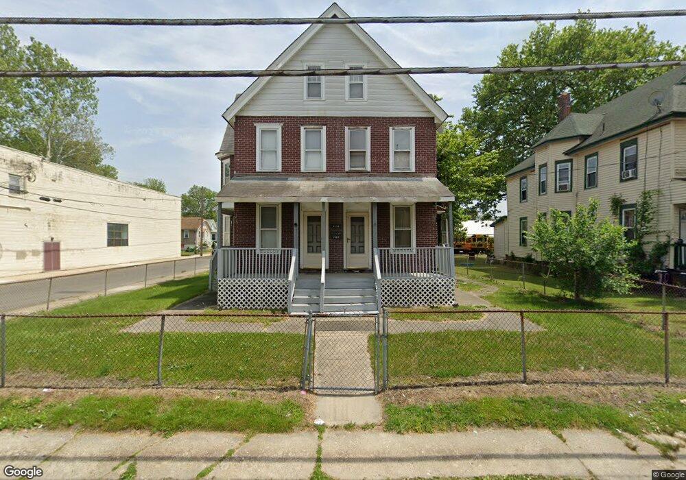
49 N Broad St Penns Grove, NJ 08069
Estimated Value: $135,116 - $195,000
--
Bed
--
Bath
1,705
Sq Ft
$99/Sq Ft
Est. Value
About This Home
This home is located at 49 N Broad St, Penns Grove, NJ 08069 and is currently estimated at $169,529, approximately $99 per square foot. 49 N Broad St is a home located in Salem County with nearby schools including Lafayette-Pershing Elementary School, Field Street Elementary School, and Paul W. Carleton Elementary School.
Ownership History
Date
Name
Owned For
Owner Type
Purchase Details
Closed on
Dec 7, 2022
Sold by
Worldwide Outreach Rest Del Church
Bought by
Evolve Bank & Trust
Current Estimated Value
Purchase Details
Closed on
Apr 1, 2002
Sold by
St Matthews Alpha & Omega Pentacostal Ch
Bought by
Worldwide Outreach Restoration & Deliver
Create a Home Valuation Report for This Property
The Home Valuation Report is an in-depth analysis detailing your home's value as well as a comparison with similar homes in the area
Home Values in the Area
Average Home Value in this Area
Purchase History
| Date | Buyer | Sale Price | Title Company |
|---|---|---|---|
| Evolve Bank & Trust | $2,039 | -- | |
| Worldwide Outreach Restoration & Deliver | -- | -- |
Source: Public Records
Tax History Compared to Growth
Tax History
| Year | Tax Paid | Tax Assessment Tax Assessment Total Assessment is a certain percentage of the fair market value that is determined by local assessors to be the total taxable value of land and additions on the property. | Land | Improvement |
|---|---|---|---|---|
| 2025 | $3,605 | $65,000 | $10,500 | $54,500 |
| 2024 | $3,484 | $65,000 | $10,500 | $54,500 |
| 2023 | $3,484 | $65,000 | $10,500 | $54,500 |
| 2022 | $3,359 | $65,000 | $10,500 | $54,500 |
| 2021 | $3,214 | $65,000 | $10,500 | $54,500 |
| 2020 | $3,256 | $65,000 | $10,500 | $54,500 |
| 2019 | $3,270 | $65,000 | $10,500 | $54,500 |
| 2018 | $2,876 | $71,300 | $18,500 | $52,800 |
| 2017 | $2,886 | $71,300 | $18,500 | $52,800 |
| 2016 | $2,777 | $71,300 | $18,500 | $52,800 |
| 2015 | $2,660 | $71,300 | $18,500 | $52,800 |
| 2014 | $2,631 | $71,300 | $18,500 | $52,800 |
Source: Public Records
Map
Nearby Homes
- 6 W Griffith St
- 18 Pearl St
- 31 Elvin Ave
- 0 Cumberland Ave
- 3 Naylor Ave
- 113 N Broad St
- 78 W Harmony St
- 0 Lincoln Avenue & Cumberland
- 27 E Line St
- 80 S Broad St
- 88 Railroad Ave
- 35 Franklin St
- 59 61 Broad St
- 54 W Pitman St
- 15 Walnut St
- 34 38 Cumberland Ave
- 39 41 Cumberland Ave
- 99 N Virginia Ave
- 106 S Broad St
- 71 Poplar St
- 43 N Broad St Unit 45
- 37 N Broad St
- 39 N Broad St Unit 41
- 7 E Harmony St
- 5 E Harmony St
- 46 N Broad St
- 57 N Broad St
- 48 N Broad St
- 50 N Broad St
- 13 E Griffith St
- 9 E Griffith St
- 11 E Griffith St
- 2 W Griffith St
- 15 E Griffith St
- 63 N Broad St
- 4 W Griffith St
- 17 E Griffith St
- 6 E Pitman St
- 69 N Broad St
- 8 E Pitman St