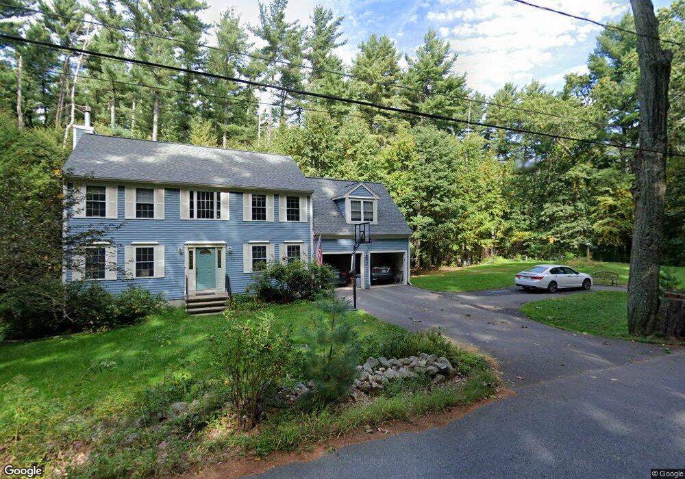
49 Pine Hill Rd Boxborough, MA 01719
Estimated Value: $912,939 - $1,170,000
4
Beds
3
Baths
2,207
Sq Ft
$460/Sq Ft
Est. Value
About This Home
This home is located at 49 Pine Hill Rd, Boxborough, MA 01719 and is currently estimated at $1,014,735, approximately $459 per square foot. 49 Pine Hill Rd is a home located in Middlesex County with nearby schools including Acton-Boxborough Regional High School.
Ownership History
Date
Name
Owned For
Owner Type
Purchase Details
Closed on
Aug 4, 1997
Sold by
Foster St T
Bought by
Hinds Andrew S and Hinds Marie Denise
Current Estimated Value
Home Financials for this Owner
Home Financials are based on the most recent Mortgage that was taken out on this home.
Original Mortgage
$200,000
Outstanding Balance
$23,845
Interest Rate
7.55%
Mortgage Type
Purchase Money Mortgage
Estimated Equity
$990,890
Create a Home Valuation Report for This Property
The Home Valuation Report is an in-depth analysis detailing your home's value as well as a comparison with similar homes in the area
Home Values in the Area
Average Home Value in this Area
Purchase History
| Date | Buyer | Sale Price | Title Company |
|---|---|---|---|
| Hinds Andrew S | $295,915 | -- |
Source: Public Records
Mortgage History
| Date | Status | Borrower | Loan Amount |
|---|---|---|---|
| Open | Hinds Andrew S | $200,000 | |
| Closed | Hinds Andrew S | $14,795 |
Source: Public Records
Tax History
| Year | Tax Paid | Tax Assessment Tax Assessment Total Assessment is a certain percentage of the fair market value that is determined by local assessors to be the total taxable value of land and additions on the property. | Land | Improvement |
|---|---|---|---|---|
| 2025 | $13,732 | $907,000 | $317,100 | $589,900 |
| 2024 | $12,740 | $849,900 | $305,100 | $544,800 |
| 2023 | $11,985 | $772,200 | $263,400 | $508,800 |
| 2022 | $11,520 | $661,300 | $263,400 | $397,900 |
| 2020 | $10,447 | $624,800 | $263,400 | $361,400 |
| 2019 | $10,259 | $624,800 | $263,400 | $361,400 |
| 2018 | $10,287 | $591,300 | $251,400 | $339,900 |
| 2017 | $9,683 | $576,000 | $251,400 | $324,600 |
| 2016 | $9,211 | $563,000 | $251,400 | $311,600 |
| 2015 | $8,718 | $523,600 | $217,600 | $306,000 |
| 2014 | $8,739 | $494,000 | $211,300 | $282,700 |
Source: Public Records
Map
Nearby Homes
- 77 Wheeler Dr Unit 77
- 92 Willow St Unit 3
- 92 Willow St Unit 2
- 90 Willow St Unit 1
- 20 Lyons Ln Unit 20
- 40 Fifers Ln
- 235 Arlington St
- 280 W Acton Rd
- 4 Littlefield Rd
- 79 Old Orchard Ln
- 247 W Acton Rd
- 20 Joseph Reed Ln
- 5 Perkins Ln
- 60 Nashoba Rd
- 79 Charter Rd
- 246 Main St Unit 2
- 959 Hill Rd
- 30-6 Taylor Rd
- 184 Main St Unit 3
- 7 Kelley Rd
- 60 Pine Hill Rd
- 42 Pine Hill Rd
- 27 Pine Hill Rd
- 27 Pine Hill Rd Unit 27
- 34 Pine Pasture Run
- 38 Pine Hill Rd
- 91 Pine Hill Rd
- 86 Pine Hill Rd
- 36 Pine Pasture Run
- 97 Pine Hill Rd
- 117 Summer Rd
- 10 Pine Hill Rd
- 32 Pine Pasture Run
- 100 Pine Hill Rd
- 20 Pine Pasture Run
- 3 Pine Hill Rd
- 7 Pine Hill Rd
- 39 Stonehedge Place
- 169 Summer Rd
- 54 Stonehedge Place
Your Personal Tour Guide
Ask me questions while you tour the home.