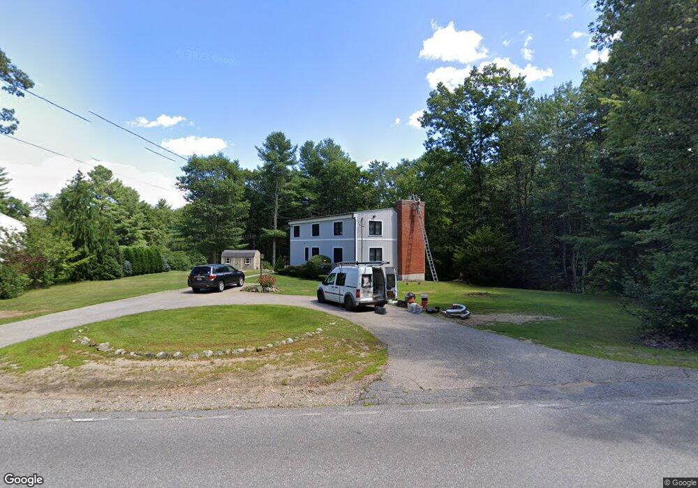
49 Pleasantdale Rd Rutland, MA 01543
Estimated Value: $449,000 - $590,000
3
Beds
2
Baths
1,768
Sq Ft
$291/Sq Ft
Est. Value
About This Home
This home is located at 49 Pleasantdale Rd, Rutland, MA 01543 and is currently estimated at $513,754, approximately $290 per square foot. 49 Pleasantdale Rd is a home located in Worcester County with nearby schools including Wachusett Regional High School.
Ownership History
Date
Name
Owned For
Owner Type
Purchase Details
Closed on
May 15, 2024
Sold by
George Michael S and George Kerrina D
Bought by
George Ft and George
Current Estimated Value
Purchase Details
Closed on
Oct 13, 2006
Sold by
Pottle David E and Pottle Marjorie J
Bought by
George Kerrina D and George Michael S
Purchase Details
Closed on
Apr 6, 2001
Sold by
Hunt Julian S
Bought by
Pottle Marjorie J and Pottle David E
Create a Home Valuation Report for This Property
The Home Valuation Report is an in-depth analysis detailing your home's value as well as a comparison with similar homes in the area
Home Values in the Area
Average Home Value in this Area
Purchase History
| Date | Buyer | Sale Price | Title Company |
|---|---|---|---|
| George Ft | -- | None Available | |
| George Ft | -- | None Available | |
| George Kerrina D | $280,000 | -- | |
| Pottle Marjorie J | $179,900 | -- | |
| George Kerrina D | $280,000 | -- | |
| Pottle Marjorie J | $179,900 | -- |
Source: Public Records
Mortgage History
| Date | Status | Borrower | Loan Amount |
|---|---|---|---|
| Previous Owner | Pottle Marjorie J | $19,045 | |
| Previous Owner | Pottle Marjorie J | $252,000 |
Source: Public Records
Tax History Compared to Growth
Tax History
| Year | Tax Paid | Tax Assessment Tax Assessment Total Assessment is a certain percentage of the fair market value that is determined by local assessors to be the total taxable value of land and additions on the property. | Land | Improvement |
|---|---|---|---|---|
| 2025 | $5,824 | $409,000 | $97,400 | $311,600 |
| 2024 | $5,588 | $376,800 | $93,500 | $283,300 |
| 2023 | $5,155 | $375,700 | $88,200 | $287,500 |
| 2022 | $5,138 | $325,400 | $74,500 | $250,900 |
| 2021 | $4,952 | $296,500 | $74,500 | $222,000 |
| 2020 | $5,036 | $286,000 | $70,700 | $215,300 |
| 2019 | $5,088 | $284,400 | $67,300 | $217,100 |
| 2018 | $4,915 | $271,100 | $67,300 | $203,800 |
| 2017 | $4,543 | $248,000 | $67,300 | $180,700 |
| 2016 | $4,177 | $240,500 | $64,000 | $176,500 |
| 2015 | $3,881 | $219,900 | $64,000 | $155,900 |
| 2014 | $3,762 | $219,900 | $64,000 | $155,900 |
Source: Public Records
Map
Nearby Homes
- Lot 24R Quail Run
- Lot 29 Quail Run
- Lot 27A Quail Run
- 4 Fidelity Dr Unit 2
- 6 Fidelity Dr Unit 3
- 10 Soucy Dr
- 12 Fidelity Dr Unit 6
- 10 Fidelity Dr Unit 5
- 132 Fidelity Dr Unit 61
- 47 Woodside Ave
- 51 Woodside Ave
- Lot 2 Barrack Hill Rd
- 0 Barrack Hill Rd Unit 73395148
- 28 Forest Hill Dr
- 6 Lewis St
- 12 Lewis St
- 85 Maple Ave Unit A
- 11 Lewis St
- 21 Lewis St
- 32 Pommogussett Rd Unit 1
- 47 Pleasantdale Rd
- 55 Pleasantdale Rd
- 45 Pleasantdale Rd
- 60 Pleasantdale Rd
- 24 Pleasantdale Rd
- 25 Pleasantdale Rd
- 64 Pleasantdale Rd
- 19 Pleasantdale Rd
- 20 Pleasantdale Rd
- 17 Pleasantdale Rd
- 16 Pleasantdale Rd
- 11 Pleasantdale Rd
- 341B Main St
- 341 Main St
- 14 Pleasantdale Rd
- 9 Pleasantdale Rd
- 000 Pleasantdale Rd
- 5 Pleasantdale Rd
- Lot 3 Pleasantdale Rd
- 7 Pleasantdale Rd