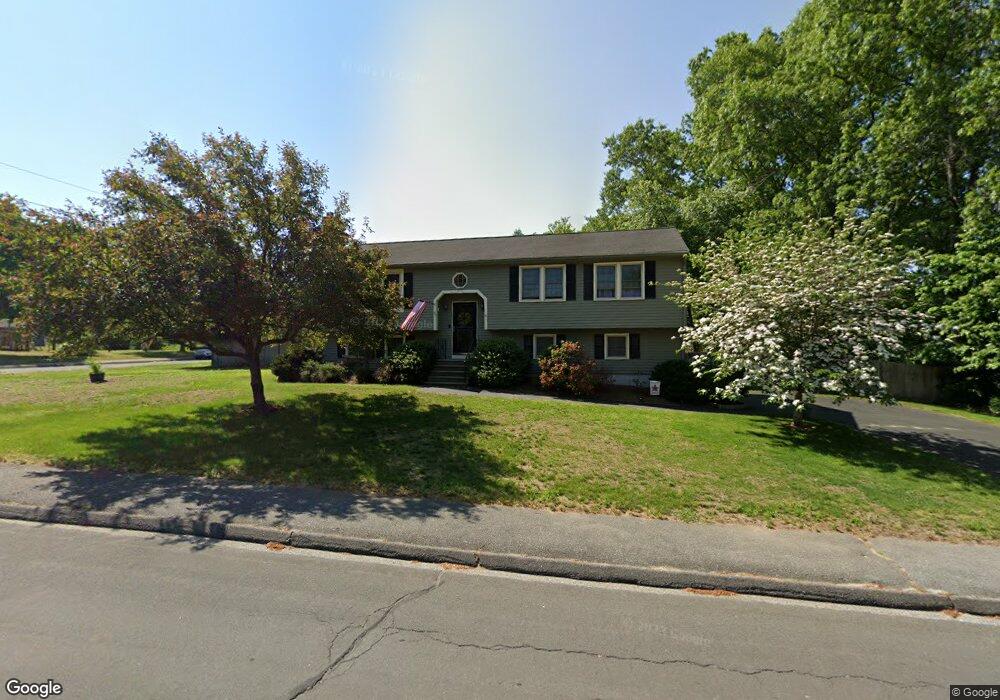
49 Reilly Ave Blackstone, MA 01504
Estimated Value: $472,000 - $523,000
3
Beds
3
Baths
1,236
Sq Ft
$408/Sq Ft
Est. Value
About This Home
This home is located at 49 Reilly Ave, Blackstone, MA 01504 and is currently estimated at $503,988, approximately $407 per square foot. 49 Reilly Ave is a home located in Worcester County with nearby schools including Blackstone-Millville Regional High School, Rise Prep Mayoral Academy Middle School, and Founders Academy.
Ownership History
Date
Name
Owned For
Owner Type
Purchase Details
Closed on
Jan 23, 1987
Sold by
L J L Const Inc
Bought by
Storme Robert W
Current Estimated Value
Create a Home Valuation Report for This Property
The Home Valuation Report is an in-depth analysis detailing your home's value as well as a comparison with similar homes in the area
Home Values in the Area
Average Home Value in this Area
Purchase History
| Date | Buyer | Sale Price | Title Company |
|---|---|---|---|
| Storme Robert W | $130,000 | -- |
Source: Public Records
Mortgage History
| Date | Status | Borrower | Loan Amount |
|---|---|---|---|
| Open | Storme Robert W | $70,000 | |
| Closed | Storme Robert W | $82,500 | |
| Closed | Storme Robert W | $40,000 | |
| Closed | Storme Robert W | $62,600 |
Source: Public Records
Tax History Compared to Growth
Tax History
| Year | Tax Paid | Tax Assessment Tax Assessment Total Assessment is a certain percentage of the fair market value that is determined by local assessors to be the total taxable value of land and additions on the property. | Land | Improvement |
|---|---|---|---|---|
| 2025 | $6,860 | $454,300 | $165,200 | $289,100 |
| 2024 | $6,720 | $411,500 | $180,400 | $231,100 |
| 2023 | $6,964 | $430,400 | $180,400 | $250,000 |
| 2022 | $5,878 | $328,400 | $149,000 | $179,400 |
| 2021 | $5,599 | $299,100 | $146,200 | $152,900 |
| 2020 | $5,709 | $302,700 | $146,000 | $156,700 |
| 2019 | $5,762 | $304,700 | $135,500 | $169,200 |
| 2018 | $5,331 | $273,500 | $129,600 | $143,900 |
| 2017 | $5,196 | $269,800 | $129,600 | $140,200 |
| 2016 | $5,220 | $269,900 | $117,200 | $152,700 |
| 2015 | $4,917 | $252,400 | $119,300 | $133,100 |
Source: Public Records
Map
Nearby Homes
- 24 Reilly Ave
- 6 Old Mendon St
- 8 Old Mendon St Unit 8
- 96 Main St Unit 1
- 225-227 Main St
- 122 Canal St
- 15 Blackstone St
- 259 Main St
- 0 Main St
- 22 Colerick Ave
- 1 Tupperware Dr Unit 226
- 1 Tupperware Dr Unit 138
- 1 Tupperware Dr Unit 108
- 175 Saint Paul St
- 81 Fountain St
- 3 Federal St
- 11 Federal St
- 246 Saint Paul St
- 29 Graves Ave
- 162 Blackstone St