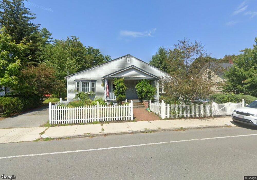
49 Sparhawk St Amesbury, MA 01913
Estimated Value: $386,775 - $482,000
6
Beds
4
Baths
2,437
Sq Ft
$184/Sq Ft
Est. Value
About This Home
This home is located at 49 Sparhawk St, Amesbury, MA 01913 and is currently estimated at $448,694, approximately $184 per square foot. 49 Sparhawk St is a home located in Essex County with nearby schools including Amesbury High School and Amesbury Seventh-Day Adventist School.
Ownership History
Date
Name
Owned For
Owner Type
Purchase Details
Closed on
Mar 25, 2011
Sold by
Hsbc Mortgage Svcs Inc
Bought by
Lewis Isaia and Daly Stefanie
Current Estimated Value
Home Financials for this Owner
Home Financials are based on the most recent Mortgage that was taken out on this home.
Original Mortgage
$85,520
Outstanding Balance
$59,530
Interest Rate
5.07%
Mortgage Type
Purchase Money Mortgage
Estimated Equity
$389,164
Purchase Details
Closed on
Oct 1, 2010
Sold by
Todd James R and Todd Miranda G
Bought by
Hsbc Mortgage Svcs Inc
Purchase Details
Closed on
Jul 1, 2004
Sold by
Meyer Gael L
Bought by
Todd James R and Todd Miranda
Home Financials for this Owner
Home Financials are based on the most recent Mortgage that was taken out on this home.
Original Mortgage
$227,900
Interest Rate
6.3%
Mortgage Type
Purchase Money Mortgage
Purchase Details
Closed on
Jul 30, 1999
Sold by
Noyes Paul B and Noyers Virginia L
Bought by
Meyer Gael L
Create a Home Valuation Report for This Property
The Home Valuation Report is an in-depth analysis detailing your home's value as well as a comparison with similar homes in the area
Home Values in the Area
Average Home Value in this Area
Purchase History
| Date | Buyer | Sale Price | Title Company |
|---|---|---|---|
| Lewis Isaia | $106,900 | -- | |
| Hsbc Mortgage Svcs Inc | $248,903 | -- | |
| Todd James R | $239,900 | -- | |
| Meyer Gael L | $210,517 | -- |
Source: Public Records
Mortgage History
| Date | Status | Borrower | Loan Amount |
|---|---|---|---|
| Open | Meyer Gael L | $85,520 | |
| Previous Owner | Meyer Gael L | $227,900 | |
| Previous Owner | Meyer Gael L | $198,950 |
Source: Public Records
Tax History Compared to Growth
Tax History
| Year | Tax Paid | Tax Assessment Tax Assessment Total Assessment is a certain percentage of the fair market value that is determined by local assessors to be the total taxable value of land and additions on the property. | Land | Improvement |
|---|---|---|---|---|
| 2025 | $4,059 | $265,300 | $0 | $265,300 |
| 2024 | $3,715 | $237,500 | $0 | $237,500 |
| 2023 | $3,830 | $234,400 | $0 | $234,400 |
| 2022 | $3,600 | $203,500 | $0 | $203,500 |
| 2021 | $3,601 | $197,300 | $0 | $197,300 |
| 2020 | $3,508 | $204,200 | $0 | $204,200 |
| 2019 | $3,395 | $184,800 | $0 | $184,800 |
| 2018 | $3,509 | $184,800 | $0 | $184,800 |
| 2017 | $3,559 | $178,400 | $0 | $178,400 |
| 2016 | $3,531 | $174,100 | $0 | $174,100 |
Source: Public Records
Map
Nearby Homes
- 4 Larnard Ct
- 93 Friend St
- 49 W Greenwood St
- 31 Whitter Meadows Dr Unit 31
- 4 Greenwood St
- 43 Aubin St Unit 43
- 37 Millyard Unit 204
- 4 Winter St
- 13 High St Unit 2
- 5 Moncrief St Unit 5
- 48 Orchard St
- 188 Lions Mouth Rd
- 97 Elm St
- 118 Elm St
- 45 Macy St Unit b101
- 45 Macy St Unit 301C
- 45 Macy St Unit 302C
- 25 Cedar St Unit 4
- 25 Cedar St Unit 14
- 25 Cedar St Unit 7
- 49 Sparhawk St Unit 2
- 49 Sparhawk St Unit 1
- 49 Sparhawk St Unit 2
- 47 Sparhawk St
- 3 Whittier St
- 3 Whittier St
- 46 Sparhawk St
- 51 Sparhawk St
- 20 Greenleaf St
- 50 Sparhawk St
- 1 Whittier St
- 1 Whittier St
- 1 Whittier St Unit 6A
- 8 Whittier St
- 8 Whittier St Unit 8
- 11 Whittier St
- 4 Whittier St
- 4 Whittier St
- 4 Whittier St Unit 4
- 44 Sparhawk St