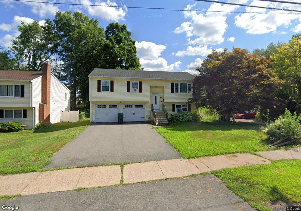
49 Stoddard Ave Newington, CT 06111
Estimated Value: $318,000 - $406,000
3
Beds
3
Baths
1,132
Sq Ft
$324/Sq Ft
Est. Value
About This Home
This home is located at 49 Stoddard Ave, Newington, CT 06111 and is currently estimated at $366,263, approximately $323 per square foot. 49 Stoddard Ave is a home located in Hartford County with nearby schools including Elizabeth Green School, Martin Kellogg Middle School, and Newington High School.
Ownership History
Date
Name
Owned For
Owner Type
Purchase Details
Closed on
Jun 30, 2021
Sold by
Mcdonald Margaret M
Bought by
Margaret M Mcdonald Ft
Current Estimated Value
Purchase Details
Closed on
May 17, 2021
Sold by
Mcdonald Dennis J
Bought by
Mcdonald Margaret M
Purchase Details
Closed on
Apr 27, 2021
Sold by
Masciocchi Margaret M
Bought by
Margaret M Mcdonald Ft
Create a Home Valuation Report for This Property
The Home Valuation Report is an in-depth analysis detailing your home's value as well as a comparison with similar homes in the area
Home Values in the Area
Average Home Value in this Area
Purchase History
| Date | Buyer | Sale Price | Title Company |
|---|---|---|---|
| Margaret M Mcdonald Ft | -- | None Available | |
| Mcdonald Margaret M | -- | None Available | |
| Mcdonald Dennis J | -- | None Available | |
| Margaret M Mcdonald Ft | -- | None Available | |
| Masciocchi Margaret M | -- | None Available |
Source: Public Records
Tax History
| Year | Tax Paid | Tax Assessment Tax Assessment Total Assessment is a certain percentage of the fair market value that is determined by local assessors to be the total taxable value of land and additions on the property. | Land | Improvement |
|---|---|---|---|---|
| 2025 | $6,596 | $164,980 | $54,320 | $110,660 |
| 2024 | $6,541 | $164,880 | $54,320 | $110,560 |
| 2023 | $6,325 | $164,880 | $54,320 | $110,560 |
| 2022 | $6,346 | $164,880 | $54,320 | $110,560 |
| 2021 | $6,399 | $164,880 | $54,320 | $110,560 |
| 2020 | $6,196 | $157,750 | $50,930 | $106,820 |
| 2019 | $6,223 | $157,750 | $50,930 | $106,820 |
| 2018 | $6,073 | $157,750 | $50,930 | $106,820 |
| 2017 | $5,772 | $157,750 | $50,930 | $106,820 |
| 2016 | $5,640 | $157,750 | $50,930 | $106,820 |
| 2014 | $5,595 | $160,920 | $51,410 | $109,510 |
Source: Public Records
Map
Nearby Homes
- 24 Millbrook Ct Unit 24 Millbrook Ct Newi
- 149 Moylan Ct
- 131 Williamstown Ct Unit 131
- 138 Williamstown Ct Unit 138
- 79 Piper Brook Ave
- 140 Dowd St
- 32 Garvan St
- 42 Sunset Rd
- 84 Connecticut Ave
- 25 Lewis Ln
- 39 Schoolhouse Crossing
- 15 Cricket Ln
- 161 Abbotsford Ave
- 575 S Main St
- 43 Marion St
- 9 Old Farm Dr
- 7 Old Farm Dr
- 1 Old Farm Dr
- 106 Grove St
- 20 Browning Ave
Your Personal Tour Guide
Ask me questions while you tour the home.