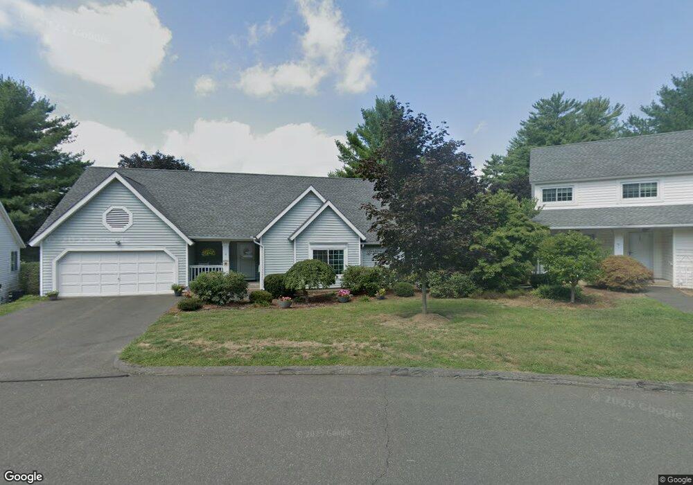
49 Stratton Forest Way Simsbury, CT 06070
Estimated Value: $364,046 - $444,000
2
Beds
2
Baths
1,369
Sq Ft
$294/Sq Ft
Est. Value
About This Home
This home is located at 49 Stratton Forest Way, Simsbury, CT 06070 and is currently estimated at $403,012, approximately $294 per square foot. 49 Stratton Forest Way is a home located in Hartford County with nearby schools including Central School, Henry James Memorial School, and Simsbury High School.
Ownership History
Date
Name
Owned For
Owner Type
Purchase Details
Closed on
Jul 17, 2019
Sold by
Winkleblack Dennis and Winkleblack Jeanne A
Bought by
Shultz Doreen
Current Estimated Value
Purchase Details
Closed on
Aug 3, 2009
Sold by
Turnbull Marion R
Bought by
Winkleblack Dennis and Winkleblack Jeanne A
Home Financials for this Owner
Home Financials are based on the most recent Mortgage that was taken out on this home.
Original Mortgage
$199,200
Interest Rate
5.43%
Purchase Details
Closed on
Feb 24, 1987
Sold by
Nunigel Charles
Bought by
Brewer Paul
Create a Home Valuation Report for This Property
The Home Valuation Report is an in-depth analysis detailing your home's value as well as a comparison with similar homes in the area
Home Values in the Area
Average Home Value in this Area
Purchase History
| Date | Buyer | Sale Price | Title Company |
|---|---|---|---|
| Shultz Doreen | $237,500 | -- | |
| Winkleblack Dennis | $249,000 | -- | |
| Brewer Paul | $131,000 | -- |
Source: Public Records
Mortgage History
| Date | Status | Borrower | Loan Amount |
|---|---|---|---|
| Previous Owner | Brewer Paul | $180,800 | |
| Previous Owner | Brewer Paul | $199,200 |
Source: Public Records
Tax History Compared to Growth
Tax History
| Year | Tax Paid | Tax Assessment Tax Assessment Total Assessment is a certain percentage of the fair market value that is determined by local assessors to be the total taxable value of land and additions on the property. | Land | Improvement |
|---|---|---|---|---|
| 2025 | $7,403 | $216,720 | $0 | $216,720 |
| 2024 | $7,219 | $216,720 | $0 | $216,720 |
| 2023 | $6,896 | $216,720 | $0 | $216,720 |
| 2022 | $6,357 | $164,570 | $0 | $164,570 |
| 2021 | $6,357 | $164,570 | $0 | $164,570 |
| 2020 | $6,104 | $164,570 | $0 | $164,570 |
| 2019 | $6,142 | $164,570 | $0 | $164,570 |
| 2018 | $6,186 | $164,570 | $0 | $164,570 |
| 2017 | $6,481 | $167,220 | $0 | $167,220 |
| 2016 | $6,207 | $167,220 | $0 | $167,220 |
| 2015 | $6,207 | $167,220 | $0 | $167,220 |
| 2014 | $6,211 | $167,220 | $0 | $167,220 |
Source: Public Records
Map
Nearby Homes
- 16 Stratton Forest Way
- 40 Firetown Rd Unit 39
- 3 Stebbins Brook Ln
- 4 Stebbins Brook Ln
- 1 West St Unit 206
- 48 Library Ln Unit 48
- 18 Meadowlark Rd
- 15 Sand Hill Rd
- 25 Barry Ln
- 308 Hopmeadow St
- 15 Pinnacle Mountain Rd
- 26 Winterset Ln
- 3 Cobtail Way
- 301 Bushy Hill Rd
- 9 Cobtail Way
- 10 Sachems Trail
- 24 Hunting Ridge Dr
- 9 Gretel Ln
- 324 Firetown Rd
- 3 Minister Brook Dr
- 57 Stratton Forest Way
- 59 Stratton Forest Way
- 83 Stratton Forest Way
- 77 Stratton Forest Way
- 47 Stratton Forest Way
- 91 Stratton Forest Way
- 43 Stratton Forest Way
- 55 Stratton Forest Way
- 45 Stratton Forest Way
- 51 Stratton Forest Way
- 89 Stratton Forest Way
- 53 Stratton Forest Way
- 73 Stratton Forest Way
- 51 Stratton Forest Way Unit 51
- 83 Stratton Forest Way Unit 83
- 49 Stratton Forest Way Unit 49
- 59 Stratton Forest Way Unit 59
- 57 Stratton Forest Way Unit 57
- 45 Stratton Forest Way Unit 45
- 55 Stratton Forest Way Unit 2