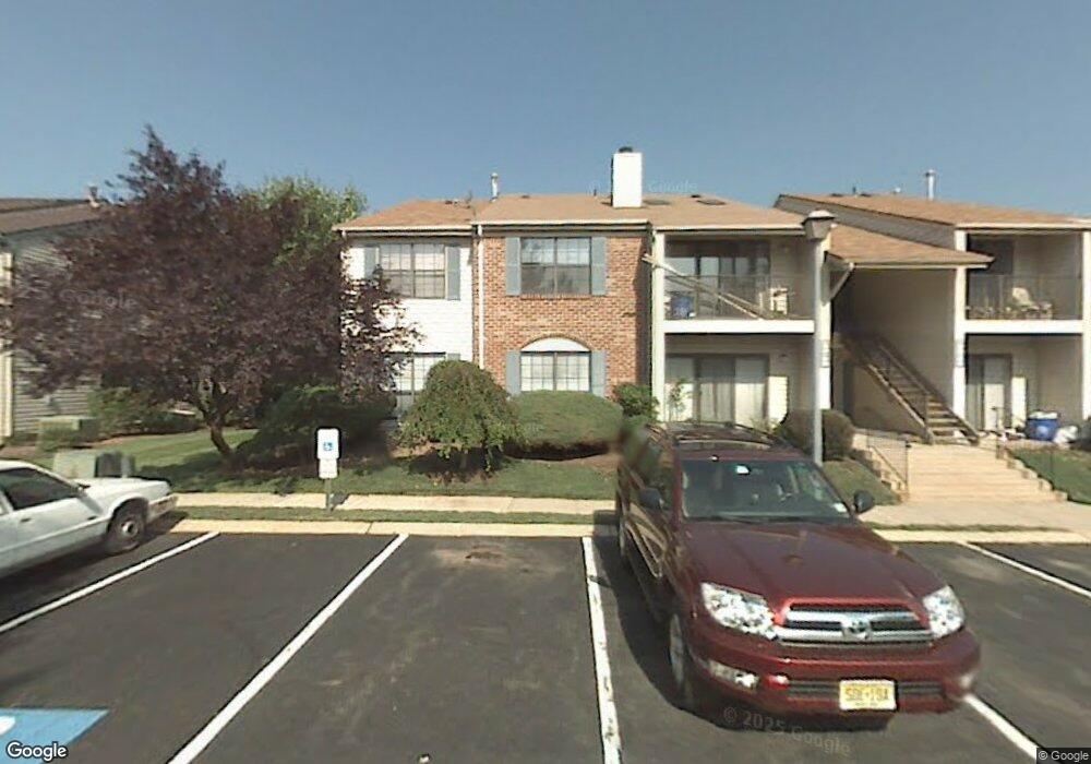
49 Taylor Dr Franklin Park, NJ 08823
Estimated Value: $348,000 - $417,000
--
Bed
--
Bath
1,138
Sq Ft
$325/Sq Ft
Est. Value
About This Home
This home is located at 49 Taylor Dr, Franklin Park, NJ 08823 and is currently estimated at $369,962, approximately $325 per square foot. 49 Taylor Dr is a home located in Somerset County with nearby schools including Franklin High School, St. Augustine of Canterbury School, and Cheder Menachem.
Ownership History
Date
Name
Owned For
Owner Type
Purchase Details
Closed on
Jul 30, 2004
Sold by
Wildgen Heather L
Bought by
Francis Austin and Mariyam Iqbal Masih
Current Estimated Value
Home Financials for this Owner
Home Financials are based on the most recent Mortgage that was taken out on this home.
Original Mortgage
$159,200
Outstanding Balance
$79,050
Interest Rate
6.02%
Estimated Equity
$290,912
Purchase Details
Closed on
Mar 1, 2001
Sold by
Fisher Jason
Bought by
Wildgen Heather
Home Financials for this Owner
Home Financials are based on the most recent Mortgage that was taken out on this home.
Original Mortgage
$111,000
Interest Rate
6.9%
Purchase Details
Closed on
May 20, 1998
Sold by
Federal Home Loan Mortgage Corporation
Bought by
Fisher Jason David
Home Financials for this Owner
Home Financials are based on the most recent Mortgage that was taken out on this home.
Original Mortgage
$63,000
Interest Rate
7.12%
Mortgage Type
FHA
Create a Home Valuation Report for This Property
The Home Valuation Report is an in-depth analysis detailing your home's value as well as a comparison with similar homes in the area
Home Values in the Area
Average Home Value in this Area
Purchase History
| Date | Buyer | Sale Price | Title Company |
|---|---|---|---|
| Francis Austin | $198,500 | -- | |
| Wildgen Heather | $116,900 | -- | |
| Fisher Jason David | $63,500 | -- |
Source: Public Records
Mortgage History
| Date | Status | Borrower | Loan Amount |
|---|---|---|---|
| Open | Francis Austin | $159,200 | |
| Previous Owner | Wildgen Heather | $111,000 | |
| Previous Owner | Fisher Jason David | $63,000 |
Source: Public Records
Tax History Compared to Growth
Tax History
| Year | Tax Paid | Tax Assessment Tax Assessment Total Assessment is a certain percentage of the fair market value that is determined by local assessors to be the total taxable value of land and additions on the property. | Land | Improvement |
|---|---|---|---|---|
| 2025 | $5,290 | $357,400 | $160,000 | $197,400 |
| 2024 | $5,290 | $293,400 | $145,000 | $148,400 |
| 2023 | $5,063 | $263,400 | $115,000 | $148,400 |
| 2022 | $4,632 | $228,400 | $80,000 | $148,400 |
| 2021 | $4,379 | $198,400 | $50,000 | $148,400 |
| 2020 | $4,256 | $188,400 | $40,000 | $148,400 |
| 2019 | $3,966 | $173,400 | $25,000 | $148,400 |
| 2018 | $4,006 | $173,400 | $25,000 | $148,400 |
| 2017 | $3,905 | $168,400 | $20,000 | $148,400 |
| 2016 | $3,822 | $163,400 | $15,000 | $148,400 |
| 2015 | $3,912 | $168,400 | $20,000 | $148,400 |
| 2014 | $3,853 | $168,400 | $20,000 | $148,400 |
Source: Public Records
Map
Nearby Homes
- 44 Crabapple Ln
- 1 Lyon La
- 1 Lyon Ln
- 69 Fisher Dr
- 65 Townsend Ct Unit 213
- 65 Townsend Ct
- 75 Pear Tree Ln Unit 10C
- 107 Rachel Ct
- 205 Rachel Ct
- 139 Rachel Ct Unit D1
- 147 Rachel Ct
- 130 Lindsey Ct
- 167 Rachel Ct
- 89 Lindsey Ct Unit 4021
- 9 Beekman Rd
- 124 Edward Dr
- 3241 Route 27
- 8 Amethyst Way
- 9 Donald Ave
- 21 Gregory Ln Unit F1
- 53 Taylor Dr Unit A2
- 53 Taylor Dr Unit 53
- 53 Taylor Dr Unit 322
- 50 Taylor Dr Unit B1
- 50 Taylor Dr Unit 323
- 54 Taylor Dr Unit B2
- 52 Taylor Dr
- 51 Taylor Dr
- 56 Taylor Dr
- 72 Taylor Dr Unit D2
- 55 Taylor Dr
- 71 Taylor Dr
- 68 Taylor Dr
- 68 Taylor Dr Unit 337
- 57 Taylor Dr Unit G1
- 67 Taylor Dr
- 58 Taylor Dr
- 61 Taylor Dr
- 62 Taylor Dr Unit 328
- 70 Taylor Dr