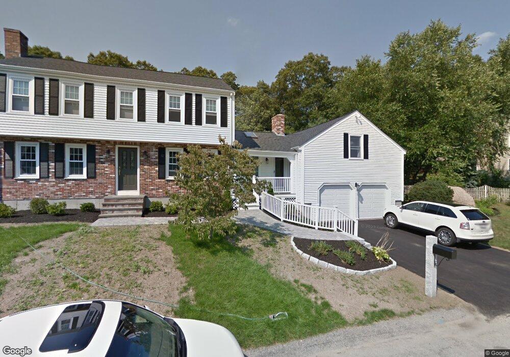
49 Tommy Marks Way South Weymouth, MA 02190
South Weymouth NeighborhoodEstimated Value: $900,000 - $1,177,000
5
Beds
5
Baths
2,590
Sq Ft
$399/Sq Ft
Est. Value
About This Home
This home is located at 49 Tommy Marks Way, South Weymouth, MA 02190 and is currently estimated at $1,033,241, approximately $398 per square foot. 49 Tommy Marks Way is a home located in Norfolk County with nearby schools including Thomas V Nash, Abigail Adams Middle School, and Weymouth Middle School Chapman.
Ownership History
Date
Name
Owned For
Owner Type
Purchase Details
Closed on
Oct 20, 1995
Sold by
Onorato Paul F and Onorato Lonnie L
Bought by
Mcniff Joseph K and Mcniff Janice M
Current Estimated Value
Home Financials for this Owner
Home Financials are based on the most recent Mortgage that was taken out on this home.
Original Mortgage
$110,000
Interest Rate
7.6%
Mortgage Type
Purchase Money Mortgage
Create a Home Valuation Report for This Property
The Home Valuation Report is an in-depth analysis detailing your home's value as well as a comparison with similar homes in the area
Home Values in the Area
Average Home Value in this Area
Purchase History
| Date | Buyer | Sale Price | Title Company |
|---|---|---|---|
| Mcniff Joseph K | $230,000 | -- |
Source: Public Records
Mortgage History
| Date | Status | Borrower | Loan Amount |
|---|---|---|---|
| Open | Mcniff Joseph K | $265,000 | |
| Closed | Mcniff Joseph K | $110,000 | |
| Previous Owner | Mcniff Joseph K | $500,000 | |
| Previous Owner | Mcniff Joseph K | $213,800 |
Source: Public Records
Tax History Compared to Growth
Tax History
| Year | Tax Paid | Tax Assessment Tax Assessment Total Assessment is a certain percentage of the fair market value that is determined by local assessors to be the total taxable value of land and additions on the property. | Land | Improvement |
|---|---|---|---|---|
| 2025 | $9,565 | $947,000 | $236,200 | $710,800 |
| 2024 | $9,273 | $902,900 | $225,000 | $677,900 |
| 2023 | $8,976 | $858,900 | $227,300 | $631,600 |
| 2022 | $8,752 | $763,700 | $210,500 | $553,200 |
| 2021 | $8,186 | $697,300 | $210,500 | $486,800 |
| 2020 | $7,859 | $659,300 | $210,500 | $448,800 |
| 2019 | $7,729 | $637,700 | $202,400 | $435,300 |
| 2018 | $7,463 | $597,000 | $192,700 | $404,300 |
| 2017 | $7,066 | $551,600 | $183,600 | $368,000 |
| 2016 | $6,849 | $535,100 | $176,500 | $358,600 |
| 2015 | $6,502 | $504,000 | $176,500 | $327,500 |
| 2014 | $6,234 | $468,700 | $164,300 | $304,400 |
Source: Public Records
Map
Nearby Homes
- 68 Massapoag St Unit 7
- 308 Forest St
- 16 Jay Rd
- 24 Fisher Rd
- 354 Tilden Commons Ln
- 92 Mercury St
- 134 Tyson Commons Ln
- 175 Tyson Commons Ln
- 30 Bradford Commons Ln
- 262 West St
- 255 West St
- 211 Randolph St
- 193 Randolph St
- 655 Summer St
- 120 Randolph St
- 441 Grove St
- 432 Grove St
- 50 Hollis St
- 2 Mitchell Ln Unit B
- 972 Liberty St
- 39 Tommy Marks Way
- 65 Tommy Marks Way
- 50 Tommy Marks Way
- 60 Tommy Marks Way
- 40 Tommy Marks Way
- 69 Tommy Marks Way
- 27 Tommy Marks Way
- 70 Tommy Marks Way
- 32 Tommy Marks Way
- 24 Tommy Marks Way
- 77 Tommy Marks Way
- 76 Tommy Marks Way
- 80 Tommy Marks Way
- 17 Tommy Marks Way
- 276 Forest St
- 8 Tommy Marks Way
- 296 Forest St
- 260 Forest St
- 24 Harvest Ln
- 302 Forest St