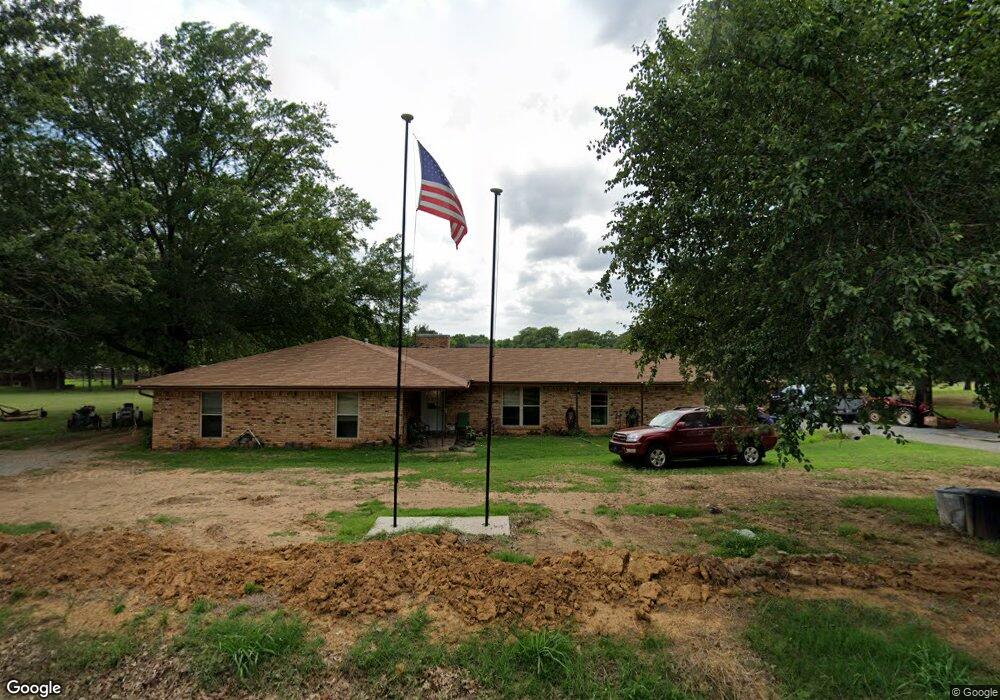
49 Tumbleweed Trail Denison, TX 75021
Estimated Value: $309,350 - $338,000
3
Beds
2
Baths
1,756
Sq Ft
$184/Sq Ft
Est. Value
About This Home
This home is located at 49 Tumbleweed Trail, Denison, TX 75021 and is currently estimated at $323,675, approximately $184 per square foot. 49 Tumbleweed Trail is a home located in Grayson County with nearby schools including Lamar Elementary School, Scott Middle School, and Denison High School.
Ownership History
Date
Name
Owned For
Owner Type
Purchase Details
Closed on
Jun 15, 2018
Sold by
Burden James David and Burden Dennis Michael
Bought by
Bell Edward and Bell Jackie
Current Estimated Value
Home Financials for this Owner
Home Financials are based on the most recent Mortgage that was taken out on this home.
Original Mortgage
$145,000
Outstanding Balance
$125,401
Interest Rate
4.5%
Mortgage Type
New Conventional
Estimated Equity
$198,274
Purchase Details
Closed on
Jun 6, 2011
Sold by
Cunningham Jane
Bought by
Burden Josephine Pate
Create a Home Valuation Report for This Property
The Home Valuation Report is an in-depth analysis detailing your home's value as well as a comparison with similar homes in the area
Home Values in the Area
Average Home Value in this Area
Purchase History
| Date | Buyer | Sale Price | Title Company |
|---|---|---|---|
| Bell Edward | -- | None Available | |
| Burden Josephine Pate | -- | None Available |
Source: Public Records
Mortgage History
| Date | Status | Borrower | Loan Amount |
|---|---|---|---|
| Open | Bell Edward | $145,000 |
Source: Public Records
Tax History Compared to Growth
Tax History
| Year | Tax Paid | Tax Assessment Tax Assessment Total Assessment is a certain percentage of the fair market value that is determined by local assessors to be the total taxable value of land and additions on the property. | Land | Improvement |
|---|---|---|---|---|
| 2025 | -- | $296,887 | -- | -- |
| 2024 | $4,359 | $269,897 | $0 | $0 |
| 2023 | $4,240 | $245,361 | $0 | $0 |
| 2022 | $3,854 | $223,055 | $0 | $0 |
| 2021 | $3,802 | $231,033 | $49,795 | $181,238 |
| 2020 | $3,306 | $166,082 | $29,887 | $136,195 |
| 2019 | $3,533 | $166,372 | $29,887 | $136,485 |
| 2018 | $3,237 | $150,808 | $29,764 | $121,044 |
| 2017 | $3,045 | $140,951 | $25,042 | $115,909 |
| 2016 | $2,898 | $142,313 | $21,138 | $121,175 |
| 2015 | $538 | $121,929 | $23,220 | $98,709 |
| 2014 | $550 | $122,496 | $31,154 | $91,342 |
Source: Public Records
Map
Nearby Homes
- 21 Chaparral Estates Dr
- TBD N Highway 69
- 230 Frosty Hollow Rd
- TBD Johnson Rd
- 1513 Desvoignes Rd
- 248 Karen Dr
- 1651 Desvoignes Rd
- 3105 U S 69
- 413 Rolling Acres Rd
- TBD Cross Timber Estates Dr
- 249 Martin Dr
- 1747 Desvoignes Rd
- 1805 Arthur Rd
- 105 Cumberland Cir
- 66 Shady Woods Ln
- 40 Cumberland Cir
- 3557 US Highway 69
- 732 E Bullock St
- 721 E Bullock St
- TBD Ledbetter Ln
- 280 Lariat Dr
- 41 Rawhide Trail
- 110 Tumbleweed Trail
- 203 Lariat Dr
- 279 Lariat Dr
- 230 Lariat Dr
- 147 Tumbleweed Trail
- 101 Rawhide Trail
- 134 Tumbleweed Trail
- 155 Lariat Dr
- 126 Lariat Dr
- 187 Tumbleweed Trail
- 79 Silver Spur Dr
- 418 Lariat Dr
- 202 Tumbleweed Trail
- 67 Lariat Dr
- 117 Silver Spur Dr
- 161 Rawhide Trail
- 37 Lariat Dr
- 177 Silver Spur Dr