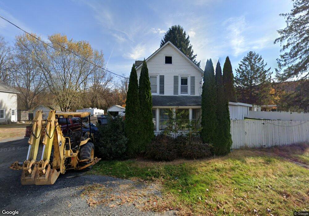
49 Vail Rd Columbia, NJ 07832
Estimated Value: $230,442 - $418,000
--
Bed
--
Bath
1,152
Sq Ft
$284/Sq Ft
Est. Value
About This Home
This home is located at 49 Vail Rd, Columbia, NJ 07832 and is currently estimated at $326,861, approximately $283 per square foot. 49 Vail Rd is a home located in Warren County with nearby schools including Blairstown Elementary School, North Warren Regional School, and Blair Academy.
Ownership History
Date
Name
Owned For
Owner Type
Purchase Details
Closed on
Jun 21, 2024
Sold by
Bennett Susan A and Smickle Susan A
Bought by
Sagan William Robert
Current Estimated Value
Purchase Details
Closed on
May 29, 2008
Sold by
Sagan William R and Sagan Ami L
Bought by
Smickle Gilbert Belford and Smickle Susan A Bennett
Purchase Details
Closed on
Sep 30, 2002
Sold by
Bennett Susan Alice and Smickle Susan A Bennett
Bought by
Sagan William R and Sagan Ami L
Purchase Details
Closed on
May 9, 1996
Sold by
Bennett Henry D
Bought by
Bennett Susan Alice
Create a Home Valuation Report for This Property
The Home Valuation Report is an in-depth analysis detailing your home's value as well as a comparison with similar homes in the area
Home Values in the Area
Average Home Value in this Area
Purchase History
| Date | Buyer | Sale Price | Title Company |
|---|---|---|---|
| Sagan William Robert | -- | Sunrise Title Services | |
| Smickle Gilbert Belford | -- | None Available | |
| Sagan William R | -- | -- | |
| Bennett Susan Alice | -- | -- |
Source: Public Records
Tax History Compared to Growth
Tax History
| Year | Tax Paid | Tax Assessment Tax Assessment Total Assessment is a certain percentage of the fair market value that is determined by local assessors to be the total taxable value of land and additions on the property. | Land | Improvement |
|---|---|---|---|---|
| 2025 | $5,870 | $189,300 | $89,000 | $100,300 |
| 2024 | $5,456 | $189,300 | $89,000 | $100,300 |
| 2023 | $5,344 | $189,300 | $89,000 | $100,300 |
| 2022 | $5,344 | $189,300 | $89,000 | $100,300 |
| 2021 | $4,573 | $189,300 | $89,000 | $100,300 |
| 2020 | $4,680 | $189,300 | $89,000 | $100,300 |
| 2019 | $4,354 | $189,300 | $89,000 | $100,300 |
| 2018 | $4,354 | $189,300 | $89,000 | $100,300 |
| 2017 | $4,369 | $189,300 | $89,000 | $100,300 |
| 2016 | $4,384 | $189,300 | $89,000 | $100,300 |
| 2015 | $4,308 | $189,300 | $89,000 | $100,300 |
| 2014 | $4,225 | $189,300 | $89,000 | $100,300 |
Source: Public Records
Map
Nearby Homes
- 60 Vail Rd
- 20 Polkville Rd
- 0 Cedar Lake Rd Unit 3936605
- 3 Hoagland Rd
- 18 W Crisman Rd
- 5 Alice Ct
- 3 Hickory Ridge Dr
- 143 Vail Rd
- 123 Vail Rd
- 7 Gap View Dr
- 163 New Jersey 94
- 2 Frontage Rd
- 0 Mount Vernon Rd
- 94 Hoagland Rd
- 148 Vail Rd
- 10 Poppys Ct
- 87 Walnut Valley Rd
- 1 Bridge Rd
- 34 Stony Brook Rd
- 77 Union Brick Rd