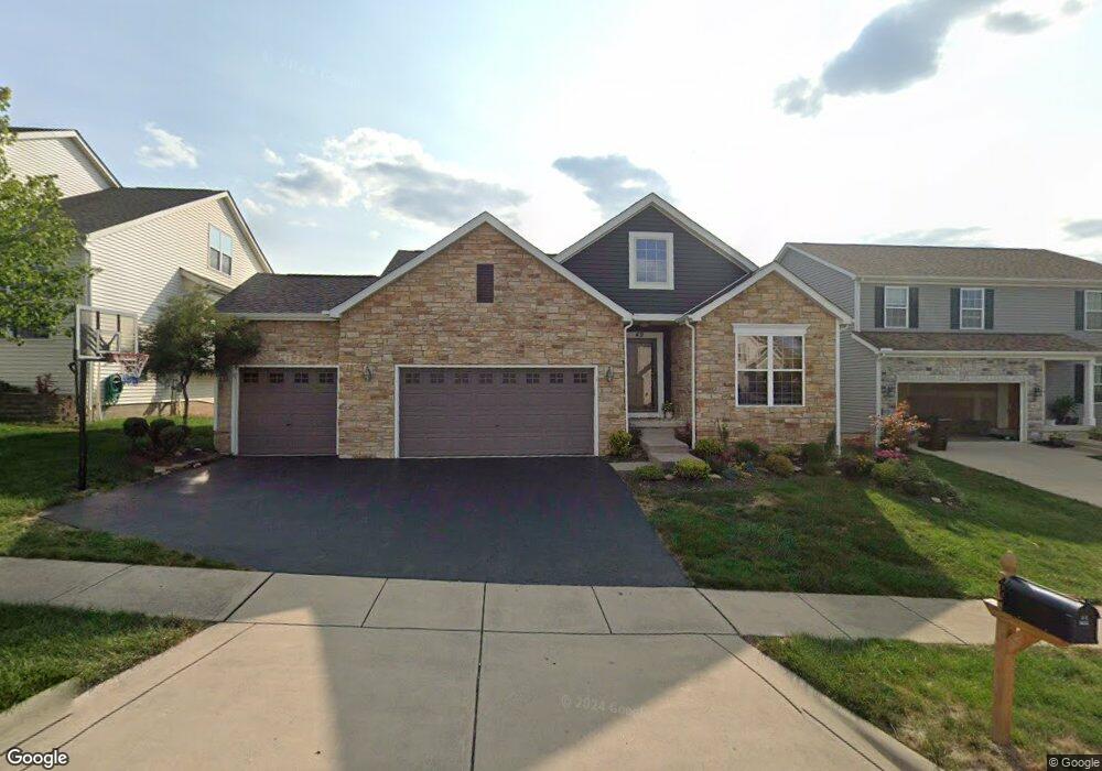
49 W Twin Maple Ave Lithopolis, OH 43136
Bloom NeighborhoodEstimated Value: $368,000 - $427,000
3
Beds
2
Baths
1,552
Sq Ft
$249/Sq Ft
Est. Value
About This Home
This home is located at 49 W Twin Maple Ave, Lithopolis, OH 43136 and is currently estimated at $386,071, approximately $248 per square foot. 49 W Twin Maple Ave is a home located in Fairfield County with nearby schools including Bloom Carroll Primary School, Bloom Carroll Intermediate School, and Bloom-Carroll Middle School.
Ownership History
Date
Name
Owned For
Owner Type
Purchase Details
Closed on
Sep 12, 2007
Sold by
Joshua Investment Co
Bought by
Getreu Eric L
Current Estimated Value
Home Financials for this Owner
Home Financials are based on the most recent Mortgage that was taken out on this home.
Original Mortgage
$212,377
Outstanding Balance
$135,424
Interest Rate
6.71%
Mortgage Type
Purchase Money Mortgage
Estimated Equity
$250,647
Create a Home Valuation Report for This Property
The Home Valuation Report is an in-depth analysis detailing your home's value as well as a comparison with similar homes in the area
Home Values in the Area
Average Home Value in this Area
Purchase History
| Date | Buyer | Sale Price | Title Company |
|---|---|---|---|
| Getreu Eric L | $223,600 | Builder Title Company |
Source: Public Records
Mortgage History
| Date | Status | Borrower | Loan Amount |
|---|---|---|---|
| Open | Getreu Eric L | $212,377 |
Source: Public Records
Tax History Compared to Growth
Tax History
| Year | Tax Paid | Tax Assessment Tax Assessment Total Assessment is a certain percentage of the fair market value that is determined by local assessors to be the total taxable value of land and additions on the property. | Land | Improvement |
|---|---|---|---|---|
| 2024 | $6,887 | $86,740 | $13,230 | $73,510 |
| 2023 | $3,640 | $86,740 | $13,230 | $73,510 |
| 2022 | $3,668 | $86,740 | $13,230 | $73,510 |
| 2021 | $3,330 | $71,570 | $13,230 | $58,340 |
| 2020 | $3,366 | $71,570 | $13,230 | $58,340 |
| 2019 | $3,377 | $71,570 | $13,230 | $58,340 |
| 2018 | $3,002 | $62,560 | $13,230 | $49,330 |
| 2017 | $2,825 | $64,740 | $13,230 | $51,510 |
| 2016 | $2,772 | $64,510 | $13,230 | $51,280 |
| 2015 | $2,746 | $62,210 | $13,230 | $48,980 |
| 2014 | $2,654 | $62,210 | $13,230 | $48,980 |
| 2013 | $2,654 | $62,210 | $13,230 | $48,980 |
Source: Public Records
Map
Nearby Homes
- 56 W Twin Maple Ave
- 526 Market St Unit 526
- 539 Market St Unit 539
- 549 Crestview Dr
- 73 E North St
- 199 Wheatley St
- 11511 Lithopolis Rd NW
- 330 W Columbus St
- 0 Columbus St Unit 225023784
- 750 Faulkner Dr
- Harmony Plan at The Summit at Wagnalls Run
- Henley Plan at The Summit at Wagnalls Run
- Bellamy Plan at The Summit at Wagnalls Run
- Stamford Plan at The Summit at Wagnalls Run
- Aldridge Plan at The Summit at Wagnalls Run
- Fairton Plan at The Summit at Wagnalls Run
- Juniper Plan at The Summit at Wagnalls Run
- Chatham Plan at The Summit at Wagnalls Run
- Pendleton Plan at The Summit at Wagnalls Run
- 1400 Hansberry Dr
- 37 W Twin Maple Ave
- 61 W Twin Maple Ave
- 25 W Twin Maple Ave
- 73 W Twin Maple Ave
- 40 W Twin Maple Ave
- 28 W Twin Maple Ave
- 405 Market St
- 385 Market St
- 387 W Twin Maple Ave
- 423 Market St
- 433 Market St
- 375 W Twin Maple Ave
- 445 Market St
- 49 Stoney Bluff Way
- 37 Stoney Bluff Way
- 13 Stoney Bluff Way
- 11511 Smith Rd
- 363 W Twin Maple Ave
- 25 Stoney Bluff Way
- 89 Stoney Bluff Way