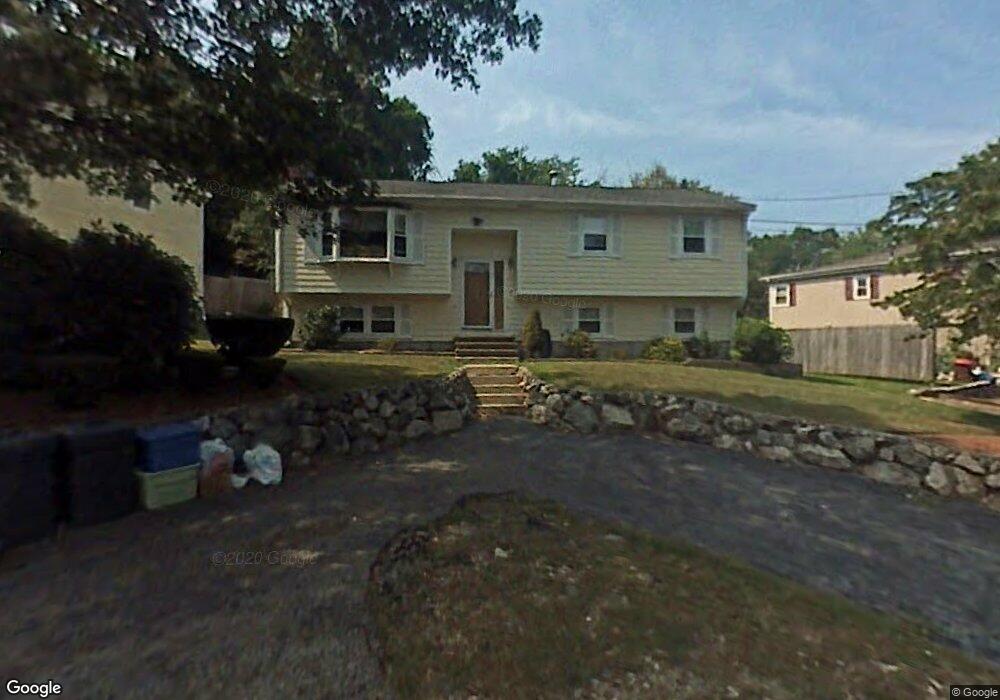
49 Waverly Rd Woburn, MA 01801
Shakerhill NeighborhoodEstimated Value: $654,000 - $804,000
3
Beds
2
Baths
1,138
Sq Ft
$634/Sq Ft
Est. Value
About This Home
This home is located at 49 Waverly Rd, Woburn, MA 01801 and is currently estimated at $721,737, approximately $634 per square foot. 49 Waverly Rd is a home located in Middlesex County with nearby schools including Reeves Elementary School, Daniel L. Joyce Middle School, and Woburn High School.
Ownership History
Date
Name
Owned For
Owner Type
Purchase Details
Closed on
Mar 11, 2016
Sold by
Zontanos Voula P
Bought by
Voula P Zontanos T P and Voula Zontanos
Current Estimated Value
Purchase Details
Closed on
Feb 12, 2016
Sold by
Us Bank Na Tr
Bought by
Zontanos Voula
Purchase Details
Closed on
Apr 20, 2001
Sold by
Smith Diane and Smith Steven R
Bought by
Tavitian Hamayag S and Tavitian D Z
Home Financials for this Owner
Home Financials are based on the most recent Mortgage that was taken out on this home.
Original Mortgage
$225,600
Interest Rate
6.9%
Mortgage Type
Purchase Money Mortgage
Purchase Details
Closed on
Oct 14, 1998
Sold by
Mccabe John L and Mccabe Llisa
Bought by
Figlioli Frank M and Smith Diane
Create a Home Valuation Report for This Property
The Home Valuation Report is an in-depth analysis detailing your home's value as well as a comparison with similar homes in the area
Home Values in the Area
Average Home Value in this Area
Purchase History
| Date | Buyer | Sale Price | Title Company |
|---|---|---|---|
| Voula P Zontanos T P | -- | -- | |
| Voula P Zontanos T | -- | -- | |
| Zontanos Voula | $322,500 | -- | |
| Tavitian Hamayag S | $282,000 | -- | |
| Figlioli Frank M | $192,500 | -- |
Source: Public Records
Mortgage History
| Date | Status | Borrower | Loan Amount |
|---|---|---|---|
| Previous Owner | Figlioli Frank M | $225,600 | |
| Previous Owner | Figlioli Frank M | $161,000 | |
| Previous Owner | Figlioli Frank M | $75,000 |
Source: Public Records
Tax History Compared to Growth
Tax History
| Year | Tax Paid | Tax Assessment Tax Assessment Total Assessment is a certain percentage of the fair market value that is determined by local assessors to be the total taxable value of land and additions on the property. | Land | Improvement |
|---|---|---|---|---|
| 2025 | $5,736 | $671,700 | $322,600 | $349,100 |
| 2024 | $5,291 | $656,400 | $307,300 | $349,100 |
| 2023 | $5,120 | $588,500 | $279,400 | $309,100 |
| 2022 | $5,034 | $539,000 | $242,900 | $296,100 |
| 2021 | $4,811 | $515,700 | $231,300 | $284,400 |
| 2020 | $11,421 | $497,500 | $231,300 | $266,200 |
| 2019 | $11,099 | $460,800 | $220,300 | $240,500 |
| 2018 | $4,184 | $423,100 | $202,100 | $221,000 |
| 2017 | $10,310 | $389,000 | $192,500 | $196,500 |
| 2016 | $3,691 | $367,300 | $179,900 | $187,400 |
| 2015 | $3,553 | $349,400 | $168,100 | $181,300 |
| 2014 | $3,545 | $339,600 | $168,100 | $171,500 |
Source: Public Records
Map
Nearby Homes
- 7 Grace Rd
- 212 Cambridge Rd
- 9 Pond Terrace
- 185 Lexington St
- 192 Lexington St
- 15 Crescent Rd
- 273 Cambridge Rd Unit 202
- 14 Liana St
- 21 Derby Dr Unit 21
- 7 Thornberry Rd
- 20 Amberwood Dr
- 41 Squire Rd
- 2 Howard Ct
- 123 Cambridge Rd Unit 4
- 16 Winning Farm Rd Unit 16
- 7 Wainwright Rd Unit 118
- 19 Gershon Way Unit 1
- 19 Gershon Way
- 500 Lexington St Unit 6
- 14 Saw Mill Brook Way