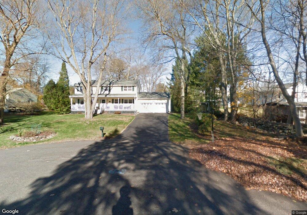
49 Yorktown Cir Trumbull, CT 06611
Estimated Value: $667,000 - $704,000
4
Beds
3
Baths
1,960
Sq Ft
$350/Sq Ft
Est. Value
About This Home
This home is located at 49 Yorktown Cir, Trumbull, CT 06611 and is currently estimated at $685,658, approximately $349 per square foot. 49 Yorktown Cir is a home located in Fairfield County with nearby schools including Jane Ryan School, Madison Middle School, and Trumbull High School.
Ownership History
Date
Name
Owned For
Owner Type
Purchase Details
Closed on
Sep 16, 2020
Sold by
Cryan Eugene T and Cryan Catherine T
Bought by
Scott Michael A and Scott Catherine A
Current Estimated Value
Home Financials for this Owner
Home Financials are based on the most recent Mortgage that was taken out on this home.
Original Mortgage
$290,000
Outstanding Balance
$257,356
Interest Rate
2.9%
Mortgage Type
New Conventional
Estimated Equity
$428,302
Purchase Details
Closed on
Jul 3, 1986
Bought by
Cryan Eugene T and Cryan Teresa C
Create a Home Valuation Report for This Property
The Home Valuation Report is an in-depth analysis detailing your home's value as well as a comparison with similar homes in the area
Home Values in the Area
Average Home Value in this Area
Purchase History
| Date | Buyer | Sale Price | Title Company |
|---|---|---|---|
| Scott Michael A | $390,000 | None Available | |
| Cryan Eugene T | -- | -- |
Source: Public Records
Mortgage History
| Date | Status | Borrower | Loan Amount |
|---|---|---|---|
| Open | Scott Michael A | $290,000 |
Source: Public Records
Tax History Compared to Growth
Tax History
| Year | Tax Paid | Tax Assessment Tax Assessment Total Assessment is a certain percentage of the fair market value that is determined by local assessors to be the total taxable value of land and additions on the property. | Land | Improvement |
|---|---|---|---|---|
| 2025 | $10,898 | $296,590 | $155,540 | $141,050 |
| 2024 | $10,590 | $296,590 | $155,540 | $141,050 |
| 2023 | $10,421 | $296,590 | $155,540 | $141,050 |
| 2022 | $10,253 | $296,590 | $155,540 | $141,050 |
| 2021 | $9,438 | $259,560 | $135,520 | $124,040 |
| 2020 | $9,257 | $259,560 | $135,520 | $124,040 |
| 2018 | $9,050 | $259,560 | $135,520 | $124,040 |
| 2017 | $8,882 | $259,560 | $135,520 | $124,040 |
| 2016 | $8,654 | $259,560 | $135,520 | $124,040 |
| 2015 | $8,752 | $261,500 | $135,500 | $126,000 |
| 2014 | $8,567 | $261,500 | $135,500 | $126,000 |
Source: Public Records
Map
Nearby Homes
- 10 Aragon Dr
- 38 Smith Place
- 253 Mayfield Dr Unit 253
- 267 Mayfield Dr
- 283 Mayfield Dr
- 275 Dayton Rd
- 17 Rainbow Dr
- 0 Main St
- 26 Grove St
- 4293 Madison Ave
- 132 Merrimac Dr
- 83 Buck Hill Rd
- lot 194 Prospect Ave
- 14 Oakland Dr
- 60 Lillian Dr
- 32 Adirondack Trail
- Lot 31 Valley View Rd
- 34 Merrimac Dr
- 87 Parkway Dr
- 67 Limerick Rd